Dhaulagiri Circuit Trek - 18 Days

Dhaulagiri Circuit Trek - 18 Days

Customize Trip
Trip at a Glance
Duration18 Days
Trip GradeStrenuous
CountryNepal
Maximum Altitude5360
Group Size2-15
StartsKathmandu
EndsKathmandu
ActivitiesTrekking
Best TimeAutumn, Spring

Dhaulagiri Circuit Trek is a thrilling and challenging trek that takes adventurers on an unforgettable journey around the towering Dhaulagiri massif in the western region of Nepal. This trek is a hidden gem, offering a remote and less-traveled route compared to the more popular trekking destinations in the country. With its rugged terrain, high mountain passes, and breathtaking landscapes.

Dhaulagiri Circuit Trek provides a truly immersive and rewarding Himalayan experience for those seeking adventure and solitude in the mountains. Commencing in the town of Beni, the trek follows a circular route around the Dhaulagiri massif, encompassing approximately 150 miles (240 kilometers) over a span of two to three weeks.

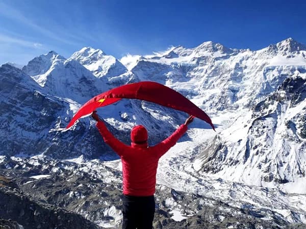
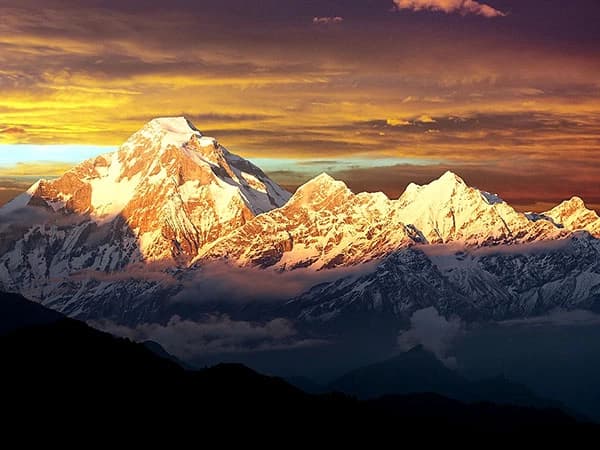
Trekkers are treated to awe-inspiring views of Dhaulagiri I, the seventh highest mountain in the world standing at 8,167 meters (26,795 feet), as well as other prominent peaks in the region such as Annapurna I, Manaslu, Nilgiri, and Tukuche Peak. The grandeur of these snow-capped giants against the backdrop of the rugged Himalayan landscape sets the stage for a truly remarkable trekking experience.

The Dhaulagiri Circuit Trek offers a diverse array of landscapes, from verdant forests of rhododendron, oak, and pine trees to terraced fields and traditional Nepalese villages. As trekkers ascend to higher altitudes, the scenery transitions into rocky terrain, glacial moraines, and icy streams characteristic of the alpine zone. The contrast between the lush greenery at lower elevations and the stark beauty of the high Himalayas creates a dynamic backdrop for the trek, showcasing the natural splendor of the region.

A highlight of the Dhaulagiri Circuit Trek is conquering two challenging high mountain passes, namely the French Pass at 5,360 meters (17,585 feet) and the Dhampus Pass at 5,200 meters (17,060 feet). These passes provide trekkers with panoramic views of the Dhaulagiri range and surrounding peaks, rewarding their efforts with breathtaking vistas that are sure to leave a lasting impression.

The ascent and descent of these passes test the physical and mental endurance of trekkers, adding an element of adventure and accomplishment to the journey. In addition to the natural wonders, the Dhaulagiri Circuit Trek offers cultural insights and encounters as trekkers pass through remote villages inhabited by various ethnic groups.

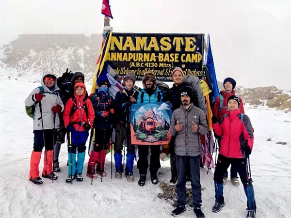
The region is home to Gurungs, Magars, Thakalis, and Tibetans, each with their own unique traditions and customs. Trekkers have the opportunity to interact with locals, visit monasteries, and experience the rich cultural heritage of the Himalayan people, adding a fascinating dimension to the trekking experience.

Overall, the Dhaulagiri Circuit Trek is a physically demanding yet immensely rewarding journey that appeals to seasoned trekkers looking for a challenging and less-traveled route in the Nepalese Himalayas. The trek offers a perfect blend of natural beauty, cultural immersion, and adventure, making it a truly unforgettable and transformative experience for those who embark on this epic mountainous adventure.

Highlights

  • views of the Seventh highest mountain of the World, and peaks like Tukuche Peak (6,920 m), and Sita Chuchura (6,611 meters).
  • Crossing French Pass is one of the most thrilling moments of the trek.
  • Dhampus Pass provides an exhilarating challenge and stunning views of the Annapurna and Nilgiri ranges.
  • Reaching Dhaulagiri Base Camp gives you a close-up view of the towering Dhaulagiri massif.
  • Few trekkers venture here, making it an ideal trek for those seeking solitude
  • The trek passes through varied landscapes, lush forests, terraced fields, barren glaciers, high alpine meadows, and snowfields.
  • Dhaulagiri Circuit is a true test of endurance and trekking skills.
Itinerary
Trip PlanExpand all

The drive from Kathmandu to Beni is a scenic journey that typically takes around 8-10 hours, depending on road conditions and traffic. The drive follows the Prithvi Highway, offering views of rivers, terraced fields, and distant mountain ranges. Pass through Mugling, where the road splits towards Pokhara. Continue through Pokhara, a popular tourist destination, before heading west to Beni. Overnight Stay in Beni.

Max Altitude: 850 m Meals: Breakfast, Lunch, DinnerAccommodation: LodgeDuration: 8-10 hoursDistance: 280 km

The trek from Beni to Babiachaur is the first leg of many treks, including the Dhaulagiri Circuit. It typically takes around 5-6 hours, covering a distance of approximately 15 kilometers. Follow the trail along the Myagdi River through small villages and terraced farmlands. Pass through traditional villages, dense forests, and terraced fields. Relatively easy trekking with gradual ascents and descents.

Babiachaur serves as a stopping point before continuing toward the higher altitudes of the Dhaulagiri region. Overnight Stay in Babiachaur.

Max Altitude: 950 m Meals: Breakfast, Lunch, DinnerAccommodation: Tea HouseDuration: 5-6 hoursDistance: 15 km

The trek from Babiachaur to Dharapani takes about 5-6 hours and covers a distance of approximately 12-14 kilometers. The trail follows the Myagdi River, passing through terraced fields, small villages, and forested areas. Scenic views of terraced farmland and the surrounding hills. A gradual ascent with some steeper sections, especially as you approach Dharapani. Experience local village life and farming communities along the way.

Dharapani serves as an overnight stop before continuing toward the higher elevations of the Dhaulagiri Circuit Trek. Overnight stay in Dharapani.

Max Altitude: 1400 m Meals: Breakfast, Lunch, DinnerAccommodation: TentDuration: 5-6 hoursDistance: 12-14 km

The trek from Dharapani to Muri typically takes about 6-7 hours and covers a distance of approximately 15 kilometers. The trail involves ascending through terraced fields, forests, and small villages. You’ll cross several suspension bridges and pass through local settlements. Gradual ascent through lush forest and agricultural land. Views of the surrounding hills and local villages. Interaction with local communities and glimpses of traditional rural life.

Muri is a charming village and serves as a key stop before continuing further into the Dhaulagiri region. Overnight Stay in Muri.

Max Altitude: 1800 m Meals: Breakfast, Lunch, DinnerAccommodation: TentDuration: 6-7 hoursDistance: 15 km

The trek from Muri to Boghara typically takes about 5-6 hours and covers a distance of approximately 13-15 kilometers. The trail involves a gradual ascent through terraced fields and forested areas, crossing several small streams and passing through local villages. Beautiful terraced landscapes and scenic views of the surrounding hills. A steady climb with opportunities to experience local rural life. Dense forests and occasional glimpses of distant peaks as you approach Boghara.

Boghara is a key stop before continuing to higher altitudes on the Dhaulagiri Circuit Trek. Overnight Stay in Boghara.

Max Altitude: 2080 m Meals: Breakfast, Lunch, DinnerAccommodation: TentDuration: 5-6 hoursDistance: 13-15 km

The trail ascends through forested areas and terraced fields, gradually gaining altitude as you approach Dobang. You will cross several streams and pass through small settlements. Gradual ascent with scenic views of terraced landscapes and dense forests. Increasingly dramatic views as you approach higher elevations

Dobang provides a more secluded and serene environment as you move closer to the mountainous terrain. Dobang is an important stop before heading to higher elevations and entering the more remote areas of the Dhaulagiri Circuit. Overnight Stay in Dobang.

Max Altitude: 2520 m Meals: Breakfast, Lunch, DinnerAccommodation: TentDuration: 5-6 hoursDistance: 13-15 km

The trail involves a steady ascent through dense forests and rugged terrain. You will cross several streams and pass through remote and scenic areas with increasing altitude. The path can be steep and challenging, with views of the surrounding mountains becoming more prominent as you climb. Enjoy the lush forested sections and the gradual transition to higher altitudes. Increasingly dramatic views of the Dhaulagiri range and other peaks.

Choriban Khola is an important stop before heading to even higher elevations on the Dhaulagiri Circuit, providing a place to rest and acclimatize. Overnight Stay in Choriban Khola.

Max Altitude: 3110 m Meals: Breakfast, Lunch, DinnerAccommodation: TentDuration: 5-6 hoursDistance: 12-14 km

The trail from Choriban Khola to Italian Base Camp involves trekking through lush forests, picturesque villages, and varied terrain, with stunning views of the Kanchenjunga massif. Landscape From dense forests to alpine meadows. Interaction with local communities and exploration of their traditional lifestyles. Beautiful vistas of Kanchenjunga and surrounding peaks.

The destination of this trek offers a close-up view of the majestic Kanchenjunga and its glaciers. Overnight Stay in Italian Base camp.

Max Altitude: 3660 m Meals: Breakfast, Lunch, DinnerAccommodation: TentDuration: 5-6 hoursDistance: 12-15 km

Rest and Recovery for Allowing your body to adjust to the altitude. Light hikes around the base camp for acclimatization and to enjoy the surrounding views. Hydration and Nutrition for Ensuring proper hydration and eating balanced meals to aid in acclimatization. Keeping an eye on symptoms of altitude sickness and resting as needed.

This day helps in reducing the risk of altitude sickness and prepares you for further high-altitude trekking.

The path includes rocky trails, moraine, and possibly some glacier travel, offering impressive views of surrounding peaks and glaciers. Glacier Camp provides closer views of the glaciers and an excellent perspective of the high-altitude environment. This segment of the trek is a key part of accessing higher altitudes and further exploration of the Kanchenjunga region. Overnight in Glacier Camp.

Max Altitude: 4210 m Meals: Breakfast, Lunch, DinnerAccommodation: TentDuration: 2-4 hoursDistance: 4-6 km

The trek from Glacier Camp to Dhaulagiri Base Camp is quite challenging and involves significant distance and altitude change. The trail includes rocky paths, glacier sections, and steep ascents, with stunning views of Dhaulagiri and surrounding peaks. Dhaulagiri Base Camp provides spectacular views of the Dhaulagiri massif and is a key point for further high-altitude trekking and exploration.

This trek requires good physical preparation due to the challenging terrain and high altitude. Overnight in Dhaulagiri Base camp.

Max Altitude: 4740 m Meals: Breakfast, Lunch, DinnerAccommodation: TentDuration: 6-8 hoursDistance: 12-15 km

An acclimatization day at Dhaulagiri Base Camp involves:

Rest and Recovery allow your body to adjust to the high altitude. Light Hiking, Short, easy walks around the base camp to aid acclimatization and enjoy the views. Maintaining proper hydration and eating nutrient-rich foods to support acclimatization. Watching for symptoms of altitude sickness and resting as needed. This day helps to reduce the risk of altitude-related issues and prepares you for further high-altitude trekking.

Max Altitude: 4740 m Meals: Breakfast, Lunch, DinnerAccommodation: Tent

The trail involves crossing high mountain passes, navigating glacier fields, and trekking through alpine meadows. Hidden Valley offers a secluded, picturesque setting with panoramic views of surrounding peaks and glaciers. This section of the trek requires good acclimatization and physical preparation due to the high altitude and demanding terrain. Overnight in Hidden Valley.

Max Altitude: 5200 m Meals: Breakfast, Lunch, DinnerAccommodation: TentDuration: 6-7 hoursDistance: 8-12 km

The trail includes a challenging ascent to Dhampus Pass, followed by a descent to Yak Kharka. Expect rocky paths, high-altitude terrain, and potentially snow-covered sections. Dhampus Pass, situated at an altitude of around 5,250 meters (17,220 feet), offers stunning views of the surrounding peaks.

Yak Kharka is a grazing area with scenic views and a good spot for rest and acclimatization. This section of the trek requires good acclimatization due to the high altitude and challenging terrain. Overnight in Yak Kharka.

Max Altitude: 3680 m Meals: Breakfast, Lunch, DinnerAccommodation: Lodge/Tea houseDuration: 6-7 hoursDistance: 10-12 km

The trail descends from Yak Kharka through varied terrain, including rocky paths and forested areas, eventually reaching the lower Mustang region. Marpha is a charming village known for its apple orchards and traditional Tibetan architecture. This section offers a transition from high-altitude terrain to the more moderate elevations of the Mustang region. Overnight in Marpha.

Max Altitude: 2670 m Meals: Breakfast, Lunch, DinnerAccommodation: LodgeDuration: 6-8 hoursDistance: 15-20 km

The journey generally involves driving through winding mountain roads, including sections of rough terrain and river crossings. The route typically passes through Jomsom and follows the Kali Gandaki River valley before reaching Pokhara.

The drive offers beautiful views of the Himalayas, river valleys, and traditional villages.

Road conditions can vary, so it's important to be prepared for potentially bumpy and slow sections of the journey. Overnight in Pokhara.

Max Altitude: 830 m Meals: Breakfast, Lunch, DinnerAccommodation: HotelDuration: 4-6 hoursDistance: 90-120 km

The journey usually follows the Prithvi Highway, a major road connecting the two cities. The road is a mix of smooth sections and winding curves, with river crossings and hilly terrain. The drive offers scenic views of lush landscapes, terraced fields, and the Trishuli River.

Road conditions can vary, with potential for traffic and delays, so it’s a good idea to plan for extra travel time. Overnight in Kathmandu.

Max Altitude: 1400 m Meals: Breakfast, DinnerAccommodation: HotelDuration: 6-8 hoursDistance: 200-250 km

This day, depart from Tribhuvan International Airport for your Next Destination.

Unable to locate what you're seeking?Reach out to our travel experts.
Customize Trip
Cost Details
Includes
  • Annapurna Conservation Area Permit (ACAP) – Required for trekking in the Annapurna region.
  • Trekkers' Information Management System (TIMS) card – Mandatory for most treks in Nepal.
  • Dhaulagiri Special Permit for restricted areas around Dhaulagiri.
  • private transport to and from the starting and ending points if more than 4 pax (e.g., Kathmandu to Beni, Pokhara to Kathmandu).
  • Lodging in teahouses in villages along the trail and in more remote areas, camping is required).
  • Tents and camping gear 
  • Breakfast, lunch, and dinner during the trek (generally included in trek packages),Meals are typically simple: rice, dal, noodles, soups, and local dishes.
  • Experienced trekking guide – Necessary for the Dhaulagiri Circuit due to its complexity.
  • Porters – To help carry equipment and supplies.
  • Guide and porter insurance – Ensures they are covered in case of accidents or medical emergencies.
  • Tents, sleeping bags, and mattresses (if trekking through more remote areas where teahouses are unavailable).
  • Climbing equipment, the route involves glacier walking (e.g., ropes, crampons, ice axes).
  • First aid kit and emergency supplies.
Excludes
  • International Flights: to and from Nepal (to Kathmandu).
  • Visa fees are charged on arrival, depending on the length of stay.
  • Comprehensive insurance covering high-altitude trekking, helicopter evacuation, accidents, and medical emergencies.
  • Hotels and meals in cities like Kathmandu or Pokhara before and after the trek.
  • Clothing, trekking boots, down jackets, gloves, and other personal items not included in trek packages.
  • Gratuities for guides and porters.
  • Bottled water, snacks, and beverages along the trail.
  • Hot showers, charging electronic devices, and Wi-Fi (where available) – typically require extra fees.
  • Personal expenses like laundry, souvenirs, or extra activities.
  • Emergency evacuation costs, if you need to be airlifted due to altitude sickness or injury (if not covered by insurance).
FAQs

Food options typically include traditional Nepali dishes such as dal bhat, as well as basic Western food. Meals are generally prepared by local cooks at teahouses or camps.

While it is possible to trek independently, it is highly recommended to hire a guide and/or porter for safety, logistical support, and local knowledge, especially given the trek's difficulty and remote areas.

  • Start: Typically accessed by driving o from Kathmandu to Darbang/Beni.
  • End: The trek often concludes in Marpha or Jomsom, with drives available to Pokhara and then Kathmandu.

While it is possible to trek independently, it is highly recommended to hire a guide and/or porter for safety, logistical support, and local knowledge, especially given the trek's difficulty and remote areas.

Be respectful of local traditions and customs, particularly in remote villages. Dress modestly and ask for permission before taking photos of people or religious sites.

Follow Leave No Trace principles, avoid littering, and use eco-friendly products. Respect local customs and culture, and support local businesses.

Essential gear includes trekking boots, warm clothing, sleeping bags, a down jacket, trekking poles, a hat, gloves, sunglasses, and a good-quality backpack. Be prepared for cold temperatures and variable weather conditions.

The best times to trek are spring (March to May) and autumn (September to November) for stable weather and clear views.

Medical facilities are limited in remote areas. It’s advisable to carry a basic first aid kit and be prepared for emergencies. In severe cases, evacuation may be required.

If you experience symptoms of altitude sickness (headache, nausea, dizziness), descend to a lower altitude, rest, stay hydrated, and seek medical attention if necessary. Acclimatization is crucial to prevent severe altitude sickness.

The Dhaulagiri Circuit Trek is a challenging high-altitude trek in Nepal that circumnavigates Mount Dhaulagiri (8,167 meters / 26,795 feet), the seventh-highest peak in the world. It offers dramatic landscapes, rugged terrain, and stunning views of the Himalayan range.

Accommodation includes teahouses and guesthouses in some areas, while camping is required in remote sections of the trek.

The standard itinerary includes traveling from Kathmandu to Darbang/Beni, trekking through various villages, crossing high passes, reaching Dhaulagiri Base Camp, and ending in Marpha or Jomsom before returning to Pokhara and Kathmandu.

Permits can be obtained in Kathmandu at the Tourism Department or through a registered trekking agency.

  • TIMS Card (Trekkers' Information Management System).
  • Dhaulagiri Conservation Area Permit.
  • ACAP (Annapurna Conservation Area Permit) if passing through parts of the Annapurna region.

Proper acclimatization is crucial. Allow time for rest and gradual ascent, stay hydrated, eat well, and monitor for symptoms of altitude sickness. It's advisable to have previous high-altitude trekking experience.

The trek reaches altitudes up to 5,360 meters (17,585 feet) at the French Pass and 5,250 meters (17,220 feet) at the Dhampus Pass.

The Dhaulagiri Circuit is considered a highly difficult trek due to its demanding terrain, high altitudes, and challenging weather conditions. It requires good physical fitness and previous trekking experience.

The trek typically takes 14-20 days, depending on the itinerary, pace, and acclimatization needs.

Call to our expert 24/7
Bhupendra Adhikari
+977 9851029611
travelers choice
Need Help? Call Us.+977 9851029611