Standing at the foot of the world's tallest mountain is a dream. It attracts thousands of adventurers to Nepal each year. The Everest Base Camp trek itinerary, 12 days, is an ideal combination. You'll get sufficient acclimatization. You'll have incredible experiences too. And you'll explore the breathtaking Khumbu region of Nepal at a fast pace.
This comprehensive travel guide will take you through each phase of your adventure. From the thrilling flight to Lukla to your triumphant return to Kathmandu, you'll know what's in store for you on this adventure of a lifetime.
Overview of the 12-Day Everest Base Camp Trek
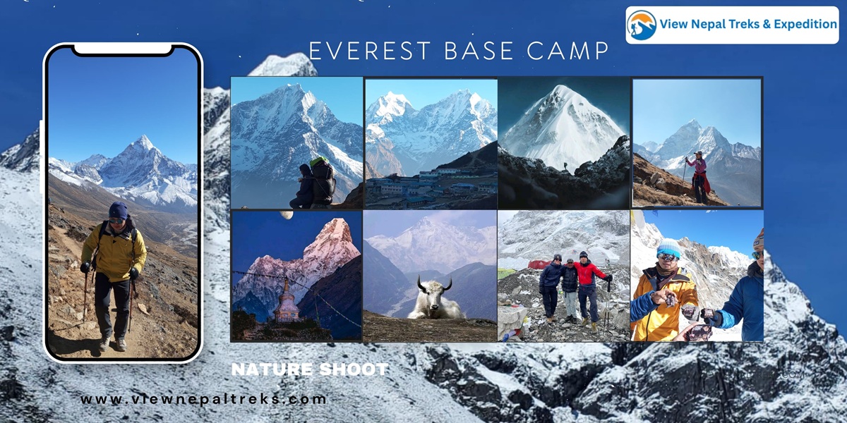
Spectacular Himalayan mountain views during the Everest Base Camp Trek in Nepal
Trek Details
Information
Total Duration
12 days
Maximum Altitude
5,555m (Kala Patthar)
Trek Difficulty
Moderate to Challenging
Best Seasons
Spring (March-May) and Autumn (September-November)
Walking Hours/Day
5-7 hours average
Acclimatization Days
2 days (Namche Bazaar and Dingboche)
Starting Point
Lukla (2,840m)
Highest Overnight Stay
Gorakshep (5,140m)
The 12-day Everest Base Camp trek is one of the most popular trekking schedules planned for travelers to the Himalayas. The well-crafted Everest Base Camp Trek Itinerary includes crucial rest days. These allow travelers to experience the wonderful culture of the Sherpa people. And they help you avoid the possible perils of high altitude trekking.
Why Choose a 12-Day Itinerary?
A 12-day itinerary is an excellent balance for trekkers. Less-than-12-day treks will rush you through these beautiful mountains. They leave no time for acclimatization. So they greatly increase the risk of altitude sickness.
More-than-12-day treks will require additional vacation days. Many people can't afford this. The 12-day itinerary has ample rest time at key locations. It gives your body time to acclimatize to lower oxygen levels.
What makes this trek special?
The trekking route offers a variety of landscapes from rhododendron forests to glacial moraines. You'll get a chance to follow the routes taken by legendary adventurers. Also, you can explore Buddhist monasteries with colorful prayer flags.
And you'll stop to have tea with trekkers on their way to the summit of the highest mountain on earth, Mount Everest.
Hiking is along the renowned Sagarmatha National Park. It’s a UNESCO World Heritage Site renowned for its distinctive alpine ecology. And you could even see rare species like the snow leopard and red panda.
Physical Demands and Preparation
You don't need technical expertise in mountaineering. But this trek needs a good level of fitness and mental toughening. Physical fitness is needed since you'll be walking for five to seven hours a day.
You should begin training at least two months prior to the trek. Your training should include cardiovascular work, leg strengthening, and backpacking with a backpack of 5 to 7 kilograms. On long days, you'll be glad you put in the training hours.
Remote glacier terrain close to Everest Base Camp in Nepal Himalayas
The following Everest Base Camp Trek Day by Day breakdown will give you an understanding of what each day entails. The EBC Trek route follows the traditional Everest Base Camp Trek Route that numerous individuals complete annually.
Day 01: Fly from Kathmandu (1,400m) to Lukla (2,840m) and Trek to Phakding (2,610m)
Flight duration: 30-35 minutes
Trek distance: 8 kilometers
Walking time: 3-4 hours
Altitude change: Descent of 230 meters
Difficulty: Easy
Your trekking adventure begins with an exciting flight from Kathmandu to Lukla. It's also called the world's most dangerous airport. A small plane travels through the towering mountain ranges before touching down on a short runway cut out of the side of the mountain. You'll get breathtaking views of the Himalayas, including glimpses of Mount Everest, Lhotse, and Makalu.
The trekking route from Lukla gently descends through the forests of pines. And it follows the Dudh Koshi River, crossing hanging bridges adorned with Buddhist flags. You'll pass tiny villages with old stone houses before you arrive at Phakding.
Pro Tip: Heavy hydration is a must. And this should begin from the very first day. You should take in at least 3 to 4 liters of water a day. Alcohol and caffeinated drinks should be avoided entirely during the first three days. So, you won't risk dehydration.
About Phakding
This lovely little village is located at 2,610 meters in a valley through which the Dudh Kosi river flows. Phakding is a popular stopping point for the first night. It provides a gentle introduction to tea-house style trekking with good quality lodges serving both Nepali and international food. There are prayer wheels along this section of the trail. Plus, it's a great spot to enjoy views of Kusum Kanguru.
Day 02: Trek from Phakding (2,610m) to Namche Bazaar (3,440m)
Trek distance: 11 kilometers
Walking time: 6-7 hours
Altitude gain: 830 meters
Difficulty: Moderate to challenging
The route goes through the Dudh Kosi River valley with stunning views of blue pine and rhododendron forests. You'll cross many suspension bridges along the route, including the famous Hillary Bridge. Also, the route takes you through Monjo, where you have to enter the Sagarmatha National Park.
From Jorsalle, the trail rises steeply over a distance of two hours to reach Namche Bazaar. En route, many trekkers catch a glimpse of Mount Everest from a viewpoint during the course of the ascent.
Pro Tip: Pace your ascent when climbing the final hill to Namche Bazaar. Walk slowly while employing pressure breathing techniques by exhaling forcefully from your lungs and then inhaling deeply. You'll conserve energy and reduce strain on your body.
About Namche Bazaar
Namche Bazaar is known as the Gateway to Everest. It's the biggest settlement within the Khumbu region, at an altitude of 3,440 meters. This prosperous town is inhabited by Sherpa people. And you can find equipment for trekking, crafts, and Tibetan items.
Every Saturday, people gather for a traditional market. You can also find bakeries, Internet cafes, gear rentals, and the headquarters for Sagarmatha National Park. Plus, there's an excellent museum on Sherpa culture.
Day 03: Acclimatization Day at Namche Bazaar (3,440m)
Acclimatization hikes: 3 to 4 hours
Gain in Altitude: 300 to 400 meters
Level of Difficulty: Easy to moderate
Acclimatization is most effective when active. Most hikers go as far as the Everest View Hotel, which is at 3,880m. Or they visit the nearby villages of Khumjung and Khunde, which lie at 3,780m. These routes follow the golden rule of trekking: Climb High, Sleep Low.
Everest View Hotel boasts the coveted Guinness World Record of being the highest hotel in the world. From here, you can view Everest, Lhotse, Ama Dablam, and a host of other majestic peaks.
Pro Tip: Use today to organize your gear and repack your duffel bag. Remove any unnecessary items. Also, withdraw extra cash at the ATM today. It's the last one until you come back.
About Namche Bazaar Activities
Apart from acclimatization treks, you can visit various places in Namche. There's a bakery that serves delicious cinnamon rolls and apple pies. And there's a Saturday market where villagers sell fresh yak cheese, vegetables, and handicrafts. You'll want to try the local yak cheese while you're here.
Day 04: Trek from Namche Bazaar (3,440m) to Tengboche (3,810m)
Trek Distance: 10 kilometers
Time Required for Walking: 5-6 hours
Altitude gain: 370 metres
Difficulty: Moderate
The trail leaves Namche on a high mountain traverse with breathtaking mountain scenery. Then it descends to the Dudh Khosi River via rhododendron and juniper forests to Phunki Tenga.
After a river crossing, the trail rises steeply. It takes 1.5 hours, passing through forests to reach Tengboche. In this world-famous monastery, you can see Ama Dablam, probably the most beautiful mountain in the range. It's visible throughout the day. On clear mornings, you'll be glad you brought your camera for this view.
Pro Tip: Try to plan your visit such that you can attend the evening prayer session at Tengboche Monastery around 3 PM in the afternoon. There's something very moving about listening to the chanting of Buddhist monks. And be sure to remove your shoes before you enter any monastery or temple. You'll appreciate the peaceful atmosphere inside.
About Tengboche
The largest monastery of the Khumbu region is situated at Tengboche. The place is of great religious significance for the Sherpas. Sixty monks live here and perform their daily prayer rituals. The monastery also has a library with old books and thangka paintings. Plus, the Mani Rimdu festival with mask dances takes place every autumn.
Day 05: Trek from Tengboche (3,810m) to Dingboche (4,410m)
Distance for trekking: 12 kilometers
Walking time: 6 to 7 hours
Altitude Gain: 600 meters
Difficulty: Moderate
The route leads down through the forest to a river crossing over Imja Khola. Then it's a long ascent to the highest permanent settlement on this side of the valley, which is called Pangboche.
From this place, the land becomes progressively bare as we enter the alpine zone. Stone walls enclose small fields where people grow barley and potatoes. Dingboche is a series of stone structures located across a vast valley floor.
Pro Tip: Be sure to dress carefully, adjusting for different microclimates. Wear sunscreen with high SPF, since ultraviolet radiation increases with altitude. It can also be reflected off snow surfaces, resulting in severe sunburn. You'll thank yourself later for applying extra sunscreen.
About Dingboche
Dingboche is a village situated at an altitude of 4,410 meters. It's an important place of acclimatization. The village has stone houses with fields containing the highest altitude crops on the planet. Also, the village has solar-powered lodges with heated dining rooms, hot showers, and even a small bakery.
The views include the peaks of Lhotse (8,516m), Island Peak (6,189m), and Ama Dablam.
Day 06: Rest and Acclimatization Day at Dingboche (4,410m)
Acclimatisation Hikes: 3 to 4 hours
Altitude gain: 300 to 500 meters
Difficulty: Moderate
The typical acclimatisation hike goes to Nagarjun Hill (5,100m), a rocky outcrop with excellent views in all directions.
From the top, Makalu, the world's fifth-highest mountain, rises to the east. Lhotse looms large to the north. And Ama Dablam's unique profile directs your gaze towards the west.
The second day of acclimatisation is the most significant. Trekkers who do not take this acclimatisation are more prone to altitude sickness.
Pro Tip: Monitor yourself for symptoms of altitude sickness: a headache that is unrelenting after taking the appropriate medication, nausea, unusual fatigue and inability to sleep. In such an event, your only alternative is to descend. Don't push through symptoms hoping they'll improve on their own.
About Dingboche Acclimatisation:
The trekkers' aid post offers free altitude sickness consultation. Plus, it can measure blood oxygen saturation, which will enable you to assess your acclimatisation progress.
Day 07: Trek from Dingboche (4,410m) to Lobuche (4,910m)
Trek Distance: 8 kilometres
Time required to walk the route:
Altitude gain: 500 meters
Difficulty: Moderate to challenging
The route gradually ascends to Dughla, passing through a valley accompanied by the lateral moraine of the Khumbu Glacier. After passing through Dughla, a one-hour steep climb through 200 meters of altitude gain takes one to a ridge where memorials are placed for climbers who lost their lives on Mount Everest. The route then proceeds over a rocky surface to Lobuche. The environment becomes more barren, with vegetation giving way to rocks and sand.
Pro Tip: Lobuche is exposed to the afternoon wind, which brings bitter cold. Arrive early to ensure a good room. Wear all your layers to dinner, as it can be quite chilly inside the lodges.
About Lobuche: This village at an altitude of 4,910 meters is inhabited only by locals to provide support to trekkers on their way to Everest Base Camp. The environment is very harsh, as not even a single plant grows in the area, nor is it ever free of wind, and the temperature is always below freezing. The Khumbu Glacier is nearby, and its surface is a maze of ice spires and crevasses.
Day 08: Trek to Gorakshep (5,140m), Visit Everest Base Camp (5,364m), Return to Gorakshep
Trek distance: 15 kilometres round trip
Time taken to walk: 8-9 hours
Maximum altitude: 5,364 meters
Difficulty: Challenging
The day starts early with a hike on a rock trail paralleling the Khumbu Glacier to Gorakshep, the last settlement before Everest Base Camp. Once you’ve dropped off your gear and had a bite to eat, you continue to Everest Base Camp across the glacier itself. The route is marked by cairns and prayer flags on the rock, moraine, and ice surfaces of the glacier. In the spring, there are many expedition camps on the glacier, forming a small city of tents. The Khumbu Icefall looms overhead, a chaotic tumble of massive ice blocks that must be climbed through to get to higher camps on the mountain itself.
Pro Tip: Start early so you can beat the clouds and wind that appear by the afternoons. Bring extra batteries for your cameras, as they drain quickly due to the cold. When you feel symptoms of altitude sickness, descend immediately and do not try to reach base camp.
About Gorakshep
Gorakshep is located at 5140 meters on a frozen lakebed and is the highest stop on the trek, although there are several basic lodges to stay in, which have extremely primitive amenities. The percentage of oxygen is 50% of sea level, which makes it hard to sleep.
Day 09: Hike to Kala Patthar (5,555m), Descend to Pheriche (4,240m)
Trek distance: 16 kilometers total
Walking Time: 8-9 hours
Maximum altitude: 5,555 meters
Loss of altitude: 1,315
Difficulty: Very Challenging
An early start begins with a challenging climb to Kala Patthar for the most spectacular views of Everest on offer in the area. Before you, standing pink and gold in the early light, is Everest. Gigantic Nuptse, Pumori, Changtse and many others are everywhere. After snapping your photos in the early light, you head back down to Gorakshep for breakfast before descending further to Lobuche, Dughla and then Pheriche.
Pro Tip: Dress in as many layers of warm clothes, down jacket, hat and gloves. Bring a thermos of hot tea. Don’t go down to Pheriche in a rush, use the trekking poles and save your knees.
About Pheriche
Pheriche is a significant medical station in the Mount Everest region, situated at an altitude of 4,240 meters. There is a free consultation at a clinic run by the Himalayan Rescue Association. Lodges: hot showers, phone charge and all sorts of food.
Day 10: Trek from Pheriche (4,240m) to Namche Bazaar (3,440m)
Trek distance: 16 kilometers
Walking time: 5-6 hours
Altitude loss: 800 meters
Difficulty: Easy to moderate
We follow a familiar trail dropping down to around 3,500m as we descend through Pangboche, Tengboche and Sanasa. You'll retrace your path back to Namche Bazaar. On the way down, you'll notice how much easier breathing feels at a lower altitude.
Each step down is a little easier to breathe. Vegetation increases considerably, and trees and flowers once more show themselves. Namche Bazaar will seem luxurious after the basic lodges further up.
Pro Tip: Going down is easier on the lungs, but harder on the knees. Slow down, use trekking poles for stability and take shorter steps to minimise impact.
About Namche Bazaar
Regarding Namche at the end, many trekkers have a special dinner to celebrate their return from base camp. The town’s bakeries popularise apple pie and cinnamon rolls.
Day 11: Trek from Namche Bazaar (3,440m) to Lukla (2,840m)
Trek distance: 19 kilometres
Walking time: 6 to 7 hours
Altitude loss: 600 meters
Difficulty: Moderate
This last full day is a long one as you retrace your tracks from Namche to Phakding. Then you hike up to Lukla. Mixed feelings accompany this final day of trekking. Sorrow for the vanishing adventure is blended with pride in your success.
Arriving in Lukla is a cause for celebration. Lodge dining rooms fill up with trekkers trading tales. You'll have plenty of stories to share by now.
Pro Tip: Pack up everything tonight except the things you absolutely need. Flights for Lukla typically leave early in the morning. Double-check with your guide for the time of your flight. And set as many alarms as you can.
About Lukla:
For most EBC trekkers, Lukla is both the start and the end. Officially, it's Tenzing-Hillary Airport. Its 527m runway is on a 12-degree incline from cliff to beach and ends with a stone wall. It takes special training for pilots to fly here.
Day 12: Fly from Lukla (2,840m) Back to Kathmandu (1,400m)
Flight duration: 30-35 minutes
Altitude loss: 1,440 meters
Difficulty: None (weather dependent)
In the event of good weather, we fly to Kathmandu early in the morning. The weather determines if there will be flights the next day fog or high winds are common reasons for delays. You get the last glimpse of the Himalayas until you land in the capital.
Pro Tip: Mentally prepare yourself for the possibility of flight delays due to weather. Make sure to bring munchable items, water and something you can do for endless hours of waiting. Don’t book tight connections in Kathmandu on the way back.
More on Kathmandu Valley Return
Returning to Kathmandu. The trek concludes with a return to the starting point of the trek and the last night at Kathmandu. It’s not uncommon for trekkers to spend a night or more in the capital, where they have an opportunity to shop for souvenirs, check out cultural sites like Durbar Square or Swayambhunath Temple and just relax and absorb their mountain experience.
Acclimatization Days Explained
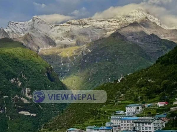
Magical sunrise reflection in the Himalayas on the Everest Base Camp Trek route
Acclimatisation is the single most significant factor that influences EBC trekking success. You absolutely need to let your body get used to the lower and lower levels of oxygen as you climb ever-higher. The program also allows for 2 acclimatizing days, making the total duration of the trekking package 14 days.
Up high, pressure is lower. So there's less oxygen available. At Mount Everest Base Camp, for instance, the air contains half as much oxygen as at sea level when you are standing at 5,364 meters.
To compensate, your body makes more red blood cells. And it also makes you breathe faster, among other responses. If you rush to a higher elevation before this adaptation happens, you’ll get altitude sickness. You don’t want to skimp on acclimatization days.
Altitude Zone
Elevation Range
Oxygen Availability
Acclimatization Need
Low Altitude
0-2,500m
100-80%
Minimal
Moderate Altitude
2,500-3,500m
80-65%
Important
High Altitude
3,500-5,500m
65-50%
Critical
Very High Altitude
5,500-8,000m+
50-30%
Extreme measures required
How Companies Plan Acclimatization
Professional trekking companies schedule itineraries based on the “climb high, sleep low” tenet. That is hiking to a higher elevation in the day and dropping back down to sleep at a lower altitude. The 12-day EBC schedule is structured to follow this pattern in the following way:
Rest Days: We have included rest days in the itinerary at Namche Bazaar (Day 3) and Dingboche (Day 6) for acclimatization. These are not traditional “rest” days, but are spent on the go hiking to higher elevations before returning to sleep at the same height.
Slow Ascent: There are a few forced marches in this itinerary. Ascending more than 500 meters per day above 3,000 meters raises the risk of altitude sickness. For this trek, normally you will climb no more than 400-600 meters on average per day.
Strategic Overnight Holds: Sleep-high gain hikes are made incrementally phased en route Phakding (2,610m), Namche (3,440m), Tengboche (3,810m), Dingboche (4,410m), Lobuche (4,910m) and Gorakshep 5(140m). The process is gradual, and there’s some order to it.
Acclimatization Hikes Explained
Day 3: Trekkers ascend to either Everest View Hotel or Khumjung, reaching 3,880m or 3,780m. That's a net increase of 340m to 440m. Then you descend to sleep again at 3,440m. The temporary increase in altitude causes a physiological response without the stress of sleeping high.
Day 6: At Dingboche, the routine hike to the top of Nagarjun Hill rises to an altitude of around 5,100 meters. That's 690 meters above sleeping altitude. It's good preparation for the ascent to Gorakshep and Everest Base Camp over the next couple of days.
Mathematical Principle: The data indicates that if you spend 6 to 8 hours at an altitude ranging from 300 to 500 meters above sleeping altitude, there'll be a significant increase in the process of acclimatization. The formula can be derived as follows:
Benefit of Acclimatization = (Peak Altitude - Sleeping Altitude) * Time Spent at Peak Altitude / Body Adaptation Factor
You'll feel the difference these calculated hikes make when you reach higher elevations.
Why Two Rest Days Are Essential
Data from trekking agencies suggests the success rate of reaching Everest Base Camp is 85 to 90% for itineraries with two acclimatization days. But it's only 65 to 70% for those with just one rest day.
The second rest day at Dingboche is particularly significant since you're sleeping over 4,000 meters. And the impact of altitude becomes more noticeable.
Your body needs time to:
Boost production of red blood cells for more efficient oxygen transportation
Modify your breathing to adjust for the decrease in oxygen pressure
Maintain fluid balance (dehydration aggravates the effects of altitude) Permit mitochondria level adaptation to take place
Skipping rest days as a time or money saver is almost certain to spell trouble. Altitude sickness knows no age. Young, fit trekkers get it just as frequently as older ones if they don't acclimatize properly. You'll be glad you took those extra days when you're standing at Base Camp feeling strong.
Altitude Sickness Prevention Beyond Rest Days
To acclimatize well, it's important to do more than just adhere to an itinerary.
Drink 4 to 5 liters of water each day. Lack of water causes dehydration, whose effects are similar to AMS. You'll want to keep a water bottle handy at all times.
Always eat, even if you don't have an appetite. You need extra calories at high altitude.
Avoid drinking alcohol or taking sleeping pills. They slow down breathing.
Always walk slowly. In fact, you can use the Swahili phrase pole pole, commonly used in climbing Kilimanjaro or Everest. It applies perfectly here.
Consider Diamox tablets. Some trekkers take acetazolamide, a drug that increases breathing rates and urination rates in the body. It promotes faster acclimatization. But please consult your doctor before you start your journey with this option in mind. The tablets don't cure altitude sickness. Instead, they reduce its severity and promote faster adaptation.
Frequently Asked Questions About the EBC Trek
What is the duration of the Everest Base Camp trek in days?
The standard Everest Base Camp trek is 12 days, once flights to and from Kathmandu to Lukla are factored in. There are shorter 10–day versions, but they miss out important acclimatization days, which can make the risk of altitude sickness much higher.
What happens on acclimatization days during the trek?
Acclimatization days are spent walking up higher than your overnight stop and coming back down to sleep lower. At Namche Bazaar, for example, you’ll hike up to 3,880m before descending to sleep at 3,440m.
Do I really need acclimatization for Everest Base Camp?
Yes, good acclimatization is essential to reach Everest Base Camp at 5,364m/17,598 ft in the safest way possible. Without acclimatization, it is unlikely that most trekkers will ever see the end of their trek.
Is the 12-day Everest Base Camp trek possible for beginners?
With good fitness and determination, even a beginner can accomplish the 12-day EBC trek. You don’t need any climbing technical skills, but you should train with cardio and practice hikes for 2-3 months preceding your trip.
What is a Everest Base Camp Trek Hardest Day?
Day 9 of combining the Kala Patthar sunrise climb and descending to Pheriche is usually the hardest. You wake at 4 a.m., ascend to 5,555m, come down to Gorakshep and then descend to 4,240m approximately 16 kilometers during a day in high altitude.
What is the cost of the Everest Base Camp trek?
The cost of the EBC trek runs between $1,200-2,500 (depending on quality of service you want). At the budget end of the scale, there are simple teahouse-stay and group guide models; at the premium level, you find higher-end accommodation, smaller groups, and experienced private guides.
What is the best time to hike to Everest Base Camp?
The best seasons for doing the Everest Base Camp trek are spring (March to May) and autumn (September to November). This time provides fine weather, good visibility and moderate temperature. So trekking conditions are perfect.
Do I need a guide to hike Everest Base Camp?
Yes, a guide is required and highly recommended for the EBC Trek. Guides offer direction, culture knowledge, altitude sickness monitoring and emergency support. All of which contribute to increased safety and comfort levels. You'll appreciate having an experienced guide when conditions get tough.
What permits are required for the Everest Base Camp trek?
You'll require two permits: the Sagarmatha National Park Entry Permit (3,000 NPR) and the Khumbu Pasang Lhamu Rural Municipality Permit (2,000 NPR). Trekking agencies usually arrange these. But you can purchase them on your own in Kathmandu.
How hard is the Everest Base Camp trek?
The EBC trek is rated as moderate to difficult. Being at altitude, not technical climbing, is the main challenge. Also, you'll be walking 5 to 7 hours each day. You'll face modest accommodation and unpredictable weather rather than dangerous terrain.