Himlung Himal Expedition (7126M) in Spring and Autumn

Himlung Himal Expedition (7126M) in Spring and Autumn

Customize Trip
Trip at a Glance
Duration32 Days
Trip GradeVery Strenuous
CountryNepal
Maximum Altitude7,126 meters (23,379 feet)
Group Size1 to 15 climbers (maintained at a strict 1:2 Sherpa-to-climber ratio)
StartsKathmandu, Nepal
EndsKathmandu, Nepal
ActivitiesHigh-altitude mountaineering, glacier navigation, fixed-line climbing, ice/snow slope ascents, and wilderness trekking through restricted areas
Best TimeAutumn (September – November), Spring (April – May)
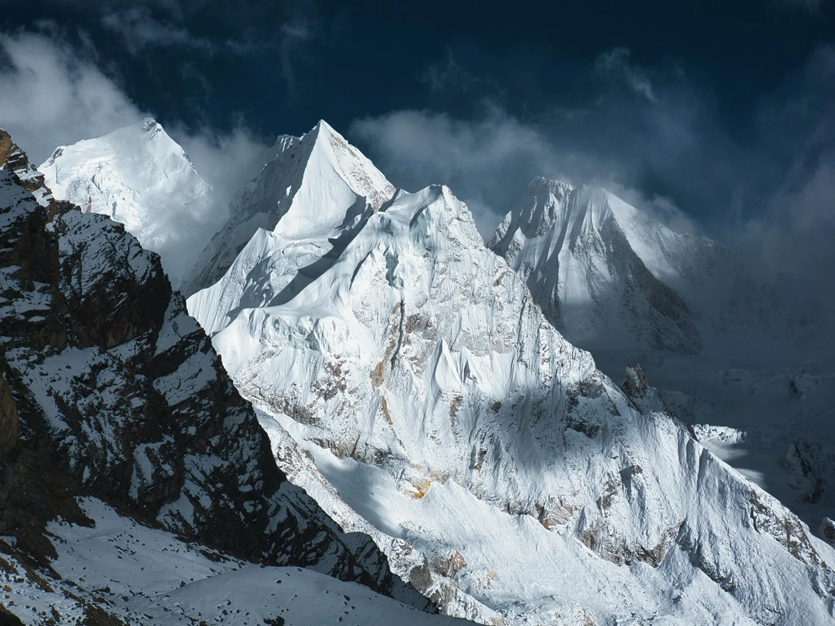
  • Himlung Himal Summit - 7,126m. One of the most straightforward 7,000m peaks in Nepal to try, ascending through the celebrated North West Ridge, graded Alpine PD+, an authentic expedition climb with little technical challenge.
  • Max Altitude: 7,126m. Himlung Himal is the bridging terrain between trekking peaks of 6,000 meters in height (Island Peak or Mera Peak) and the top Himalayan peaks of 8,000-meter scale such as Manaslu or Cho Oyu.
  • 32-Day Expedition Schedule: We do not offer abbreviated trips. The schedule for 32 days allows for the 9-day wilderness walk-in through the limited Nar-Phu corridor, two complete high camp rotations, a full summit window, and extra days as per the weather forecast.
  • Technical Alpine Grading (PD+ / AD): The NW Ridge route is not of extreme verticality, but certainly not for the faint-hearted and requires heavy-duty alpine skills. Navigating through glacier crevasses and on 35-45 degree snow & ice slopes with an extended stretch of fixed line under extreme sub-zero conditions.
  • Small, intentionally expanded team - one dedicated Sherpa climber for every two clients, always that ratio rather than a ratio reduced for trekking days and sharpened for the summit attempt.
  • Climb leadership by Dorje Sherpa/ Nima Sherpa or Ang Dawa Sherpa 10 years+ experience at altitude per climber.
  • Non-restricted access to Nar-Phu Valley: The least-traveled of the area's trekking routes, it extends from Koto and Meta to Kyang and the Tibetan enclave of Phu Gaun.
  • Warm tented dining area at Base Camp, where a dedicated expedition chef prepares fresh, high-calorie meals each day.
  • Accessible 24/7 in direct communication with company managers - Bhupendra Adhikari / Santosh Bikram Adhikari available on WhatsApp, Viber, or WeChat at all times during the expedition.
  • Pre-trek briefing at our Nursing Chowk office in Thamel, Kathmandu, with either Bhupen or Santosh before your departure.
  • 1:2 High-Altitude Sherpa Ratio: Special 1:2 ratio of experienced Sherpas. Initially experienced Sherpas establish for clients Camps I and II before they arrive and support these camps in difficult climbing conditions with regard to strict ratio of 1:2 (one Sherpa for two clients). 

At 7,126m, Himlung Himal is a mountain located in Nepal's Nar-Phu valley on the Tibetan border. It was first summited in 1992 via its Northwest Ridge route, which is considered to be moderately easy (Alpine PD+) and includes some glacier travel and fixed roping. Thus, Himlung Himal is a great place to train climbers en route to 8,000m peaks. During this 32-day expedition, participants hike through the restricted area where they will spend a night at Koto, a night at Meta and 5 nights at Phu Gaun. Led by a climbing guide, Dorje Sherpa, the team will carry out the final rotation to Base Camp and beyond. Prices range from $7,500 to $10,000 depending on the number of participants. Our expeditions to Himlung Himal follow a careful framework of 32 days that ensures proper acclimatisation, considers safety, and achieves a successful summit.

Himlung Himal Expedition (7126M) in Spring and Autumn Overview

We do not consider Himlung Himal an "easy 7,000er" at View Nepal Treks, even though the trend in the industry is to sell it that way. The fact is that alpine PD+ terrain at the altitude of 7,126m is the same journey that requires climbing up the glacier, overcoming crevasses, and moving along with the help of fixed ropes in the mountain's upper region. What makes the ascent possible is not the ease of the trip, but maintaining an appropriate pace.

Dorje Sherpa, our climbing guide, leads expeditions personally, and every two clients are assigned one Sherpa to maintain the ratio of serving people that is optimum in terms of guiding them through challenging areas getting to the top of the mountain.

The route has tangible significance beyond mere numbers concerning summiting the peaks. Walking through the Nar-Phu Valley - places like Koto, Meta, Kyang, Phu Gaun - lets trekkers immerse themselves in one of the last few surviving Tibetan cultural trade areas, still functioning to a significant degree independently before the mountain climbing starts. This route represents for us an integral part of the adventure and not a technical, administrative part of the journey to Base Camp.

Pricing reflects the logic of group economics: there are three price points, of $10,000 for solo climbers, of $8,000 per person for groups of 2 to 6 people, and of $7,500 per person for groups of 7 to 15 people, which are determined by cost-sharing in terms of permits, staffing, and logistics rather than arbitrary discounts. We built this itinerary around one idea, which states that turning back before the summit because of bad weather conditions is the right decision, one upon which guide teams, and not clients, decide something that many other companies would prefer to conceal.

Himlung Himal Expedition Trip Highlights

  • Progress to the summit of a real 7,126m Himalayan peak via the Northwest Ridge, first summited on October 3, 1992 - this climb is a true introduction to high-altitude climbing at the 7,000m level, rather than a glorified, commercially overstated "trekking peak".
  • Enter the secured Nar-Phu valley, where permits regulate the number of people entering this area, leading to significantly fewer trekkers compared to the clouds of hikers on the Annapurna Circuit.
  • Proceed to Phu Gaun, a village that is completely enclosed, with all the features of a Tibetan landscape and home to dialects, sounds, and rhythms of life that are closer to Tibet than to the lower part of Nepal.
  • Make your way past the ruins of Kyang, which are in good condition and connected to stories of a settlement populated many generations ago.
  • Follow the drive north through the Marsyangdi gorge beyond Chame with Annapurna II breaking through the clouds.
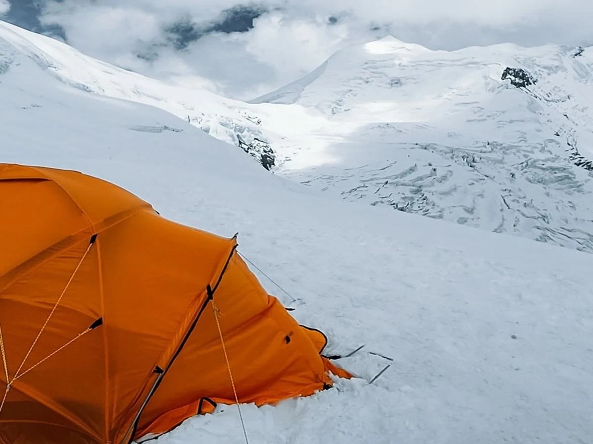
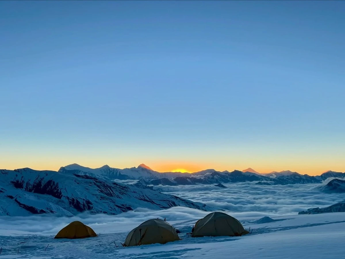
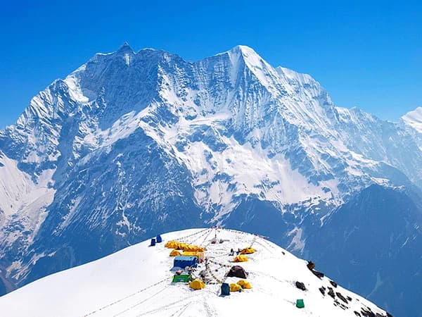
  • Setting up your camp beneath the pyramid-shaped summit of Himlung at an altitude of 4,900m on a rocky terrace makes it possible to do glacier walking and fixed-rope climbing.
  • The upper mountain offers a true glacier experience and requires moderate steep snow climbing with an Alpine PD+ difficulty level.
  • The valley where the trek takes place has long served as a trade route between Tibet and India and has preserved its culture.
  • Complete the trek on a path few trekkers are ever allowed to go on in Nepal.

Where Is Himlung Himal Located?

The Himlung Himal (7,126 m) has a latitude of 28°46'18"N and a longitude of 84°25'29"E in the Peri Himal, which is a relatively small sub-range situated between the Annapurna massif and Manaslu in the Manang district of Gandaki Province, near the border with Tibet. The climbing route starts from Besisahar, continuing through Chame, Koto, Meta, Kyang, and Phu Gaun, ending at Base Camp and spanning around 97 km of trekking distance before the start of any climbing process.

This jeep road passing through this part of the Marsyangdi valley has a propensity for seasonal landslides in the post-monsoon season, an aspect that is specific to this route rather than an obstacle. Phu Gaun is the nearest village and last significant supply point before Base Camp; from there onwards, the communication facilities drop significantly, as expected of a restricted and sparsely populated region. The area has been closed for mountaineering until 1992, and still, today, this part of Manang receives much less traffic than the adjacent main Annapurna Circuit, from which it deviates due to the permit restrictions on group size.

Himlung Himal Expedition Quick Essential Facts

Operational Category

Parameter

Specification Details

Geographic & Peak Profile

Peak Elevation

7,126m / 23,379ft

Coordinates

2846'18''N, 8425'29''E

Mountain Range

Peri Himal (between Annapurna & Manaslu ranges)

Location & Border

Manang District, Gandaki Province, Nepal (adjoins Tibet border)

Nearest Settlement

Phu Gaun

Peak Classification

Major Expedition Peak (Government of Nepal / Ministry of Tourism)

Historical & Route Data

Region Opened

1992

First Ascent

October 3, 1992 (Osamu Hanai, Akio Koizumi, Nima Sherpa)

Standard Route

Northwest Ridge

Technical Grade

Alpine PD+ (Glacial navigation, fixed ropes on upper snowfields)

Climbing Logistics

Base Camp Elevation

4,900m

High Camp Setup

Camp I (5,450m), Camp II (6,000m), High Camp (6,350m)

Access Route

Kathmandu → Besisahar → Chame → Koto → Meta → Kyang → Phu Gaun → BC

Approach Distance

97km caravan route from Besisahar

Permit Requirements

Nar-Phu Valley Restricted Area Permit (RAP) + Government Climbing Royalty

Ideal Climbing Windows

Autumn (Late Sep - Nov) & Spring (April - May)

Expedition Duration

30-40 Days (Kathmandu to Kathmandu)

Operator Specifications

Operator

View Nepal Treks

Lead Climbing Guide

Dorje Sherpa

High-Altitude Support Ratio

1:2 (1 Climbing Sherpa per 2 Guests)

Tiered Group Pricing

1 Pax: $10,000 per person

2-6 Pax: $$8,000 per person

7-15 Pax: $$7,500 per person

Why Choose View Nepal Treks for Himlung Himal Peak Climbing?

  • The climbing team is led by Dorje Sherpa, Nima Sherpa, and Ang Dawa Sherpa, with each of them having more than 10 years of experience working at heights. We have adapted our approach in this manner, even if it costs us more than hiring just one guide for the entire group, because we believe that using only one person to handle all the rotation, rope fixing, and ultimate climbing is taking too much risk for the clients in terms of safety.
  • We provide real 24/7 assistance, which means direct contact and availability of Chairman Bhupendra Adhikari or Santosh Bikram Adhikari via WhatsApp, Viber, or WeChat, instead of some email, as is common in many companies. Many of the companies use the phrase “24/7 support” only for some ticket system on their sites, while we mean that, in case something goes wrong at the height of 6000 m, the client should be sure that he/she is contacting the one who can make any decision in the case. If the situation is otherwise, that is our failure.
  • Pre-campaign briefing is not done over email - you meet Bhupen or Santosh face-to-face at the office. As we understand it, a briefing in which you cannot ask follow-up questions is not a briefing; it is just a disclaimer.
  • A duffel bag, a medical kit, oxygen, and support are not offered for extra charges - some companies state that these are optional extras after booking.
  • When we coordinate the rescue, we do it ourselves. If we have to use a helicopter for evacuation, we will do so ourselves and not pass on the responsibility to the client. We believe that a company that makes a climber responsible for logistics related to his or her rescue is not fulfilling its mission.
  • The presence of satellite phone communications at Base Camp is not simply for convenience but also for accountability, allowing climbers to be in touch with their families and providing the Kathmandu office with a means of keeping up with developments and reacting to them quickly so that there is no need to rely on hindsight when something goes wrong.
  • Two preparations are made prior to making climbs up to Camp I (5,450m) and Camp II (6,000m), including the advance cargo runs carried out by the 1:2 ratio of Sherpas. With these arrangements in place, climbers are guaranteed arrival at the camps prepared and do not waste precious energy setting them up after an eight-hour hike.
  • Employing dedicated teams for rescuing or providing evacuation by helicopter is common practice in the locations the company services, where the Kathmandu offices take full responsibility for obtaining the necessary rights and permissions, as well as calling helicopters to the rescue sites, such as Phu Gaun.
  • Regular High-Altitude Hydration and Kitchen Sanitation: Fluid deficiency fastens altitude sickness and frostbite on ascent to frigid ridges. It is our protocol to always have a melt-and-boil station open to supply unlimited hot and mineral-infused drinks at Base Camp and high camps, and to dewax the food using stringent thermal sanitation protocols to avoid gastrointestinal illness prior to rotations.
  • Fixed-Line Safety and Equipment Transparency: Safety on Himlung’s Northwest ridge is guaranteed by the presence of secure fixed lines over crevassed glaciers situated at Camp I (5,450m) and with incline angles up to 35°–45° on snowy/icy slopes on the way to High Camp (6,350m). View Nepal Treks delivers to the place of the setup the fresh 10mm low-stretch static rope and equipment for fixing, as well as sends its own Sherpa team to check the reliability of anchoring, snow pickets, and rope tension at each setup prior to all rotations.

Why Is the Restricted Nar-Phu Approach Essential to Our Strategy?

The nine-day journey through Nar-Phu Valley is employed as an acclimatization strategy, rather than merely being considered a stage of transit. The gradual climb from Koto (2600 m) through Meta and Kyang to Phu Gaun (4080 m) brings about a natural increase in altitude, which starts the production of red blood cells before reaching Base Camp (4900 m).

The restricted area limits the passing of commercial traffic and protects the team against possible infections while allowing high-altitude recovery walks to Tashi Lhakhang Monastery. Once the team reaches the moraine of the Pankri Glacier, it can adapt physiologically to the low-altitude conditions and decrease the chance of Acute Mountain Sickness (AMS) on the way to the high camp on Himlung Himal.

Himlung Himal Climbing Expedition Cost 2027/2028

We have tiered group pricing to ensure our strict 1:2 ratio of Sherpas to climbers, that our Base Camp chef maintains high-quality standards, and that we have all the high-altitude safety measures in place no matter how big the team is.

Group Size

Cost Per Person (USD)

Support Ratio and Operations

Solo Climber (1 Pax)

$10,000

Dedicated logistics, 1:1 Sherpa support, private Base Camp setup

Small Group (2 to 6 Pax)

$8,000

1:2 Sherpa-to-climber ratio, full Base Camp infrastructure

Full Team (7 to 15 Pax)

$7,500

1:2 Sherpa-to-climber ratio, triple leadership core oversight

Itinerary

This comprehensive 32-day expedition on Himlung Himal utilizes a progressive acclimatization schedule that merges cutting-edge high-altitude physiologist techniques and modern expedition logistics. Starting in Kathmandu, the 4WD drive will take climbers to Koto, and the expedition will continue via the restricted Nar-Phu Valley towards the Base Camp located at 4900m elevation. 

Instead of making a hasty ascent to the high altitude camps, climbers will make multiple trips to Camp 1 (5450m), Camp 2 (6000m), and the High Camp, located on the Northwest Ridge at 6350m elevation. Under the leadership of Dorje Sherpa and our expert leaders, climbers will adjust to a harsh environment of high-altitude climbing before actually approaching the summit of 7126m. Days reserved for bad weather are included in the itinerary for safety purposes and increase the efficiency of the climb. The itinerary follows the [Dorje's / View Nepal Treks] standard Himlung Himal program but with the personal commentaries of the climber who put forward the peak in October 2022.

Trip PlanExpand all

As soon as you step outside the arrival hall of Tribhuvan, the first thing that greets you is the noise generated by honking horns, taxi drivers offering you their services, and flower garlands, among other things.

Our team will find you by holding your name at the exit of the airport. The ride to the Thamel area can take longer than expected because of the traffic. Nothing is planned for you except breakfast.

There are many travel companies that plan day one of their itinerary with many activities, including a welcome dinner, in order to appear generous. We don’t believe in that. After spending hours in a confined space, adventurers want to unwind and not attend fancy dinners and meetings.

Caution: Skip the long hike and big meal tonight. The water damage caused by the flight far outweighs any issues caused by altitude.

Max Altitude: 1,400 m Meals: BreakfastAccommodation: 3-Star Standard Hotel (Kathmandu)Duration: 30 minsDistance: 6 km (Airport transfer)

Dorje Sherpa or Bhupen or Santosh gives the briefing himself, and it can take a full two or three hours, not a rushed forty minutes. This briefing usually concerns the Nar Phu route village by village and describes the specifics of Himlung Mountain: its first ascent took place on October 3rd, 1992. It was made by Osamu Hanai, Akio Koizumi, and Nima Sherpa using the Northwest Ridge route, which is still popular nowadays and is considered Alpine PD+ graded and requires extensive glacier hikes and ropes on the steep parts. As part of the briefing, Dorje clearly emphasizes that the so-called technically feasible mountains are those where climbers get hurt, since their climbing seems easier and causes nothing but negligence. This is also why do not forget to check your equipment at the very end of the day before the start of the climbing.

Tip: bring anything you're uncertain about to this session! The shops in Kathmandu can often fix it for you that day, whereas in Koto and beyond they can't.

Max Altitude: 1,400m Meals: BreakfastAccommodation: 3-Star Standard Hotel (Kathmandu)Duration: 0 km (In-town)Distance: Full day

Following the Prithvi Highway is a journey through Trishuli and Marsyangdi, while the rice paddies take the place of city development. Besisahar is Lamjung’s district headquarters, the main town more concerned with being a working one than a tourist attraction.

Some travelers have managed to complete their trip in half a day to save on overnight accommodation. We, however, do not take this route.

While other places might have their own merits, the significant motive behind our choice of Besisahar is the fact that it is the first opportunity to spot people who are trying to mislead others about their fitness records at an early stage, so as to prevent it from developing into a rescue mission two weeks later in the Nar Valley.

This long drive is said to take around 6-8 hours depending on the condition of the roads, especially during the monsoon season (June-September), when landslide situations can stop the car unexpectedly.

Max Altitude: 760m Meals: Breakfast, Lunch, DinnerAccommodation: TeahouseDuration: 6–7 hoursDistance: ~175 km

This was the toughest day of driving, for sure. The jeep road hugs the cliffs of the Marsyangdi gorge, beyond Chame, the headquarters of the Manang district, with Annapurna II peeking through the clouds sometimes.

Koto is the middle checkpoint village to verify Nar-Phu area restricted permits physically. Dorje and the team verify these while you can relax. The whole great trekking team meets here: the porters, mules, kitchen crew, and all.

Dorje has a firm belief that no one can get the porters ready in advance or in other villages because he can’t allow them to remain idle on his payroll for as long as three days.

Climber's Note: Due to heavy snow and lots of rain in the preceding weeks, roads were washed out, and previously we started our trek from Chame (900m) instead of Koto; take into consideration the possibility during the monsoon shoulder season. For the trek, it's enough to bring along a 35L daypack, containing a spare shirt, small towel, rain jacket and pants, 2-3L of water and some snacks. It's vital to drink enough water to help your body acclimatize, even this early on.

Max Altitude: 2,600m Meals: Breakfast, Lunch, DinnerAccommodation: TeahouseDuration: 6–7 hoursDistance: ~65 km

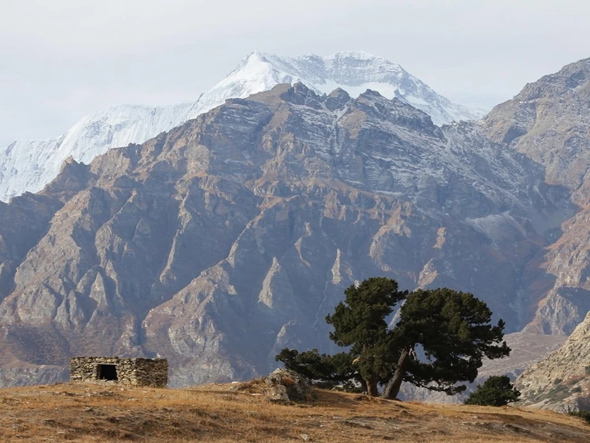
The path suddenly vanishes, and the Nar Khola gorge engulfs us; steep rocky cliffs and the pines and junipers begin to diminish rapidly. Fewer groups approach here compared to the Annapurna Circuit; there are no tea houses along the trail, just a scattering of stone shepherd’s huts and endless silence interspersed with the sounds of the river. Dorje takes his leisurely pace and bluntly explains it: he has seen groups from other agencies race through Meta during an afternoon to accumulate a rest day later on in the journey and believes this swap is not beneficial for anyone since there is no significant difference between resting at this point and during the descent from the high camps.

Caution: This is the altitude that most climbers first start to notice - a slight headache or the onset of breathlessness on the hills. If it gets worse or leads to nausea, then this is not normal. Say something immediately.

Tip: Category B or C boots for the trek: don't carry anything heavier, as they are liable to cause blisters. Keep your massive 8000m boots for above base camp.

Max Altitude: 3,560m Meals: Breakfast, Lunch, DinnerAccommodation: Tented Camp / TeahouseDuration: 7–8 hoursDistance: ~18.5 km

There is a small distance separating the two points, but the change in atmosphere adds to the description. The width of the valley decreases, while the flora gives way to shrubs. At this point, the climbers pass by the remains of what are said to be the ruins of the village abandoned centuries ago.

The distance is covered step by step, and Kyang is the place where many climbers have their first true conversation with Dorje. When climbers are alone, he asks how they are feeling, so that they will be able to speak their minds without worrying about their appearances in front of the rest.

As Dorje states, the group talks reveal certain symptoms, but the one-on-one conversation uncovers the truth about the person’s condition.

Climbers’ note: Kyang was destroyed during the earthquake of 2015 and was only rebuilt in the last couple of years.

Max Altitude: 3,840m Meals: Breakfast, Lunch, DinnerAccommodation: Tented Camp / TeahouseDuration: 5–6 hoursDistance: ~14 km

To get to Phu Gaun, the most remote village on this route, one will cross a wobbly suspension bridge followed by a narrow gorge. The hamlet is surrounded by stone walls. As one approaches it, they will come across chortens and then will see an ancient gompa that guards barren houses built for winds and not for views.

Usually, it is on this day that climbers see the peak of Himlung for the first time. Dorje is quite adamant about his position on drone photography in this settlement, although it is legally permissible to take photographs.

Dorje doesn't consider it to be the right thing to do, so he is ready to lose a photo opportunity for the sake of keeping good relations with the village that he constantly visits with his team.

Tip: Some climbers go hiking to Gangbu (~4,800 m) in the afternoon. The climb is short, but worth doing because it offers the first real view of Himlung.

Max Altitude: 3,900m Meals: Breakfast, Lunch, DinnerAccommodation: Tented Camp / TeahouseDuration: 4–5 hoursDistance: ~11 km

This day is not a day off for Dorje but a life-saving measure in his eyes. He adheres to the advice that when a healthy, strong-seeming group solicits him to forgo this one day for some extra time, he has turned down similar offers before. He has informed such groups that the people look and seem healthy at sea level, but that was not the case upon arriving at 4,900m two days later.

Others take advantage of the morning to walk through the stone-littered alleys of Phu, or undertake a gentle trek along the ridge that runs parallel to the village, with an altitude sufficient to begin the acclimatization process. The group's oxygen saturation levels are also measured at the start of the day.

Tip: Most people need to drink much more than they believe they do - 4 to 5 litres per day is a reasonable goal. Eating & drinking will be essential to avoid dehydration symptoms mistaken for altitude sickness.

Max Altitude: 3,900m Meals: Breakfast, Lunch, DinnerAccommodation: Tented Camp / TeahouseDuration: 3–4 hoursDistance: ~5 km

You have moved beyond the last settlement; the landscape has taken on an unmistakably alpine character; the moraines, the scree, and the foot of the glaciers can be seen. There are great heights to conquer, but how to make this climb easier? You need to go step by step, using staging. The Base Camp is located on a rocky ledge beneath the peak of Himlung.

The base camp manager, Dorje, follows one rule: no one is allowed to ask about the climb until the camp has been established and the climbers have enjoyed dinner. He has seen many climbers make mistakes when they talk about the climbing preparation during hours of traveling to the camp, so he is ready to hold up the conversation for two hours rather than allow climbers to make wrong decisions.

According to some measurements, the Base Camp is a little less than 4,850m high, so expect about three days of stay in the camp before the climbing rotation starts. This is a good time for acclimatization before climbing.

Before climbing started, the expedition team went through puja, a ceremonial operation that involves bestowing blessings on climbers by monks from the Phu village.

Max Altitude: 4,900m Meals: Breakfast, Lunch, DinnerAccommodation: Expedition Tented CampDuration: 5–6 hoursDistance: ~13.5 km

This is the eleven-day block in which the expedition is transformed from a trek into a technical climb. It is based around just one principle - controlled, repeated exposure to altitude, with a gradual acclimatisation down each night - and what follows is a breakdown of exactly what this entails on a daily basis as it plays out on the route up Himlung's Northwest Ridge.

The Rotation Structure

Rather than pushing straight up towards the summit, climbers rotate between Base Camp (4,900m), Camp I and Camp II in an overlapping series of loops, gradually pushing higher and further each time before retreating down to Base Camp to rest and recover for a few days; a typical rotation would see a climber return to Base Camp after the first push up to Camp I, spend a few days resting at Base Camp and then push up the route again, this time to Camp II before returning to Base Camp once more.

These rotations are always dictated by the weather, with no two years likely to follow exactly the same pattern, and it is the combination of snowfall and crevasse conditions on the glacier that dictates how much rotation can take place in any given year.

What the Climbing Sherpa Team Is Doing Ahead of You

Whilst climbers rotate back down to Base Camp and spend a few days resting, the climbing Sherpa team work on the mountain in relative isolation, fixing ropes along the most crevassed and technical sections of the route, assessing their condition and working with the local ice conditions to make sure they are stable and safe.

This work goes on in the background to the rotations of the client group, but it is the most important task on the mountain, as it is what enables any rotation to take place at all; it is the progress made by these guides that determines how far any given rotation can get on any particular day, and is the first item of discussion during each morning's briefing.

Camp I and Camp II: What They're Actually Like

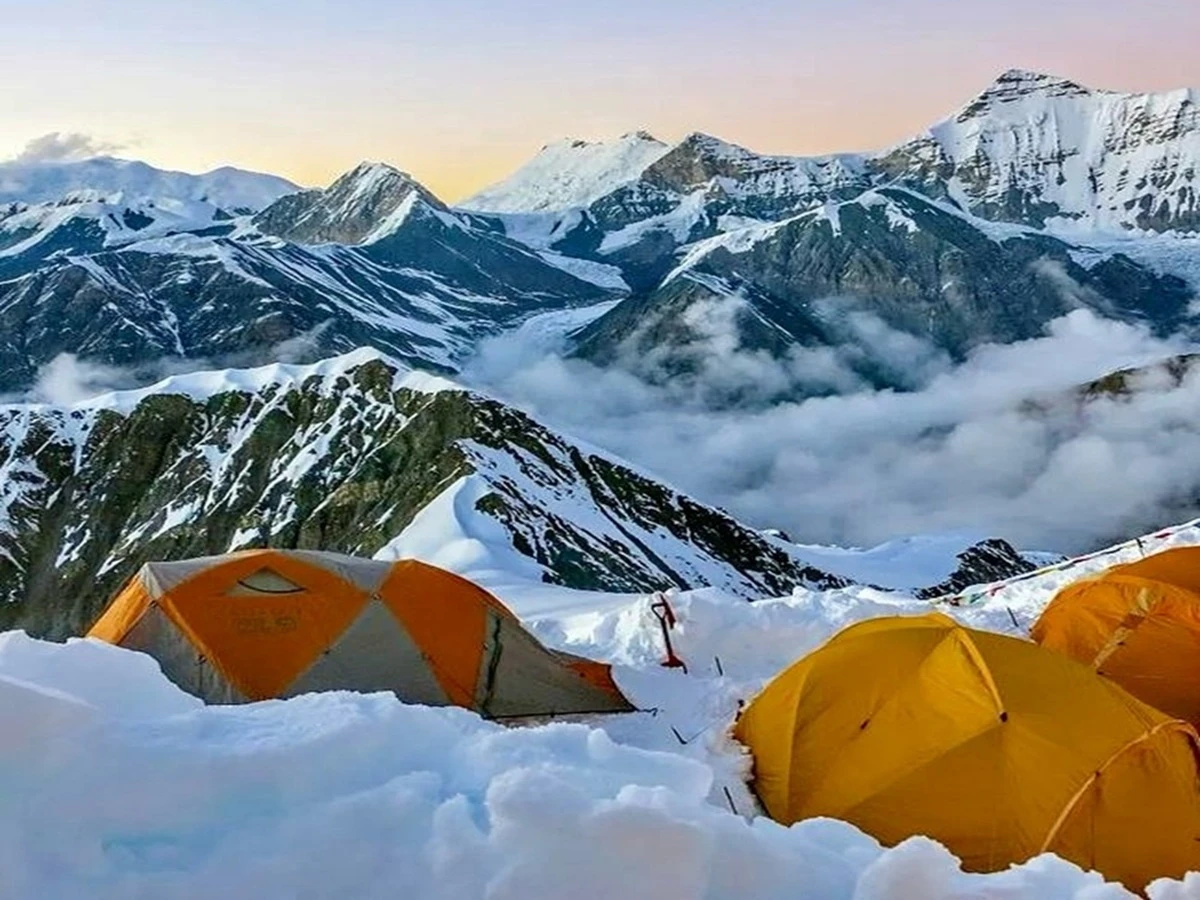
Camp I is located at the lower glacier and can be reached with moderate snow and ice condition and short sections along the route have fixed ropes. From here it is easier to go to Camp II which is more exposed and higher. As a rule, Camp II is typically colder and windier. The increased altitude means that the overall classification remains PD + but everything demands significantly more work and time.

Sleep at both camps is poor, even though the climbers were accustomed to a high altitude before the rotation. This is not a sign of concern, merely normal occurrence.

Health Monitoring Through the Block

Oxygen saturation, heart rate, and the entire condition of the camps over the entire period must be carefully monitored, the frequency is increasing together with the climbers’ move higher. It should be informed about symptoms that make it for guide to cease the rotation - the headache which can not be remitted by rest, water, and food, inability to coordinate movements or a cough getting worse and not better.

A Climber's Example: Camp Layout and Rotation in Practice

Although the altitudes of the camps vary from season to season and route to route, as a rough guide, they are as follows: Camp I – 5,450m on a small plateau; Camp II - approx. 6,000m on the glacier (some teams use an additional Camp 2.5 – 6,100m on the glacier a little further along the route), Camp III - 6,450m on the summit ridge where you get your first ever glimpse of Annapurna and Dhaulagiri.

Apart from the normal toils of climbing at altitude, there are a number of features which are particularly hard or require extra caution. The crossing over the moraine from the Base Camp to Camp I is extremely strenuous, and the return journey from Camp I is riddled with loose rocks – better to keep to the side of the trail using the fixed ropes along the way. Just above Camp I lies the infamous “bottleneck”, a steepening of the path best negotiated on a knee-deep belly. A little below Camp III, another challenge awaits in the form of a short but steep wall of ice which requires the use of ascenders. Finally, the climb to the summit does not involve any technical difficulties.

The standard rotation is as follows: Rotation 1: Base Camp - Camp I (spend the night) - Camp II (spend the night; shed any unnecessary equipment such as mittens, dried food, base layers and gas)  - return to Base Camp for a well-deserved rest.

In practice, it is important to note that this rotation can often take longer than accounted for if bad weather means you have to delay your departure for the summit. Rotation 2 (the summit rotation): Base Camp - Camp I (spend the night) - Camp II (spend the night) – Camp III (spend the night) – push for the summit.

There is also the option of using the French Base Camp, situated beyond the moraine in a small clearing. However, due to the extra effort required to shift supplies from the French Base Camp to the actual Base Camp, it is rarely used.

Weather as the Real Variable

This phase is not necessarily solely about the time of year. Weather updates are monitored daily with satellite and regional meteorological sources, meaning the rotation can be cut short, delayed, or even prolonged by a day or two based on the wind speed and precipitation level at the high camp. Hence, it is important to note that Days 10-20 are referred to in the itinerary as a block rather than 11 fixed days. Indeed, the number of rotations is more decisive than the specific date of each rotation.

Caution: One of the most common mistakes committed by inexperienced climbers at the 7,000m level is correlating a rest day in Base Camp with inactivity. Remember that drinking enough water, eating on schedule, and moving lightly on such breaks is very significant, as it is not just lying idle that guarantees a successful subsequent rotation.

Max Altitude: Base Camp (4,900m) to Camp II (6,000m) Meals: Full Board (High-Altitude Rations & Fresh BC Meals)Accommodation: High-Altitude Mountain Tents / Base Camp DomesDuration: 4–7 hours per rotation legDistance: Variable (~6–10 km per rotation cycle)

The summit opportunity arises after all the rotations have ended and the reliable forecast occurs. This usually includes several days advancing from Camp I and Camp II to the final camp and then a summit attempt which lasts approximately 8 to10 hours.

It is at this point that Dorje's very clear, repeated statement about this whole expedition comes into play. The decision to turn back must be made by the guides, not the clients, and he will not reverse his choice because of a disappointed client. He has stated clearly that he would rather receive an angry phone call from someone who did not make it to the top than the other type of phone call made to someone who did not make it to the summit, and whose family should be informed about that.

Descending down to Base Camp happens approximately 24-48 hours after summiting, provided the weather conditions are suitable.

Caution: More Himalayan accidents are caused by climbers' or guides' stubbornness past a safe turnaround time than by any other single factor. A non-summit is a competent outcome. The climb itself is the point.

Climber's note: Weather can delay an acclimated summit push; plan on a 4-5 am start to actually kick off at 9-10 am if the winds haven't died down overnight. Once on the move, budget 7 hours for the final push to the summit and 2 hours to get back down to high camp. Expect to spend another night at high camp before turning around and heading back down to Base Camp (some people prefer to break up the descent at Camp I instead of doing it all in one day).

Lesson learned: Cold toes and fingers on the summit push are entirely expected, even with good gear. Inadequate insulation (particularly legs and hands) is a common cause of this, so consider two pairs of socks (thin merino liner + thick wool), appropriate base layer, down pants over insulated pants, and proper 8000m boots as critical gear upgrades. Meanwhile, chemical hand and toe warmers are an essential item to pack, no matter how prepared you think you are.

Max Altitude: High Camp (6,350m) to Summit (7,126m) Meals: Full Board (High-Altitude Rations & Energy Packs)Accommodation: High-Altitude Mountain Tents / Base Camp DomesDuration: 8–12 hours on summit dayDistance: ~12 km total (High Camp – Summit – Base Camp round trip)

The downward journey begins, and it is quicker than climbing up the mountain. There is no acclimatization necessary for the descent, but the legs are tired, and the backpack is heavier due to camp equipment. What took a whole day to climb is now done in less than a half-day descent.

Dorje has his own method of approaching the first day of descent: he deliberately slows the pace just like all the other operators, he has seen tired climbers being careless once they realize that the hardest part is behind them.

He believes that the mountain continues to be dangerous even after all the hardships are over, injuries during the descent in easy places are common in the industry, and he knows that being careful in this situation is not excessively cautious.

Tip: The emotional crash comes here, not at Base Camp, adrenaline dissipates once you start moving away from the mountain.

Note: You can descend some of the way to Ngawal (a tiny village between Kyang and Meta), not along the actual ascent route, before proceeding to Koto the following day.

Max Altitude: 3,560m Meals: Breakfast, Lunch, DinnerAccommodation: Tented Camp / TeahouseDuration: 7–8 hoursDistance: ~27.5 km

We will travel back through the Nar Khola gorge, taking the same route we took earlier. Once we arrive at Koto, we can finally sleep in real beds and eat at a teahouse after weeks of no civilization, a small but hugely significant comfort during the last three weeks in a row.

The very first thing Dorje does is he starts to debrief every climber separately, rather than waiting until the team gets to Kathmandu after the news starts to fade. He makes it very clear that he wants to get very specific feedback, where he finds out what went well, what went badly, and what he should improve for the next people.

Tip: Don't push your pace on descent days, tired legs after a loose scree day cause more late-trip injuries than the morning ascent.

Max Altitude: 2,600m Meals: Breakfast, Lunch, DinnerAccommodation: Teahouse LodgeDuration: 6–7 hoursDistance: ~18.5 km

The car takes the group back down the gorge of the river Marsyangdi, and now they meet the same place in a completely different spirit and mood. Most climbers have only now started noticing the details they did not pay attention to while climbing up, the life of villages, the terraced fields and the size of the valley in which the ascent took place.

Dorje uses this day as a true rest day instead of a day to kill while waiting for the group members to arrive in Kathmandu. He understands that after being at altitudes higher than 3,500 meters for three weeks, a person cannot recover in the blink of an eye. So he doesn’t agree to shorten the duration of the trip to arrive sooner in Kathmandu and save one night spent in a hotel.

Caution: A point to note is that even going downhill can be a torment for those who are coping with altitude sickness.

Max Altitude: 760m Meals: Breakfast, Lunch, DinnerAccommodation: TeahouseDuration: 6–7 hoursDistance: ~65 km

Back on the Prithvi Highway and back into the chaos of Kathmandu, which is nearly unbearable after the previous month spent in the Nar-Phu valley. The hotel is checked into, a hot shower is taken, and finally the first proper rest occurs after the journey from Base Camp.

Some tour operators may plan celebratory dinners or shopping trips for the same night, but Dorje purposely does not for the same reason that day one will be calm, the body after spending a month at high altitude needs not a busy program, but some rest. He said he prefers that clients be rested for their free day tomorrow instead of a busy program for the night.

Tip: In Kathmandu, your appetite and sleep patterns might still be a little out of sync, this is a common post-expedition phenomenon, not anything to worry about.

Max Altitude: 1,400m Meals: Breakfast, LunchAccommodation: 3-Star Standard HotelDuration: 6–7 hoursDistance: ~175 km

A buffer day, partly because the flight schedules and moods of the mountain don't always agree on things that matter, and partly because many climbers take the opportunity to see a certificate awarded to them by Dorje and the team, or to do last-minute souvenir shopping in Thamel, or to get some proper sleep for the first time in weeks. In any case, that's the sort of day that Dorje's philosophy prefers to any other, if only because after three weeks of everyone crammed into the same tents, eating similar food and following the same schedule, most people would rather have an unscheduled break than another guided adventure. So the day begins and proceeds not according to any plan.

Max Altitude: 1,400m Meals: BreakfastAccommodation: 3-Star Standard HotelDuration: Rest dayDistance: 0 km

A transfer to Tribhuvan International Airport begins the process of getting these climbers out of the country, and the expedition comes to a close. Whether or not they've gotten to the summit, reached the ridge, or been turned back below the icefall, Dorje has one parting message for every one of his charges. He considers a well-executed turnaround to be a success in and of itself, because it means that all his clients have returned home safely, and he thinks that's a good message to carry with them wherever they go. It's not an easy standard to live up to, for him or for the guides he employs on Himlung, and this expedition is no different.

Max Altitude: 1,400m Meals: BreakfastDuration: 30 minsDistance: ~6 km
Unable to locate what you're seeking?Reach out to our travel experts.
Customize Trip
Cost Details
Includes

Kathmandu and Permits

  • Round-trip private airport transfers in Kathmandu.
  • 3 nights standard hotel in Kathmandu with breakfast.
  • In-person briefing and gear check at our Thamel office.
  • Official Himlung Himal climbing permit and royalty fees.
  • Nar-Phu Restricted Area Permit (RAP) and ACAP permit.
  • Government Liaison Officer allowance, insurance, and logistics.

Transport and Base Camp

  • Round-trip private highway and 4WD jeep transport (Kathmandu–Koto).
  • Mules and porters for luggage transport to Base Camp.
  • Private 4-season dome tent per climber with insulated flooring.
  • Dedicated chef preparing 3 daily fresh meals and continuous hot drinks.
  • Heated dining tent, shower tent, and private toilet tent.
  • Central solar panel and generator charging hub.

Mountain Operations and Safety

  • Guaranteed 1:2 climbing Sherpa-to-climber support ratio.
  • Pre-pitched high-altitude tents at Camp I, Camp II, and High Camp.
  • Mountain stoves, high-altitude food, and fuel above Base Camp.
  • Supply of 10mm static ropes and hardware to the route-fixing pool.
  • Daily SpO2 and heart-rate medical monitoring.
  • Emergency medical oxygen and Gamow hyperbaric bag.
  • Full insurance and gear coverage for all Sherpas and porters.
  • Complimentary View Nepal Treks expedition duffel bag.
Excludes

Travel and Personal Gear

  • International flights to and from Kathmandu.
  • Nepal entry visa fee ($50 for 30 days / $125 for 90 days).
  • Mandatory emergency insurance covering search, rescue, and 7,126m evac.
  • Personal climbing gear, boots, down suit, and sleeping bag (-30°C).
  • Lunch and dinner in Kathmandu (except welcome dinner).

Personal Expenses and Tips

  • Personal satellite phone calls, Wi-Fi, and SIM cards.
  • Alcoholic drinks, bottled cold beverages, and laundry.
  • Teahouse showers and battery charging during the approach trek.
  • Staff tips (300 - 500 for camp team; 800 - 1,200 for summit Sherpa).
  • Costs from early departure, personal delays, or unscheduled evacuations.
Essential Information

What Are the Best Weather Windows to Climb Himlung Himal?

The summit of Himlung can be attempted only twice a year, and most experienced climbers, including those who’ve written up reports for this page, agree that the best time to go is autumn.

Autumn Season: The Primary Summit Window (Late September to Early November)

Once the monsoon clears the area (usually by late Sept), conditions improve rapidly above 6,000m and most successful summits of Himlung have happened in this period. 

It is also not unheard of for a large amount of rain and snow to fall at the Base Camp during the tail end of the monsoon in early October, before a period of several weeks with very calm, high-pressure weather over the mountain, allowing for ten days of fine, if occasionally breezy, climbing at the mountain. 

This is the window, which is not as reliable as the April window, but still often stays dry after the monsoon has finished. It can also be exceptionally cold at the summit on a clear day in October, the temperature at the peak was -23C to -26C in one October ascent (with sunset), with ten hours of shaded climbing before seeing the sun on the face

Spring Season: The Secondary Summit Window (Late April to May)

As winter comes to an end in the Himalayas, the protracted days of April/early May and rising temperatures mean a diminishing danger of cold injuries and that we can expect to start summiting in the morning. Spring does bring more snow on some of the lower glacier and moraines and on upper slopes, meaning for Pemba and the fixing team it is a mixed blessing. On the one hand, it allows them to have more certainty while kick stepping on consolidated snow in lower areas of the mountain, but the need to pay more attention to daily variations in the conditions of the upper slopes increases substantially.

How We Track and Manage High-Altitude Weather Hazards

We don't manage our own internal weather service (nor do we believe any team our size could be expected to do so), and we use trusted mountain weather service providers and add elements of seasoned guides' input in addition to the forecast. Pemba Sherpa studies the long-term and seasonal patterns before the forecast is utilized and determines when the implementation of decisions to rotate groups at the high camp and to move climbers from Camp II to the summit ridge will take place, using the certainty of the forecast rather than the timetable assigned to him.

And on cold and wind: 6500+ can periodically hit the temps we saw last time doing Himlung summit pushes. On wind-chilly days it can even be down in the -20s C (even at elevation), which is why our Kathmandu gear check gets on cold-weather gear as seriously as it does the Rock, Paper, Scissors of a ritual eating snatch. Our Camp I and Camp II tent siting very intentionally avoids the very wind-blasted open ground of the Himlung-Nemjung ridgeline, choosing lee pockets with substantially more protection for saving heat and energy.

Seasonal Weather Windows

Factor

Autumn (Late Sep - Early Nov)

Spring (Late April - May)

Status

Primary summit window

Secondary summit window

Typical Conditions

Clearer post-monsoon skies, but can open later some years after a slow monsoon retreat

Longer daylight, milder ambient temperatures

Snowpack

Generally drier once stabilized

Heavier residual snow on lower moraines and upper slopes

Documented Summit-Day Cold

As low as -23°C to -26°C recorded on a past October summit push, before wind chill

Milder pre-dawn starts than autumn, still sub-zero at altitude

Key Hazard Focus

Waiting out a genuine monsoon-tail break before committing

Afternoon snow softening and avalanche stability above Camp I

Forecasting Approach

Standard mountain weather services + guide judgment on trend stability

Same

Climber's Gear List

Below is a list of some equipment and supply suggestions for a climber to have. This is from a Himlung Himal climb we did and is provided for general information only.

Trekking gear (Kathmandu to Base Camp)

Hiking shoes (Category B or C) 35L daypack with a change of shirt and a small towel, rain jacket and pants, 2-3L of water and some snacks, hiking pants with a shirt or light fleece, sunglasses, sun hat (very strong UV even below the elevation of the glaciers).

Base camp gear

A thin foam mattress with a second inflatable mattress on top of it for insulation and comfort. A sleeping bag made with down (rated to about -18C for comfort) and a liner. Down pants and jacket for evenings, when it can be as cold as about -10C after sunset. And a 20W power bank and solar panel for charging up electronics.

High-altitude climbing gear (above Base Camp)

An 8000m-rated mountaineering boot; A 70L pack to carry personal kit between rotations (smaller if the porter system is used); a pair of lightweight hiking pants, shirt and fleece/soft shell for climbing in fine weather during the day.

Summit push layering system (recommended)

Two pairs of socks (thin Merino liner plus thick wool); 200-weight Merino wool long johns as base layer; down pants for insulation while hard shell pants are added only for high wind; turtleneck of 200-weight Merino wool and Merino buff; fleece and soft shell jacket; down jacket as an outer insulating layer while for high wind hard shell jacket is kept in reserve; thin Merino glove liners with a nice mitten on top; warm wool hat; ski goggles in wind or sunglasses in case of calm; good headlamp for early starts; insulated water bottle (it is actually a golden standard as lukewarm tea is better than nothing at high altitude).

Photography

A simple point-and-shoot camera withstands the cold better than bigger cameras, which quickly zap batteries in cold conditions. It may be worthwhile to bring a drone, but you may be too exhausted to use it once you get to the top.

High-Altitude Safety and Medical Management

Medical Oversight & Health Monitoring

Altitude sickness does not come with warning. Early AMS symptoms are frequently misidentified as fatigue, resulting in deaths that could have been easily prevented by performing regular pulse oximetry and AMS assessments by the expedition medic. We should not be thinking about checking in with the expedition leader only sporadically. Instead, checking should be something we do daily and at every camp, not merely in Base Camp, when it is often unsustainable to do so.

  • Daily pulse-oximetry and AMS tracking:As the name suggests, the heart rate and oxygen saturation of each climber is checked daily at every camp by the expedition leader. It's not a one-time, at Base Camp test and then rough estimates at higher altitudes based solely on looking at the climbers. Every climber has a complete set of daily readings to compare with at every camp, so if there's a slow, progressive decline, it can be nipped in the bud before it becomes an emergency.
  • Emergency oxygen at Base Camp and high camps: Our emergency oxygen is not stored at the bottom of the mountain! We have emergency oxygen at Base Camp and the higher camps. This way, if there is an emergency at Camp 2, for example, you wouldn't have to go all the way down to Base Camp before getting to the emergency supply. Our view on the emergency oxygen stored at base camp is that it is no longer an emergency if you have to go down to base camp to get to it!

Comprehensive Evacuation Protocols

Every operator will tell you they have emergency evacuation on demand. Less will explain exactly what this means if, on the odd occasion in which the situation arises, you must call upon them to use this service – often it involves you or your family member beating the clock to get a helicopter, sorting your insurance claims from your satellite phone at 5000m. Meanwhile, your guide is still on the mountain. We think this approach to emergency management is wrong, and we have built our procedures to ensure this doesn't happen.

  • Helicopter rescue is the process that is planned and coordinated from our side in order to reduce as much as possible the pressure from the client and the guide. Our team of coordinators handles insurance companies and hospitals, sets up a landing place, and coordinates a reception in the hospital instead of putting a trekker who is injured and oxygen-deprived.
  • Communication from the remote areas is via satellite Internet, so we can always be in contact when the telephone line from the trekking area isn't possible - this can happen in the Nar-Phu trekking area outside of Koto, as the valley structure dictates it. We believe any procedures implying this are not an emergency plan for an area not covered by mobile phone network.

Our policy is philosophy-driven and puts more emphasis on tangible, real safety issues than on theoretical headaches that serve no purpose. We believe that our daily safety checks, forward oxygen depots, and ground evacuation coordination are most effective when put to use in the "real" situations in which they were meant to be used and not in the "imaginary" time when there is no need.

Base Camp Life & Hospitality Standards

High-Altitude Nutrition & Dining

The factor of Food is not highlighted enough with regards to the results of an expedition at high altitude, as well as its important impact on nutrition, even for the health condition of professionally trained climbers; if an operator underestimates meals as part of camping, it works against its clients’ acclimatization. Contrary to common practices, where various cooking activities are performed by the same person, we use an expedition chef at our Himlung Base Camp, which allows for a higher level of quality in the various tasks carried out by the team than when the two types of work are performed by one cook.

  • At Base Camp, we provide climbers with fresh meals that contain lots of calories, aiming at the daily preparation of Food which meets the requirements of climbers in terms of food supply. 
  • High-energy, freeze-dried Food up high, hot hydration at higher camps; weight is everything at altitude – once you climb beyond Base Camp and start your rotation, approach your food strategy differently.

Base Camp Amenities & Communication

The philosophy of Base Camp comfort is straightforward: Rest during the route is a privilege of successful climbing and the safety that allows success. When the climber has survived cold sleep and the cold dining tent, he will encounter Camp I cold, and he has come to the climber to get him there. The refuge Bae Camp provides is not marketed as hospitality – it's bought for safety.

Heated dining tents: Fully heated (sit in the warm, eat your meal, rest and hold team briefings without any added effort to keep warm).

Satellite communication: Nar-Phu Valley is off-line even before you get to Base Camp, so Base Camp always ensures satellite communication so that Kathmandu can be contacted to conduct search and rescue for all logistics.

Weather window planning: Our guides do not have a meteorological department, but depend on standard mountain forecast services for planning. The decision to ascent and rotate the group is made by our lead guide, who takes into account multi-day variables, not the raw forecast.

Who Leads Your Himlung Himal Climbing Operations?

Expedition Leadership by Dorje Sherpa

Himlung Route-finding, fixed-rope, and high-altitude weather judgment rest with Dorje Sherpa, one of our experienced guides who has climbed Everest and 7 other 8,000m peaks. Nima Sherpa and Ang Dawa Sherpa assist him, with the same level of experience as Dorje Sherpa, essentially creating a true team of three leaders and one guide not trying to do three jobs at once.

More than the technical route setting, Dorje oversees the team's teamwork and tempo over the entire 32-day programme - determining when a group should surge ahead and when it should drop back, according to what each individual is actually capable of, rather than a schedule planned months earlier.

High-Altitude Sherpa Support

One Sherpa climber is there to assist two guests; that ratio stays the same throughout the entire journey- not loosened during the trek approach and increased just during the summit push, and not expanded further during group booking to save money. That support ratio is flexible and varies during the journey in order to optimize it; that's not a ratio- that's marketing.

Superior carrying capacity also matters above Base Camp, where Sherpas must lug all the heavier bits of logistics, food, fuel, and gear for the higher camps, and, closer to the summit, it is the Sherpa who pre-establishes tents at high camps and boils water at temperatures that regularly dip into the -20sC on summit night. Nothing beats arriving at a warm, pitched, ready-to-drink camp after hours of slogging at altitude; arriving at a cold and empty one at 6,000m is no match, which is what the 1:2 ratio makes possible all the time, not only on a bluebird day.

Physical Conditioning and Technical Skill Requirements

Most climbers obtain Himlung technical grade- many operators sell Alpine PD+ as "beginner-friendly", and honestly, we are concerned about that. Moderate Technical Grade does not equal moderate consequences; it just means that the mountain (unlike bigger mountains) will not stop a poorly equipped climber. Much of what we see go wrong at Himlung has to do with physical/technical shortfalls that are revealed at altitude, not because of the mountain itself.

Physical Conditioning

Sustained cardiovascular endurance: Sustained cardiovascular endurance. Summit-window days often involve 6-10 hours of hiking at altitude, and sometimes begin hiking at midnight in subzero temperatures. You can't simulate that kind of activity in your training. The ability to sustain moderate exertion is more important than being able to perform maximum-effort bursts.

Load-bearing strength under fatigue: Load-bearing strength, especially under fatigue. Even with Sherpas carrying most of the load, climbs still involve hikers carrying personal gear with them up and down. Hour 8 of a climbing day is not the time to find out that you can't maintain your pack's weight.

Altitude-specific conditioning where possible: Altitude-specific conditioning if possible. You should consider training at altitude or in an altitude chamber if you can. It will give you a better idea of what to expect on the climb, and make the rotations a little easier once you get there.

Mental endurance for repetition, not just difficulty: Mental endurance for repetition, not just length or difficulty. The most mentally grueling aspect of the climb is not a technical challenge, but a repeated one. It's not summit day, or even a difficult traverse; it's the eleventh day in a row of rotation hikes.

Required Technical Competencies

  • Sustained cardiovascular endurance. Summit-window days often involve 6-10 hours of hiking at altitude, and sometimes begin hiking at midnight in subzero temperatures. You can't simulate that kind of activity in your training. The ability to sustain moderate exertion is more important than being able to perform maximum-effort bursts.
  • Load-bearing strength, especially under fatigue. Even with Sherpas carrying most of the load, climbs still involve hikers carrying personal gear with them up and down. Hour 8 of a climbing day is not the time to find out that you can't maintain your pack's weight.
  • Altitude-specific conditioning if possible. You should consider training at altitude or in an altitude chamber if you can. It will give you a better idea of what to expect on the climb, and make the rotations a little easier once you get there.
  • Mental endurance for repetition, not just length or difficulty. The most mentally grueling aspect of the climb is not a technical challenge, but a repeated one. It's not summit day, or even a difficult traverse; it's the eleventh day in a row of rotation hikes.

Our take, literally: No previous experience on a 5,000- 6,500 m peak isn't some checklist guide; that's just the absolute baseline for someone to most likely already have this stuff in their muscle memory and not be actively trying to figure it out at 6,500m for the first time. A climber struggling to figure out ascender technique on the summit push isn't just in greater danger to their own personal safety - they're holding up the entire rotation for everyone else.

Tip: If your question is more technical and you don't have enough experience to know if the suggested knowledge is current (or not), just state: "I haven't used that technique in a while", or "My knowledge is current," during the Day 2 brief. A skills review in Kathmandu is a day; discovering that you are not currently at Camp I costs the expedition's margin of error.

What Is Our Fixed-Line and Technical Route Fixing Protocol?

Why this matters: Himlung's Northwest Ridge is not straightforward in the sense that you shouldn't read into a description that refers to it as "moderate grade" as an easy route. To ascend here, one must traverse jagged edges on fixed lines and cross snow slopes that are 40 degrees. Though this isn't as steep as many peaks above 7,000m, the consequences of falling through a rope when tied to an insecure line or falling into a crevasse in this sector of the Himalayas are no different from being on an 8000m mountain. The Himalayan database reports that at least one expedition aborted its ascent from below 7000m when it was unable to find a safe route around a crevasse, which is to say, the problem isn't hypothetical.

Sherpa Fixing Crew & Rope Allocation

Dorje Sherpa and our chief fixing team precede the rotation, rather than ride side by side - so by the time climbers reach the steepening terrain above Camp I, the rope is in place and secured, not being put in as they go. For Himlung past trips, we have fixed an average of anything from about 300 m of line to 800 m, depending on the season's snowpack and crevasse conditions - it is not a fixed supply in store, because the terrain dictates it, so our current team assesses the situation and plans on the spot, rather than following a plan from a previous trip.

  • Semi-static, low-stretch rope is used this way because dynamic climbing rope's elastic nature under load is the wrong characteristic for a fixed hand-line - you require little elasticity as a climber fatigued from roping up, pulls on the line during ascent or rappel.
  • The practice of continuous anchoring is when the climbing rope is kept clipped in from one anchor point to the next as opposed to crossing through an unprotected section "just for a moment".

Anchor Integrity & Crevasse Bridging

Snow pickets, deadmen and ice screws will need to be placed not only to match the snow and ice conditions but would have different values with a picket in good hard snow than it would hold in deep unconsolidated snow; that is the sort of judgment that can only come from the experienced team rather than one that simply does everything according to a set pattern. Glacier transitions and rope crossing hold the same concept as by the time 2025 came back at 6800 meters the glacier terrain of the mountain was variable and different enough to stop a very prepared team.

Caution: Fixed-line systems do not eliminate risks from glaciated terrain; they only reduce them.

What Is Our Environmental Policy and Garbage Deposit Management?

The option of a refundable garbage deposit exists because the mountaineering industry has created a problem that funds could address: decades of abandoned oxygen bottles, fuel canisters, and equipment on Himalayan slopes, as it's much less attractive to haul down pounds of rubbish than it is to haul up pounds of equipment. On smaller expedition peaks like Himlung, the fee might be $250-500 and refundable if the expedition can prove itself trash-free, a much lower amount than Everest's higher, mountain-specific garbage deposit, but the same concept.

Waste Containment & Clean-Mountain Protocol

Nepal's Ministry of Tourism requires that garbage deposits for expeditions be refunded only after proof of completion of each expedition. We view that as a starting point, not an endpoint: We check each expedition from the standpoint of that starting point, because the expedition was planned from the standpoint of that endpoint. All packaging, gear that was destroyed, fuel bottles, and all inorganic waste are labelled, categorised and packed out on each expedition rather than on the final day in our camp at 4,900m, because that's where those things sit until the end.

Human waste is managed similarly at the higher elevation above Base Camp, rather than being left to those more natural or opportunistic processes in a valley where glacial meltwater flows directly into the water sources used by Phu Gaun and the downstream villages, and thus into the water source used by the trekking villages through which we pass.

FAQs

Most nationalities can acquire a 15, 30, or 90-day tourist visa on arrival in cash or by card at Tribhuvan International Airport. Only a handful of nationalities require an advance visa from a Nepali embassy. As this trip exceeds the duration of a standard visa, we will advise clients of the appropriate duration and assist with any pre-approval paperwork.

Yes. Nepal travel insurance is mandatory, not optional and can be specific for high-altitude mountaineering, helicopter rescue & emergency medical treatment. Normal travel insurance policies don't usually cover expedition-style activity over a certain elevation. Hence, you need expedition/high-altitude/rescue coverage, which can normally be sorted through an insurer in your home country before you travel. You cannot get this while in Nepal.

There are no legally required vaccinations for entry, but travel vaccinations (hepatitis A/B, typhoid, tetanus) are routinely encouraged by travel clinics for travel to Nepal generally. We insist on a medical being completed prior to travel and a "fit to climb" check from your doctor before you travel. This is due to the specific physical requirements of this expedition.

It's truly one of the more technically accessible 7,000m objectives, but don't mistake accessible for easy, at least in terms of the actual technical grade, which requires minimum climbing skills that you should have already accumulated climbing 5,000–6,500m peaks where you've mastered crampon and ice axe skills and rappelling. Non-climbers at this altitude face a much greater gamble, no matter the technical rating.

International flights to/from Kathmandu, Nepal Visa Fees in Kathmandu, Nepal Personal travel and rescue insurance Personal climbing equipment Alcoholic beverages, bottled soft drinks Tip for guides & porters Any other expenses resulting from a personal decision to extend the trip or leave the expedition early.

Both. Pricing is dependent on group size, Solo climbers, groups of 2-6, and larger groups of 7-15 are allowed, with price per person decreasing as the number in the group increases based on shared permit and logistics fees.

The cell network is good up to Besisahar, Chame, and the trek only gets worse beyond this point. Until Koto, and then as you enter the Nar-Phu valley, the mobile network is fine, and you can easily make phone calls. Beyond this point, you lose normal cell coverage, and communication is limited to satellites.

While there's no legal obligation to tip, it's a normal tradition and part of expedition life in Nepal – in terms of the familiarity and direct link between support staff and guide income. It is common practice to leave an amount among members of the full support team at the end of the expedition, which will be decided based on the length and difficulty.

Whether we summit is up to the guide team alone, who make the call based on safety above all, in extreme wind, whiteout or storm situations, not the timing of a stay on the mountain. Turning around should never be seen as a negative byproduct, but part of proper safety protocol. If weather prevents a bid, we have contingency days built into the expedition to continue waiting at Base Camp until conditions are safe for another window.

Considering the limited-area permit procedure, Liaison Officer coordination, and Ministry of Tourism climbing permit forms, it makes much more sense to book many months in advance of your preferred season (spring or autumn) than to make a "last-minute" reservation. It is particularly advantageous for group departures whose individual prices are based upon the final number of people.

Call to our expert 24/7
Bhupendra Adhikari
+977 9851029611
travelers choice
You May Also Like
Fixed Departure guaranteed
Everest Base Camp Trek
Starting From
US$1180US$1500
Manaslu Expedition
Starting From
US$30000
Need Help? Call Us.+977 9851029611