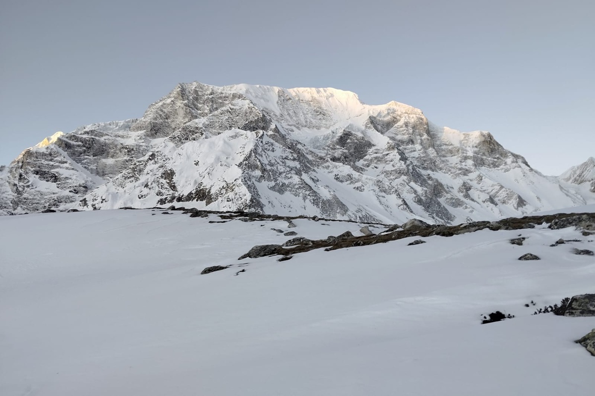
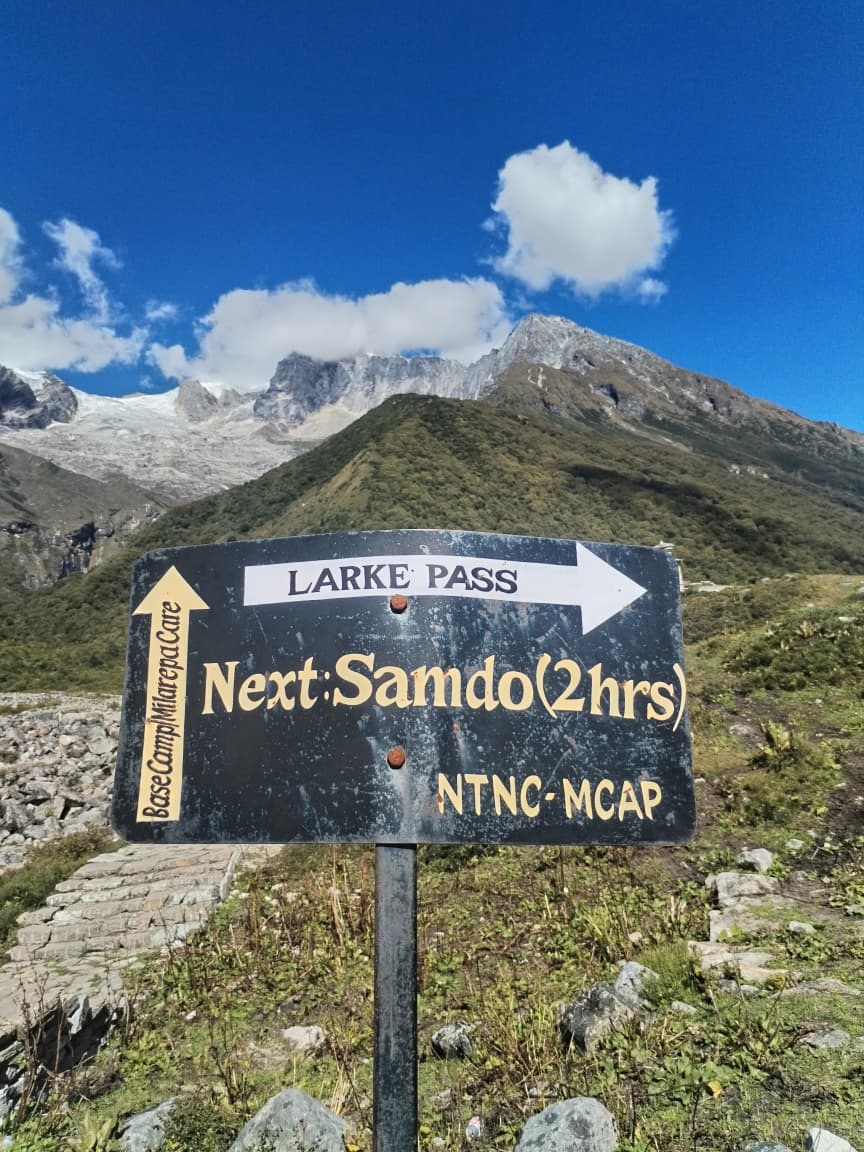
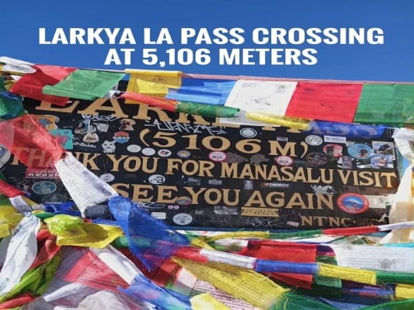
The itinerary for the Manaslu Circuit Trek-a 14-day trekking adventure in the Himalayas around the 8,163-meter-high world's eighth-highest peak, Manaslu- has been designed keeping in mind all aspects of trekking in the mountains; it consists of road traveling, remote mountain villages, Buddhist culture, river valleys, forest areas, high-altitude terrain and crossing of the high-altitude Larkya La Pass (5,106 m).
This 14-day Manaslu trekking itinerary has been structured in such a way that trekkers have ample time to cover every kilometer at a comfortable trekking speed and gain altitude steadily. We shall drive from Kathmandu to the Manaslu trekking region and trek from day to day, resting in villages like Machha Khola, Jagat, Deng, Namrung, Samagaon, Samdo and then to Dharamsala before crossing Larkya La Pass. One full day at Samagaon will be reserved for rest as well as optional treks to hike around or to other higher villages in the vicinity.
14-day trekking itinerary: crossing Larkya La Pass will be the highest and the most strenuous part of the trek before trekking down to Bimthang, followed by the path towards Dharapani and back to Kathmandu. The trek has been designed with a correct acclimatisation schedule as well as a reasonable amount of walking for each day. Completing the circuit around the Manaslu region, this 14-day itinerary is a great way to cover the entire Manaslu region on a trekking schedule fitting for everyone.
Manaslu Circuit Trek Itinerary Is a 14-Day Journey Around Mount Manaslu
The Manaslu Circuit Trek is a 14-day route that circles the Manaslu massif, leading trekkers up the remote Budhi Gandaki Valley and through rural mountain villages and high Himalayan scenery before turning north and climbing up to the Larke la (5106 m) pass a nd descending to Bimthang, on its way back to Kathmandu.
The 14-day Manaslu Circuit trek itinerary allows for steady daily trekking progress and good acclimatisation on a high-altitude trekking circuit. Rather than rapidly climbing into the higher zone and forcing your body to cope with high altitude right when it would most dislike it, this 14-day program is more gradually escalating and designed for adjustment.
This trip will be a mixture of various experiences:
Road trip from Kathmandu to Manaslu starting trail.
Trekking in the Budhi Gandaki valley along rivers, swinging bridges, forests and steep gorges.
The charming traditional villages like Jagat, Deng, Namrung and Samagaun where gradually the scenery and culture shift to Tibetan culture.
The acclimatization day in Samagaun, where possible for a small day hike and preparation for high altitude.
High altitude trek via Samdo, Dharamsala till the pass.
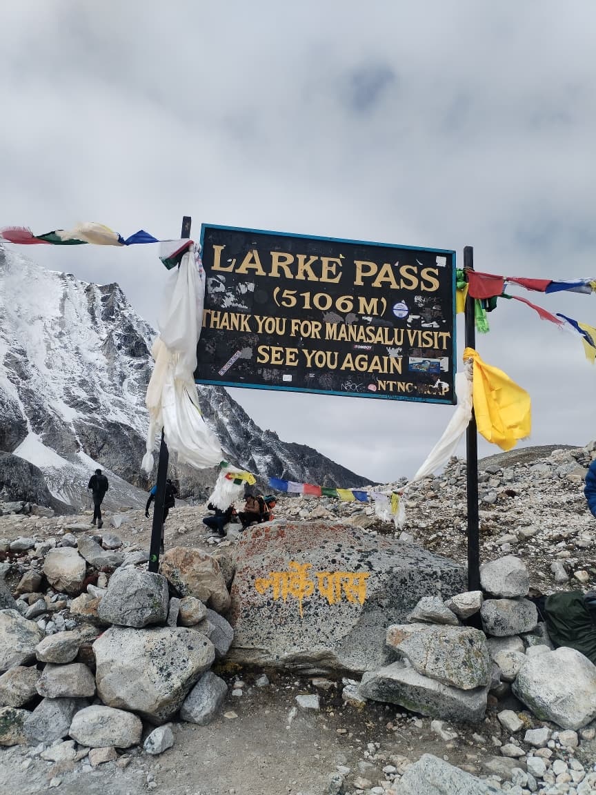
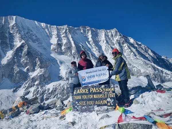
Cross the Larkya La Pass; this is the highest and most incredible point on the trek.
A steep and long descent to Bimthang, where the scenery will change from harsh alpine terrain to green valleys.
Ride back to Kathmandu after completion of the Manaslu circuit.
It is a restricted trekking region, so you are compelled to obey the permit regulations.
How Long Is the Manaslu Circuit Trek?
A trek to the Manaslu Circuit takes an average duration of 12 to 16 days starting from the access trekking point. The length depends on the choice of the road to access the trek, the trek’s approach route, your walking ability, acclimatization strategy, road conditions and also the inclusion or exclusion of buffer days for unplanned changes or additional acclimatization.
Hence, a typical itinerary of 14 days, consisting of 9 to 11 days of trekking and road journey time and acclimatization. This will offer you a viable way to complete this trek with ease and sufficient acclimatization opportunity. However, these durations may even vary due to weather conditions, road conditions, or acclimatization rates of an individual.
How Many Days Does It Take to Trek the Manaslu Circuit?
For most trekkers, 14 days is considered an ideal and balanced plan in the Manaslu Circuit trekking journey, because it gives enough time for most of the trekkers to experience the whole journey and make each day not too tiring and not to rush high altitude zones.
A general 14-day plan covers:
1-2 days for road journey to and back to the trekking region.
Some days walking through the low and mid valleys in a gradual way.
A vital acclimatization day in Samagaun.
Passing through Samdo and Dharamsala.
A long day trip to Larkya La pass crossing.
Down journey from Bimthang towards the lower route in a gradual way.
Some experts can finish faster than this; others may do 15 and 16 days plan with slow movement and more days for acclimatization.
Why Choose a 14-Day Manaslu Circuit Trek Itinerary?
The 14-day itinerary of the Manaslu Circuit offers optimum space, distances, altitudes, as well as recovery time. It's undoubtedly demanding but at the same time offers enough buffer to transition from Budhi Gandaki Valley up to the high Himalayas gradually rather than rapidly increasing altitude.
Benefits of the 14-day Manaslu Circuit trek:
Optimal Acclimatization: Spending a few days in Samagaun gives you the leverage of proper acclimatization time before heading further high up in the Himalayas.
Balanced Daily Walk: Instead of packing more into each trekking day, this itinerary ensures that most of the trekking days are paced according to the ability of a trekker; however, the pass climbing day is to be done in full.
Covers All Major Sites: Without skipping major attractions like the traditional villages, the Buddhist monasteries and astounding mountain landscapes, you will witness the entirety of the Manaslu region.
Adequate Preparation for Pass: Moving from Samdo to Dharamsala through varied landscapes over quite a few days would help you prepare yourself mentally for the 5,106m height of Larkya La Pass.
Fit for Office Travellers: If you are planning for a two-week vacation, then 14 days is what is mostly suitable within your work plan (however, having 1-2 buffer days to avoid any international flight schedules and climate-based cancellations will do best for trekkers).
Machha Khola, Jagat, Deng, Namrung, Samagaun and Samdo
Main Highlights
Mountain villages, Buddhist culture, Manaslu views, glaciers and Larkya La Pass
Accommodation
Local teahouses and mountain lodges
Best Itinerary Feature
Gradual ascent with time for acclimatization
Return Route
Bimthang to Dharapani, followed by road travel to Kathmandu
Manaslu Circuit Trek 14 Days Itinerary Overview
Day
Route
Overnight Altitude
Distance
Walking/Driving Hours
Day 1
Kathmandu to Machha Khola
930 m
Approximately 160 km
8 to 10 hours drive
Day 2
Machha Khola to Jagat
1,340 m
Approximately 17 km
6 to 7 hours
Day 3
Jagat to Deng
1,860 m
Approximately 20 km
6 to 7 hours
Day 4
Deng to Namrung
2,630 m
Approximately 19 km
6 to 7 hours
Day 5
Namrung to Samagaun
3,530 m
Approximately 22 km
6 to 7 hours
Day 6
Acclimatization day in Samagaun
3,530 m
Optional side hike
3 to 6 hours
Day 7
Samagaun to Samdo
3,860 m
Approximately 8 km
3 to 4 hours
Day 8
Samdo to Dharamsala
4,460 m
Approximately 7 km
4 to 5 hours
Day 9
Dharamsala to Bimthang via Larkya La Pass
3,720 m
Approximately 24 km
8 to 10 hours
Day 10
Bimthang to Dharapani
1,860 m
Approximately 22 km
6 to 8 hours
Day 11
Dharapani to Besisahar
Approximately 760 m
Approximately 70 km
4 to 6 hours drive
Day 12
Besisahar to Kathmandu
1,400 m
Approximately 175 km
6 to 8 hours drive
Day 13
Extra day in Kathmandu
1,400 m
Local travel only
Flexible
Day 14
Final departure from Kathmandu
1,400 m
Airport transfer
Depends on flight
The acclimatization process is crucial on this route. Hikers increase their altitude gradually, working from lower valleys to Samagaun, where a day for acclimatization allows the body to adjust for the higher climbs. From Samagaun, the trek moves on to Samdo and Dharamsala, before climbing Larkya La Pass at an elevation of 5,106 m. Larkya La Pass is not a place to sleep overnight; at its highest point, trekkers will descend rapidly to their overnight sleeping location at 3,720m Bimthang.
Detailed Day-by-Day Itinerary
Day 1: Drive from Kathmandu to Machha Khola, Start of the Manaslu Circuit Trek
Route: Kathmandu to Machha Khola along Arughat and Soti Khola
Road conditions: Highway, asphalt, gravel and bumpy road; sometimes mud.
On Day 1 of the Manaslu Circuit Trek, a transfer to Machha Khola takes you from Kathmandu after an early morning start. You'll be on the Prithvi Highway toward Dhading district, after which we continue to the Gurung village of Machha Khola, where you'll check into your teahouse and rest to be ready for the 1st day of the trek. It is about 160-170 km and takes around 8-10 hours to travel to Machha Khola.
Road Conditions from Kathmandu to Machha Khola
Initially, the road from Kathmandu is paved. However, beyond Arughat and especially beyond Soti Khola, the road develops into a narrow, rougher, and more uneven track with a lot of gravel and dust on it during the dry season and mud on it during the monsoon. It is quite bumpy in parts and has tight bends at places.
Landslides and rockfalls can delay the journey during monsoon. Travel by a privately hired 4WD vehicle could be more comfortable than a bus during the latter section to Machha Khola.
Overnight altitude & Acclimatisation
Machha Khola is at 930m, which is a bit lower than Kathmandu. There is generally no acclimatisation necessary as at this altitude, trekkers are not exposed to altitude sickness. Acclimatisation starts from day 2 when the upward trail begins.
Machha Khola
Machha Khola is a small Gurung village situated on the riverbanks of Budhi Gandaki valley. This is a commonly used overnight station, as now a road has reached the place, so the trekkers of the Manaslu Circuit trek can start their trek from here. It has got some 40 houses, according to some current accommodation guides of Manaslu.
Teahouses in Machha Khola
There are at least 4 Teahouse/Lodge at Machha Khola according to a current Accommodation Listing:
Larkye Guest House
Hilltop Guest House
Everest Guest House
Hotel Chum Valley Restaurant and Lodge
Teahouse Facility
Most of the teahouse offers:
Private or shared double rooms
Shared Bathrooms; only a few with attaching bathrooms
A common dining hall with a good atmosphere to socialize.
Trekking Distance: About 20-22 km (12.5 to 13.7 miles)
Walking Time: Between 6-7 hours
Start altitude: Machha Khola, altitude 930 m (3050 ft)
End altitude: Jagat, altitude 1340 m (4400 ft)
Altitude gain: Around 410 m (1345 ft) net; actual ascents and descents are significantly more.
Level of Difficulty: Moderate
Accommodation: Local teahouse/lodge
This is the first official trekking day of the Manaslu Circuit trek itinerary. You will walk along the Budhi Gandaki river from Machha Khola to Khorlabesi to Tatopani to Dobhan and finally to Yaru before descending for 2.5 km to Jagat. This day involves more ups and downs compared to the net altitude change of the trek. You will typically need between 6-7 hours to finish the day's hike.
Trail Conditions: Machha Khola to Jagat
You will mostly walk along the Budhi Gandaki River. The trail predominantly consists of stone steps, natural footpaths, forest sections and several bridges across various streams. Some of the stretches, especially during the steep climbs and descents, involve constant work on an unstable and tricky surface which may be slippery if the weather is wet and muddy during the monsoon months. Watch out for landslide-prone areas; there might be warning signs.
Altitude & Acclimatization at Jagat
Altitude 1340m / 4400ft. Altitude sickness is unlikely at this altitude, so a proper acclimatization plan for this day is not really required. The physical demand is more in question than any other factor for the end of this day.
Short Briefing on Jagat
Jagat is a large stone village and marks the entry to the upper reaches of the Manaslu region. It is one of the popular stops for overnight stays on the lower circuit and is also an important trekker's checkpoint further into the Manaslu region.
How many lodges are available at Jagat?
There is no fixed count, with numbers varying slightly from season to season. However, there are multiple guesthouses at Jagat as per present information, ranging from smaller teahouses to larger lodges like Jagat Guest House (approx. 25 rooms and accommodates 50 guests) to the more traditional Shanti Guest House.
Internal Facilities at lodges
Lodges at Jagat offer you
Twin/basic private rooms
Sharing toilet; some might have well-maintained toilets attached to the room.
Dining room
Local Dal Bhat along with Noodles, Rice etc. For lunch and dinner, some breakfast options included.
Electricity, charging facilities (may incur an extra fee)
Hot shower facility (in some lodges)
Basic WiFi (select lodges only)
Bedding and pillows
Day 3: From Jagat to Deng trekking
The day's route will be Jagat to Salleri to Sirdibas to Philim to Ekle Bhatti to Lokpa to Nyak to Deng.
Distance: approximately 19 to 21 kilometers.
Duration: approximately 6 to 7 hours
Starting elevation: Jagat; 1,340 meters.
Altitude gain: approximately 520 meters net gain
Ending elevation: Deng; 1,860 meters
Difficulty level: Moderate to Difficult
Accommodation type: Simple, locally run teahouse or lodge
Day 3 of our trek journey begins from Jagat as we make our way to Deng. This leg of the trek takes you further into the remote beauty of the Manaslu region, where you'll get to explore traditional settlements, cross numerous suspension bridges and trek alongside the Budhi Gandaki River in a much narrower and rugged canyon. The terrain today offers a mixed bag, with constant ups and downs in terms of altitude, so even though the overall net altitude gain of the day isn't significant, the amount of physical energy that has to be expended can feel more.
Altitude of Overnight Stop at Deng & Acclimatization
Deng stands at an altitude of 1,860 meters above sea level. There is a normal chance of developing altitude sickness if healthy trekkers find themselves at this altitude for more than 24 hours without physical activity. At 1860 meters, normally people do not develop sickness. You will be active at all times with a reasonable pace, and also acclimatization at 1860m will be very mild for healthy trekkers.
As you start climbing up every day, your drinking and eating habits have to be taken special care of, and the normal rule of going slow and taking rest always when feeling tired has to be followed at every stage. The real problem of sickness will arise when we cross 3000 meters and above.
Overview of Deng village
Deng is a remote and small village located in the middle of the Manaslu trekking trail; it marks a point that will lead towards the upper reaches of the valley and serves as an alternative resting place along the trail beyond Jagat. Accommodation is available in teahouses which run on local hospitality. These family-run guesthouses or teahouses provide a rustic stay option for trekkers passing through.
Number of Teahouses available in Deng
There are a few guesthouses available in Deng; the exact count for teahouses is difficult to verify, as each season it varies. However, for sure, there are family-run teahouses that cater to trekkers and guides traversing the trail.
Amenities inside the teahouses
Basic private rooms(shared facilities)
Toilets outside the room or shared
Shared dining hall
Local delicacies and trekking foods are available.
Charging facilities.
Showers are available at most teahouses.
Wifi is available only when the teahouse is charging for it.
Blankets, pillows, mattresses, etc are available.
Day 4: Trek from Deng to Namrung
Trail: Deng - Rana - Bihi Phedi - Ghap - Namrung
Distance: About 19 km
Walking time: 6-7 hours
Start altitude: 1860 m. (Deng).
Ending elevation: Approx. 2630m (Namrung)
Net elevation gain: Approx. 770m
Difficulty: Moderately to difficult
Overnight lodging: Lodge or mountain teahouse
Day 4 offers a subtle shift both in scenery and culture. Walking through dense woods, narrow river passages, along a narrow river and up several undulating slopes, it visits hamlets like Rana, Bihi and Ghap before proceeding to Namrung at about 2630m. Along the trail you'll see a famous Tibetan Buddhist presence in the form of prayer flags, mani walls and chortens. This day’s trek is more physically demanding due to repeated ascents and descents than the distance suggests. Namrung marks one of the earlier points where the higher Himalaya range becomes more apparent.
Altitude and Acclimatization
At 2630m, Namrung still presents no major risk of altitude-related sickness for most hikers; however, the gained elevation on day 4 is significant. Some individuals may start feeling lightly breathless while ascending or have a generally higher fatigue level. Drink as much water as you can, avoid alcohol, and rest in order to be prepared for trekking over 3000m on Day 5.
Overview of Namrung village
Namrung is a substantial mountain village and is well developed for trekkers in relation to some of the preceding stops on the Manaslu Circuit. The region around Namrung is of striking visual appeal due to Tibetan influences and high mountain surroundings. Compared to its neighbors like Deng, accommodation in Namrung (teahouses and lodges) is generally considered more comfortable, sometimes even offering private rooms, hot showers and WiFi.
Teahouse options in Namrung
The most common teahouses in Namrung (as listed in guides and trekked by people) include:
Namrung Cottage
Nubri Four Season Resort
Namrung Thakali Guest House
Actual numbers of operating accommodations might be higher, as more teahouses are opening up on this route, giving tourists a wider array of choices during their treks.
Namrung Teahouse Facilities
By and large, the accommodation offered in Namrung tends to be better than Deng and includes:
Private rooms and basic double/twin sharing ones.
Shared bathrooms and some private bathrooms/en-suites to select.
Hot showers in several teahouses.
WiFi access (not in all accommodations).
Power sources for charging gadgets.
Cozy, common dining rooms for trekkers.
Typical menus offering Dal Bhat, noodles, soups, Tibetan dishes, fried rice, etc.
Comfortable bedding such as duvets and mattresses to aid sleeping
Day 6: Acclimatization Day in Samagaun
Manaslu area
Location: Samagaun
Altitude at which to stay overnight: 3,530m
Main aim: Acclimatization before ascending further
Hours walking: optional 2-7 hrs
Main walk: Manaslu Base Camp
Other possibilities: Birendra Lake, Pungyen Gompa
Challenge level: Easy to difficult depending on the walk undertaken
Where you sleep overnight: the same teahouse as Day 5, at 3,530m
Day six on the 14-day Manaslu Circuit trek itinerary is probably one of the more important ones. You remain at the same altitude as the night before, around 3,530m, with one more day where you take a different trail to acclimatize before heading to higher villages and Larkya La Pass.
Overnight altitude and acclimatizing
At 3,530m, the air has thinned, and altitude can affect most people in varying ways. Common symptoms can range from headaches, poor sleeping patterns, little appetite and poor performance, to short-term loss of memory, and breathlessness. Always pay attention and do not be complacent. Drink plenty of water, continue with a nutritious meal, and no alcohol on this day.
The strategy on this day is to follow one of the most important rules for trekking at altitude: climb higher and sleep lower. You can walk to a point and descend to your lodge in Samagaun. This can help your body acclimatize more before travelling on and ascending toward Samdo and Dharamsala.
Samagaun to Manaslu Base Camp walk
This option is the longest and the most challenging of the three, extending up to approximately 4,500-4,800m depending on where the turnaround point is and the conditions of the path that day. It takes around 6 to 7 hours for the return journey. The trail is steep, made of scree and moraine and is considered 'high mountain' trekking, but is worth the walk just for the views of the surrounding glacier and Mount Manaslu itself.
Pungyen Gompa from Samagaun walk
This is the most cultural and spiritual option available on the acclimatization day, though still a significant walk. Pungyen Gompa takes a few hours to reach via a trek uphill from the village. It consists of a traditionally built gompa situated amidst the majestic Himalayan peaks and glaciers that surround it.
Birendra Lake and rest day in the village
This is a shorter and easier option, consisting of a relatively flat walk to Birendra Lake; an aesthetically beautiful glacial lake situated very close to Samagaun. It normally takes around 2 to 3 hours for the round trek depending on your pace and path taken; though you have ample opportunity to rest within your teahouse and explore the village and monastery at leisure, and to take numerous photographs.
How many teahouses are there in Samagaun?
Samagaun boasts some of the most extensive facilities and has one of the largest varieties of trekking accommodation in the entire Manaslu Circuit. Well-known lodges include Tashi Dalek Guest House, Mount Manaslu Guest House, Sama Gaun Guest House, Peace Heaven Guest House, Norling Guest House, Nubri Valley Guest House, and Gurung Cottage Guest House, amongst others. The precise number may vary in season and as other lodges open and close.
Teahouse Facilities
Most lodges are equipped with the following:
Private rooms and multiple twin-sharing rooms
Communal bathrooms/shared toilets
Showers that cost money (sometimes hot showers are included)
Charging stations for electronics
Wi-Fi (sometimes unreliable)
Shared dining areas
Typical Nepalese cuisine such as dal bhat, noodles, fried rice, soup, etc.; Tibetan-inspired dishes can also be found.
Blankets, sheets, pillows and mattresses
This is the second night you will be spending in Samagaun; therefore, you should have a good rest as you will be increasing altitude substantially on the following days.
Day 7: Trek from Samagaun to Samdo
Samdo Village
Route: Samagaun to Kermo Kharka to Samdo
Distance to hike: 8-9 km, approx.
Time to hike: 3-4 hours
Samagaun starting altitude: Approx. 3,530 m / 11,581 feet
Samdo destination altitude: Approx. 3,860-3,875 m / 12,664-12,713 feet
Net gain in altitude: Approx. 330-345 m / 1,083-1,131 feet
Difficulty: Moderate
Where you will sleep: Basic high-altitude teahouse
Day 7 is shorter than most days that come before it, but it now goes considerably higher in altitude. You'll set off from the beautiful village of Samagaun and start up an increasingly ascending route leading towards Samdo. The trek typically only lasts 3-4 hours, which allows everyone to take their time and keep their acclimatization processes moving at a good pace without covering too large a distance. Recent trip reports put the trail length at around 9 km.
As you head to this high-altitude village, the landscape opens up in spectacular ways. You'll get views of snow-capped peaks in the distance, including areas of the majestic Larkya Glacier. Forests will gradually disappear and will be replaced by hardy alpine vegetation that dots the surrounding high mountain pastures and rocks that line the route for most of the journey from now on.
Trail Conditions for Samagaun to Samdo
This path is somewhat wider and less steep than much of the lower trail in this part of the Manaslu Circuit. For much of the journey you will walk through open yak-grazing pastures while the trail subtly gains elevation as it winds its way up the arid landscape. Be warned; it can be quite chilly and windy up this way. At certain times of year, ice and snow may cover the ground at this point in the trail.
Overnight Samdo Altitude and Human Body Adaptations
At approximately 3,860-3,875 meters, you may begin experiencing altitude-sickness symptoms. Even with a reduced trek distance, you must not take it easy upon your arrival into Samdo – your efforts must remain measured, keep drinking fluids and try to rest after you arrive. The route itself is designed in short stages like this so that each individual has an adequate opportunity to adjust their breathing. The plan is for you to increase your altitude steadily toward tomorrow's destination – Dharamsala, which sits around 4,460 m.
Samdo Brief Introduction and Tibetan Culture Connection
Samdo is located in proximity to Nepal and the bordering nation of Tibet and bears a strong cultural connection to Tibet. Traditionally, the town was positioned along the path of local trading routes and was home to yak herders throughout the area. Many travelers have reported finding the stone architecture of the houses of the town to be quite distinctive compared to the other villages visited previously on your route.
How many teahouses are in Samdo?
There are only a handful of basic teahouse accommodation options in Samdo, most of which are family-run businesses. While the available teahouse names and facilities might change over time and with the season, here is a selection of some commonly available Samdo teahouses: Jambala Guest House, Yak Hotel, Tibetan Twin Guest House, and other smaller guesthouses in town. Be prepared for limited options relative to Samagaun; Samdo is a place where simplicity dominates.
Teahouse Amenities in Samdo
In Samdo, teahouses come with limited amenities owing to the remoteness of the place and high altitude:
Common dining room
Shared toilets
Single and/or shared twin bedrooms
Basic services for charging electronics (use is not guaranteed)
Limited, and often slow, Wi-Fi
Shared rooms sometimes include heating on chilly nights.
You won't get a gourmet menu in Samdo; instead expect to have hearty (sometimes plain, but always satisfying) meals, including a variety of soups, fried rice, chowmein, dal-bhat and simple noodle soups. Blankets, pillows, and mattresses provided.
Day 8: Samdo to Dharamsala (or Larkya Phedi)
Route: Samdo to Larkya Bazaar to Dharamsala (or Larkya Phedi)
Trekking Distance: ~8 km (5 miles)
Walking time: ~3 to 4 hours
Starting point altitude: Samdo (~3,860 meters/12,664 feet)
Ending point altitude: Dharamsala (~4,460 meters/14,632 feet)
Altitude gain: ~600 meters (1,970 feet)
Difficulty: Moderate with extreme cold at altitude. Short but very challenging in terms of the altitude gain and weather.
Accommodation: A number of basic, seasonal teahouses.
Main highlight of Day 8: Larkya Glacier, Budhi Gandaki Valley, classic Himalayan scenery.
Day 8 of the Manaslu Circuit Trek leads us from Samdo to Dharamsala, often referred to as Larkya Phedi. It's just an 8 km day but gains a total of around 600 meters to what is the highest sleeping point of the standard route. The path to Dharamsala leads through Larkya Bazaar, which is basically a seasonal trading hub, and to what's typically the last sleeping point before crossing Larkya La Pass.
Trail Condition from Samdo to Dharamsala
This trail is predominantly a high-altitude mountain pass with gentle climbs, rocky stretches, and exposed landscapes. We will cross the Budhi Gandaki River on a wooden bridge and trek towards an area with sparse vegetation with high Himalayan vistas above. The trail itself does not necessitate any technical expertise, although wind and extreme temperatures may make it seem more arduous, as may a lot of coldness and lower oxygen.
High altitude, altitude acclimatization and overnight stay
At 4,460 meters / 14,632 ft., the altitude in Dharamsala can cause altitude symptoms. Expect possible headaches, issues with sleep, loss of appetite, and difficulty breathing. Be sure to sip plenty of water and walk at a slow pace, making sure to report any change in symptoms to your guide.
This is also the maximum altitude that we can actually camp at or stay overnight. There is another, higher, mountain pass, but you cross it the next day.
Information about Dharamsala
Also known as Larkya Phedi or Larkya Base Camp. This is a seasonal high mountain pass resting point; there are actually no resident locals and it's just a few teahouses operating throughout the season.
Number of teahouses available in Dharamsala
There are two to three (possibly four, but can also vary from year to year) very simple seasonal teahouses to choose from. Names to typically find are Larkya Guest House and Peace Hotel.
Facilities inside teahouse at Dharamsala
Accommodation is the very base. Shared facilities and a shared bedroom (also possibility to sleep in the common dining area if fully booked), minimal blankets, simple beds, meals (cooked), and tea. Be prepared to use the squat toilet outside in the cold!
No internet in Dharamsala.
Very sporadic electricity.
Bring a high-quality warm sleeping bag.
Due to its seasonal nature, not all lodges are guaranteed to be open unless you book a full board trekking package.
Day 9: Traverse Larkya La Pass and trek to Bimthang
Larke la Pass (the Highest Point of Manaslu Circuit Trek)
Trip Route: Dharamsala to Larkya La Pass to Bimthang
Trek Distance: Around 22-24 km
Trekking time: 8-10 hours approximately
Altitude at start point: Approximately 4,460 m in Dharamsala
Highest altitude on the trek: Approximately 5,106 m at Larkya La Pass
Altitude at end point: Approximately 3,720 m in Bimthang
Trip's Difficulty: Challenging to very challenging
Highlights of the trip: Crossing Larkya La Pass, glaciers and panoramic Himalayan views
Accommodation: Teahouse or lodge
The longest day in the Manaslu trek, the 14th day route, involves the ascent and crossing of the Larkya La Pass, followed by a rather long descent to Bimthang. Usually, treks start as early as 4 am to make it to the pass by forenoon. To trek up 1,400m after trekking along the rugged, tough routes is exhausting.
Hence, reaching your hotel room in Bimthang requires all your energy and effort, as after you reach Bimthang. You need proper rest, as the next day's trek is from Bimthang to Baghar.
The trail condition from Dharamsala to Bimthang
From Dharamsala it's mostly up with a moraine glacier trail to Larkya La Pass and downhill to Bimthang. There are some streams to cross also. The condition of the pass: snow may create a great obstruction if the pass is snowed in with lots of snow. The crossing, in such cases, depends on luck. It does not require technical skills; in most cases the pass is clear of technical climbing or crossing, but it requires being well-fit to walk all day and reach the hotel in Bimthang.
Overnight altitude & Recovery
As we reach Larkya La Pass at around 4,460m, after that it drops 1,400 m to Bimthang. This is what saves trekkers from exposure to high altitude. You would experience severe exhaustion after completing a full day hike for such a long duration. Thus, Bimthang becomes the most important place for rest.
About Bimthang
The valley of Bimthang, situated just below the Larkya La Pass of Nepal, offers a very dramatic shift from the monotonous, stark and snow-bound landscapes surrounding the pass to its own serene and tranquil ambiance. It's a charming alpine settlement, known for the stunning alpine flowers that bloom every year. After Larkya La pass, Bimthang would be the first village where teahouse trekking starts, which you can expect from the Manaslu trek to a degree, with cozy lodging, cordial hospitality & savory food.
How many teahouses are there in Bimthang?
Typically, there are 3 to 4 well-established teahouses/lodges to stay at in Bimthang. Some prominent names include Ponker Guest House, Mountain Ponker Cottage, Ganga Manaslu Lodges, and Apple Garden Lodges, etc. The operating number can vary by season and availability of rooms.
Facilities inside the teahouses?
Bimthang offers generally better lodging facilities than in Dharamsala with a more relaxed vibe. Here are the usual facilities available:
Rooms are often twin-sharing with basic beds. Some lodges might have private rooms as well.
Common toilets for all.
HHot shower is normally available in limited Lodges at an additional price.
Electricity to charge your gadgets is available (usually by solar power) but may not consistently.
WiFi can sometimes be available but may be unreliable and at a high cost.
They usually have a nice common area where you can have meals and relax, where there is often a fire in the fireplace.
These places provide tasty and hot meals. Typically dal bhat, but also soup, noodles, and warm dishes.
Day 10: Bimthang to Dharapani trek
Route: Bimthang to Hampuk to Yak Kharka to Kharche to Gho to Dharapani
Trekking distance: 20-22 km approximately
Time spent walking: 6-8 hours approximately
Current altitude: 3,720m (Bimthang)
Elevation at the end of trekking day: 1,860m (Dharapani)
Elevation gain or loss: considerable descent (- 1,860 m)
Difficulty: Moderate to tough (due to length and downhill)
Accommodation: Better choice of teahouses and lodges
Key sights: Forests, river, waterfalls and transition into Annapurna region
Day 10 starts from Bimthang and includes a long, major descent toward Dharapani. You'll generally leave the stark high-mountain landscape and descend into lusher forests and lower valley terrain. Many sources describe the trek as lasting approx. 20km and taking between 7 and 8 hours to complete. Please remember the timing mentioned here can vary greatly, depending on the exact route you decide to take or accommodation choice.
Trail conditions (Bimthang to Dharapani)
This day involves mostly a downhill hike with sections through forest, by rivers, and passing through local settlements. Significant downhill sections can be challenging on the knees, particularly after the effort required the day before on Larkya La Pass. Trekking poles are highly recommended.
Further down, the trail merges with paths in the Annapurna region, becoming noticeably greener and more populated.
Overnight altitude and acclimatization
Dharapani sits at around 1,860 metres, a significant drop in altitude from Bimthang. Altitude sickness should generally not be a concern at this elevation, and most trekkers will notice an improvement in breathing and sleeping patterns.
The major issue this day is muscle fatigue, a direct result of crossing the previous day's high pass and the long, steady downhill walk.
A short look at Dharapani
Dharapani serves as an important nexus for treks connecting the Manaslu and Annapurna ranges and is a common concluding point for the walking portion of 14-day Manaslu itineraries because it's road-accessible.
How many teahouses/lodges are in Dharapani?
Typically, there are about 3-4 primary teahouses and lodges available in Dharapani.
Amenities available in Dharapani teahouses
Dharapani offers facilities which often include:
En-suite and shared bathrooms
Hot showers
Wi-Fi (in some places)
Charging outlets
Dedicated dining areas
Diverse menu options
Comfortable beds with warm bedding
All of these elements make Dharapani a more pleasant place to end your trek after reaching a high point.
Driving time: 4-6 hours (depending on road conditions)
Altitude of start point: 1,860 m (Dharapani)
Altitude of overnight point: 760 m (Besisahar)
Difference in Altitude: 1,100 m (Descent)
Type: Road trip
Altitude risk: None
Lodging facility: Hotel, Lodge, Guesthouse
Salient features: Marsyangdi valley, falls, towns, shift in landscape.
Day 11: From high up Dharapani back down into civilization. This day begins from Dharapani (1,860 m) at a moderate elevation and descends sharply back down to Besisahar, a busy trekking gateway town (760 m). This day’s travel will follow the Marsyangdi River all the way back down through villages of Tal, Chamje, Jagat and Syange to reach our endpoint of Besisahar. Back to civilized amenities, this journey offers a unique landscape in transition from wild mountains to well-connected areas.
Road condition of Dharapani-Beshi Sahar
The upper section of the road right from Dharapani tends to be rough and bumpy, where the route continues on narrow mountain roads with tight curves and turns. As we proceed further downstream of the Marsyangdi River, the condition of the road tends to smoothen out until reaching Beshi Sahar. There might be delays and different driving times if the roads are blocked during monsoon season due to heavy rainfall or rockslides.
Overnight Altitude and Acclimatization
As Besisahar is situated at an elevation of 760 m, it is not likely to be affected by altitude-related illness. After sleeping at an elevation above 4,000 meters at Dharamsala and successfully traversing the Larkya La Pass, your body receives considerable relief and rest from high altitude due to the massive descent.
Besisahar Short Overview
Besisahar, the administrative center of Lamjung District, is the transportation hub and gateway to Annapurna and Manaslu trekking regions. Compared to villages located in the Himalayas, Besisahar provides upgraded and much more convenient access to various shops, banking services, restaurants, and accommodation options. The area can be integrated with other trekking access routes designated by the Nepal Tourism Board.
Number of Hotels and Lodges in Besisahar
There are a large number of hotels, guesthouses, and lodges in Besisahar. Unlike trekking destinations such as Samdo or Dharamsala where you can expect only a few teahouses, there is no specific numerical limitation to the available options. Accommodation may be booked according to travelers' preference for budget, room type, and location.
Available Facilities in Besisahar Accommodation
The facilities provided by the majority of the hotels include:
Private rooms
Most hotels have attached bathrooms.
Hot showers
Wi-Fi internet
A consistent electricity supply
Facilities for recharging electronics
Restaurants or local eateries in close proximity
Shops and transport services nearby
An upgrade to softer beds and larger rooms
Day 12: Drive from Besisahar to Kathmandu
Route: Besisahar-Muglin Area-Kathmandu
Distance: approx. 172-177 km
Time estimate: 5-7 hrs
Altitude Besisahar: approx. 760 m
Altitude Kathmandu: approx. 1,400 m
Travel: highway and main road
Altitude issues: No health altitude risk
Accommodation: Hotel Kathmandu
Day 12 brings you from Besisahar back to Kathmandu. Your mountain journey is completed today. The journey is about 172 to 177 km of distance; however, this is highly dependent on traffic, road repairs and highway conditions. A normal journey takes about 5 to 7 hours, but even longer journeys are possible.
Road Condition Besisahar to Kathmandu
The road conditions here are better than earlier in the itinerary of the mountain journey. If there are road closures during the monsoon due to heavy rain or rockfall there could be delays and changes to driving times.
Overnight Stay at High Altitude and Acclimatization
Since Besisahar is at an altitude of 760 meters, it is unlikely that it will be affected by altitude sickness. Here your acclimatization is complete, because the trip at high altitude has already been completed after descending from Larkya La.
Kathmandu Short Overview
Kathmandu is a main city for Nepal's tourism and transportation and a common starting and finishing point for international itineraries of the Manaslu Circuit Trek. After many days of staying in local villages in the high mountains, Kathmandu represents luxury, comfort and diverse amenities such as fully-equipped hotels, varied restaurants, an abundance of shops and multiple transportation possibilities.
Day 13: Extra Day in Kathmandu for Rest or Sightseeing
Altitude: 1400 meters approx.
Itinerary Overview: Trek recovery & free exploring - free day for additional activities.
Physical Grading: Easy
High Altitude: No.
Overnight stay: In Kathmandu in the hotel
Suggested activities: Sightseeing of historic sites, shopping for souvenir products, visiting a spa or an indoor cafe, unpacking, sorting gear or an optional meeting for the finale report.
Added value: One buffer day before your journey home to facilitate smooth arrangements.
An extra day in Kathmandu is planned for the day before departure. This allows some time to either recover and rest from the Manaslu Circuit Trek or sightsee around Kathmandu at your own pace. It is also included to allow time in case road conditions or weather have caused delays on the return journey.
Benefit of an Extra Day in Kathmandu
An extra day can also be valuable because Himalayan travel is unpredictable at times. Your day may be subject to change due to weather conditions or roads being affected, especially by the monsoon in the Himalayas. You may take the day to relax or sort through the thousands of pictures you have taken, or organize your trek gear from the trip.
The day is also an ideal time to pick up any last-minute souvenirs and have a final meet-up with your trek group before your international departure. This day also provides you with additional time to explore the city and savor the delectable local foods.
Sightseeing options in Kathmandu:
Popular landmarks in Kathmandu consist of Durbar Squares and many UNESCO World Heritage sites; such as Swayambhunath (Monkey Temple) & Boudhanath Stupa. You can also spend time in Thamel where shops and cafes are abundant. However, if time is an issue on Day 13 it is an opportunity to hire a guide for a personalized private tour.
What if the trek is delayed?
If the trek is longer than the stated duration and Day 13 is now used for your travel back from the Manaslu Circuit, or if there are delays due to road conditions and weather, you should consider it a "buffer" day that will be used for essential travelling instead of relaxation or sightseeing.
Kathmandu Hotel Facilities:
At your hotel, you should find the same hotel-level services as provided on Day 12, including private rooms, an attached bathroom, hot showers, reliable internet access, charging outlets and restaurants/shops.
Day 14: International Departure from Kathmandu
Nepal-Kathmandu
Starting Point: Kathmandu hotel
Destination: Tribhuvan International Airport (TIA)
Main Activity: Departure, airport transfer
Airport Arrival Recommendation: Approximately 3 hours prior to departure time
Accommodation: N/A after hotel checkout (unless arranged privately)
Altitude: Kathmandu, approx. 1,400 m
Physical Difficulty: Easy
Altitude Risk: N/A
Day 14 comes to an end of your Manaslu Circuit Trek tour. You can have breakfast at your hotel and check out. Later, transfer to Tribhuvan International Airport. Don't forget your passport, visa, air ticket and so on before leaving the hotel.
Airport Transfer and Departure Information:
Traffic in Kathmandu can be heavy; therefore, please ensure you allow ample time when departing from your hotel for your airport transfer. For international flights, the Nepal Tourism Board recommends arriving at the airport 3 hours prior to your departure time. Check-in generally begins three hours before departure, and ticket checking counters close about one hour before departure. Refer to your individual airline's information for specific departure details.
The Manaslu Circuit Trek altitude chart charts the progressive increase in altitude from around 930 meters at Machha Khola up to Larkya La Pass at 5,106 meters. Acclimatization is essential as the track climbs to over 3,500m before the villages of Samdo and Dharamsala.
Day
Place
Sleeping Altitude
Highest Point Reached
Elevation Gain/Loss
1
Machha Khola
930 m
1,400 m
470 m loss
2
Jagat
1,340 m
1,340 m
410 m gain
3
Deng
1,860 m
1,860 m
520 m gain
4
Namrung
2,630 m
2,630 m
770 m gain
5
Samagaun
3,530 m
3,530 m
900 m gain
6
Samagaun
3,530 m
Up to 4,500 m or more
Sleep at same altitude
7
Samdo
3,860 m
3,860 m
330 m gain
8
Dharamsala
4,460 m
4,460 m
600 m gain
9
Bimthang
3,720 m
Larkya La, 5,106 m
646 m gain then 1,386 m loss
10
Dharapani
1,860 m
3,720 m
1,860 m loss
11 to 14
Besisahar to Kathmandu
Below 1,400 m
Road travel
Continued descent and travel
How the Altitude Changes During the 14-Day Trek
The trek steadily gains altitude before arriving in Samagaun with time for the body to acclimatize to new levels and continues to Samdo, then to Dharamsala before the pass.
Which Day Has the Biggest Altitude Gain?
Day 5 represents the largest net change in altitude from one night to the next, with altitudes between Namrung and Samagaun summing to approximately 900 meters.
What Is the Highest Point on the Manaslu Circuit?
The highest point along this route is Larkya La Pass, which reaches about 5,106 meters high.
Highest Sleeping Altitude vs Highest Trekking Altitude
Dharamsala is the highest sleeping point at an altitude of about 4,460 m. Whereas Larkya is climbed, it is not used for sleeping purposes.
Manaslu Circuit Trek Acclimatization Schedule
The Manaslu Circuit Trek acclimatization plan involves ascending gradually through the valleys of the lower Budhi Gandaki River up to 5,106 m at Larkya La Pass. It also requires two critical stops at Samagaun, Samdo, and Dharamsala for proper acclimatization. By acclimatizing step by step, keeping the body well-hydrated and resting for an entire day or doing extra hiking days at Samagaun, you prevent yourself from getting altitude sickness.
What is Samagaun Acclimatization Day?
At Samagaun, 3,530 m altitude, you will be spending your extra night, so you could consider taking it as the acclimatization day for trekking. As a consequence, you gain more acclimatization by ascending higher during the day and descending after the acclimatization hike, sleeping lower at night; this is the essential altitude strategy for this entire trip. Therefore, this extra night helps you acclimatize to prevent going up to higher altitudes above 3,800m, keeping yourself safe from altitude sickness while traveling toward Dharamsala (4,460m).
Hiking to Pungyen Gompa: An Acclimatization Hike
While staying at Samagaun, you can do an acclimatization hike toward Pungyen Gompa. It usually takes you toward a Buddhist monastery with an awesome view of the mountains surrounding you. This hike gives additional altitude and then a descent back to the same village for sleep; it really benefits your trip.
It might not be as challenging as the latter sections of the trail. For this, make sure to do physical preparation after consultation with your local guide on how many hours and how far you can reach the gompa according to your physical condition.
Acclimatization at Samdo
You will walk from Samagaun toward Samdo (3,860m), where your overnight stay is planned for a higher altitude than where you have come from. So the day walk between Samagaun and Samdo is short, but the elevated height helps prepare your body further for the step to 4,460 m at Dharamsala and safely crossing the Larkya La Pass. Stay properly hydrated, avoid strenuous walking and consume less alcohol during your stay at Samdo so there are no issues with breathing or sickness during the trek.
Frequently Asked Questions About the Manaslu Circuit Trek Itinerary
How Many Days to Trek Manaslu Circuit?
Most trekkers finish a Manaslu Circuit Trek in around 12 to 16 days, but a 14-day itinerary generally offers a better balance between walking distance each day, time for acclimatization, the Larkya La Pass and travel back to Kathmandu. It's a popular time as it allows time for the body to adjust to the growing altitudes.
How Long Is the Manaslu Circuit Trek From Kathmandu to Kathmandu?
A standard Kathmandu to Kathmandu Manaslu Circuit Trek typically takes about 14 days. This duration includes the drive to the trailhead, between 9 and 10 days on the trek itself, again depending on the exact itinerary you take, an acclimatization day, the attempt to cross the Larkya La Pass, and finally your return to Kathmandu. Various tour operators offer differing itineraries.
How Many Days Off Work Do I Need for the Manaslu Circuit Trek?
For a typical 14-day itinerary, you should plan 14 to 16 days off work to account for the duration of the trek, plus a day or two for travel complications or any potential alterations to the itinerary.
Minimum leave for 14-day Manaslu trek:
14 consecutive days off work should be the minimum requirement if you are starting on a trek as soon as you can and returning straight to work afterward, as this leaves no scope for delayed road travel, inclement weather, or recovery.
How many days off should international trekkers take?
International trekkers should aim to take 16 to 18 days off work. This allows time for long-haul flights, possible jet lag, arrival, the 14-day trekking trip, and a brief recovery period after the trek.
Why You Should Keep 1 to 2 Extra Buffer Days
Road conditions in the mountains can lead to delays due to weather, landslides and traffic, so an extra couple of days can mean the difference between a relaxed trip and trying to race an international flight.
A two-week work leave sample:
Day 1 to Day 14: complete Manaslu Circuit itinerary
Day 15: Buffer / Recovery day
Day 16: return to work / commence international flight
International travelers should ideally add another 1 or 2 days.
How Long Is the Manaslu Circuit Trek in Kilometers?
The length of the trek varies, as different itineraries can involve longer or shorter driving time at the beginning and end of the trek. However, the Manaslu Circuit Trek is normally cited between 160 and 180 km or roughly 100 miles.
How Many Hours Do You Walk Each Day?
On the trekking part of the journey, you will walk for an average of between five and seven hours per day. There are a number of shorter days, such as Samagaun to Samdo, which take around three to four hours, and the longest day is trekking up and over the Larkya La Pass.
Can Beginners Complete the 14-Day Manaslu Circuit Trek?
Beginners with a good level of fitness, who prepare fully and listen to their trekking guides, could potentially do a 14-day Manaslu Circuit Trek; however, it is still a demanding high-altitude trek and should not be taken on as a first trek with minimal training.
What Happens If I Cannot Cross Larkya La Pass Due to Weather?
The guide will evaluate the weather, the snow and trail conditions. It's possible that the crossing cannot be attempted if the conditions are too dangerous. You may have to wait for appropriate conditions, or take the safest detour. The itinerary can change and an extra day is often convenient. Do not attempt the pass at all in dangerous conditions.
Manaslu Circuit Larkey pass Trek start from Barpak (Epicenter of Earthquake 2015), samagaun, monasteries , Tibet boarder and Larkey Pass