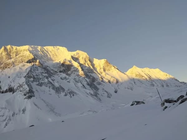
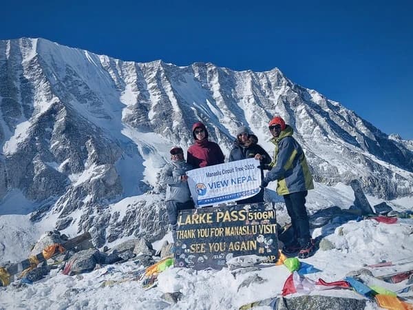
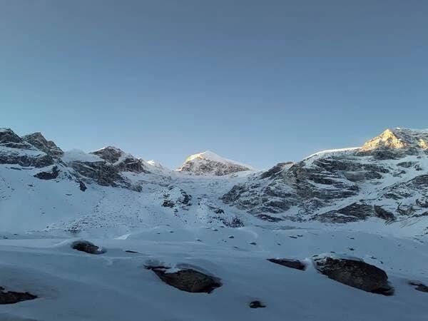
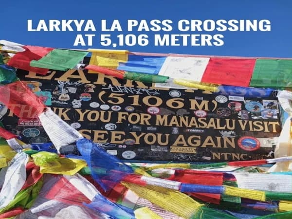
Samagaun, also called Sama Gaun or Samagaon, is an alpine village situated at an elevation of 3,530 meters (11,581 ft) above sea level in Gorkha district of Nepal within the Manaslu Conservation Area. It is a village in the Himalayas located below the eighth-highest peak in the world, the Manaslu (8,163 m), and is one of the key resting points for trekking around the Manaslu Circuit Trek. The trekkers normally come to Samagaun from Shyala village after having a stopover in this village en route to Samdo and Larkya La Pass (5,106 m).
Unlike other traditional Himalayan villages in the valley of Budhi Gandaki, this village shows more Tibetan influence. Stone houses, Buddhist monasteries, prayer flags, along with the terraced fields and yak pastures, make this place distinctively unique from other trekking villages in the region. The local Nubri residents are Buddhists who welcome tourists, and the tea houses in the village are family-owned and operated.
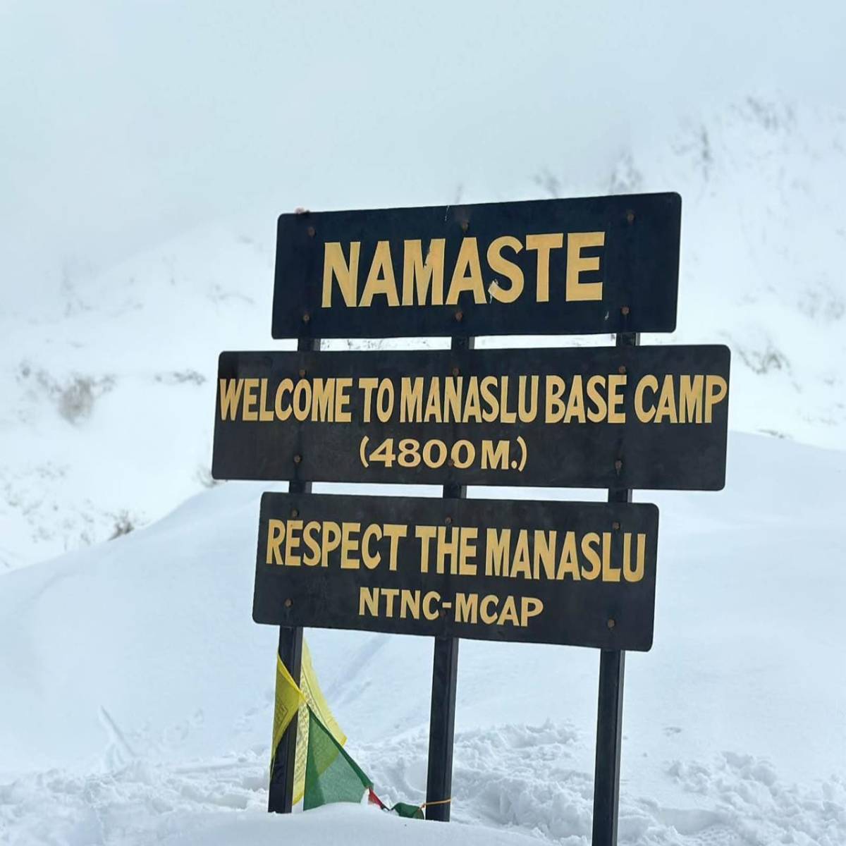
In addition to that, Samagaun will be the starting point for side trips to Birendra Lake, Pungyen Gompa, and Manaslu Base Camp (4,800 meters). Acclimatization is always good before moving to higher altitudes. One may spend time exploring the village and resting for a night in the village before moving further up to Samdo on the Manaslu Circuit Trek.
Where Is Samagaun Village Located on the Manaslu Circuit Trek?
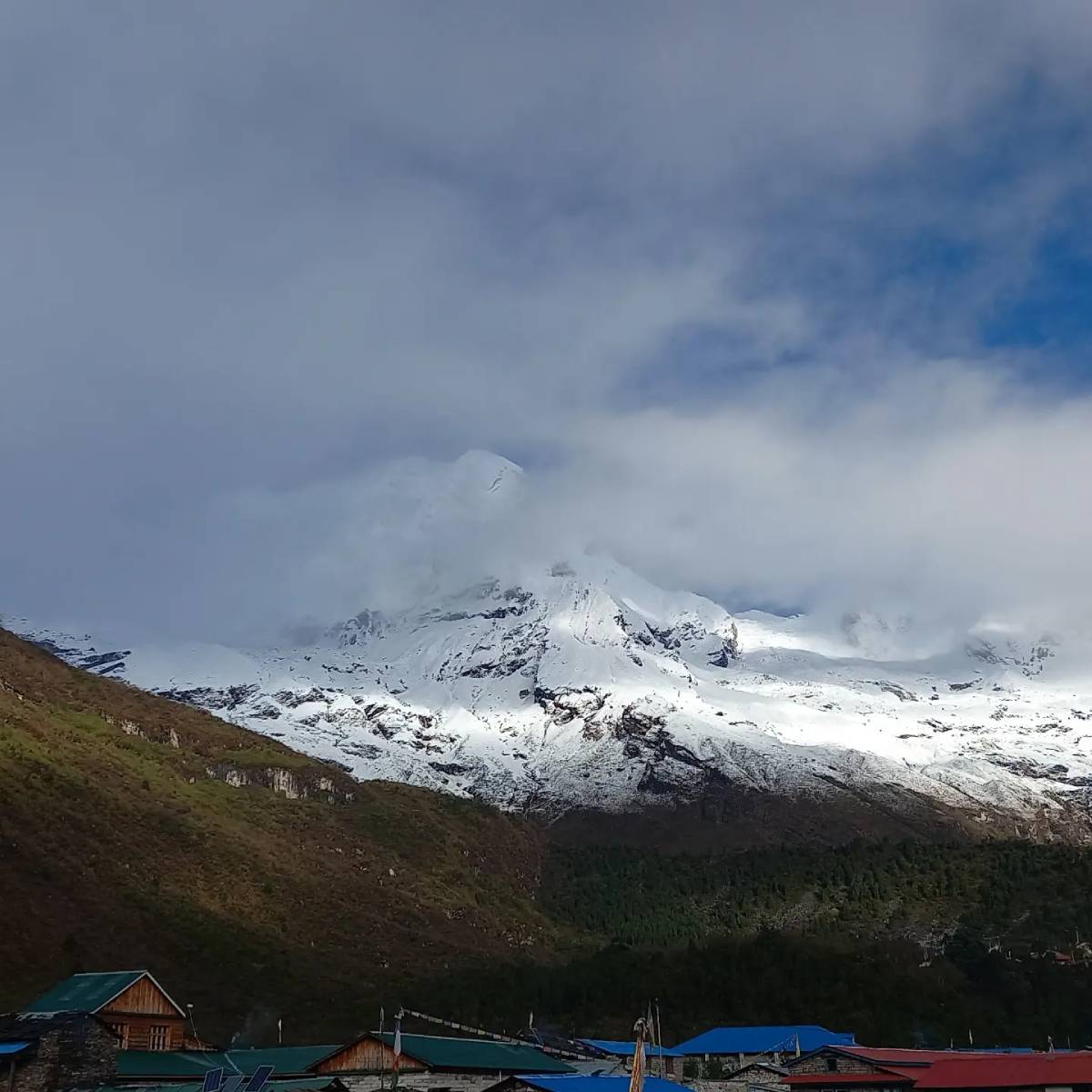
View from samagaun Village Nepal
Find Out About Samagaun Altitude in Detail
Location details
Verified information
Official village name
Samagaun (सामागाउँ)
Alternative spellings
Samagaon, Sama Gaun, Sama
Country
Nepal
Province
Gandaki Province
District
Gorkha
Municipality
Chumnubri Rural Municipality (Tsum Nubri)
Ward number
Ward No. 1
Geographical region
Northern-central Nepal, Manaslu Himal
Valley
Upper Nubri Valley, Budhi Gandaki watershed
Conservation area
Manaslu Conservation Area (MCA)
Village altitude
Approximately 3,530 m (11,581 ft)
Latitude
28.58468° N
Longitude
84.64404° E
GPS coordinates (DMS)
28°35′05″ N, 84°38′39″ E
Nearby mountain
Mount Manaslu (8,163 m)
Previous trekking village
Shyala (Syala)
Next trekking village
Samdo
Approximate distance from Shyala
3.5 km by the direct approach
Approximate distance to Samdo
8 km by trekking trail
Nearby attractions
Birendra Lake, Pungyen Gompa, Manaslu Base Camp
Main trekking route
Manaslu Circuit Trek
Normal access
Multi-day trek from the lower Budhi Gandaki Valley
Nepal time zone
Nepal Standard Time (UTC+5:45)
Samagaun Village (सामागाउँ) is a high-altitude village in Chumnubri Rural Municipality, Gorkha District, Gandaki Province, Nepal, situated at an elevation of around 3,530 m (11,581 ft). Samagaun Village sits along a wide part of the upper Budhi Gandaki Valley in the Nubri region. The valley is to the south of Mount Manaslu (8,163 m), near the Tibetan border in northern Nepal.
Village-center coordinates are based on the Open Street Map position as shown on Mapcarta; other mapping services may have the marker a few hundred meters from this location.
Where Does Samagaun Fall Along the Manaslu Circuit Trek Route?
Samagaun lies after Shyala and before Samdo in the traditional Manaslu Circuit Trek. The trekkers are expected to start their journey from Machha Khola through Jagat, Deng, Namrung, Lho, and Shyala, onwards to Samdo (approximately 3,860- 3,875 m), as well as Dharamsala/Larkya Phedi and Larkya La Pass (approximately 5,106m).
How Far Is Samagaun From Shyala and Samdo?
Samagaun lies approximately 3.5 km after Shyala in terms of distance while following the more direct trekking trail without including the one to Pungyen Gompa, which is much longer. Samdo lies approximately 8 km away from Samagaun and requires trekking for about 3-4 hours.
No tourist vehicle can be used to reach this place since the village is only reachable on foot through the Manaslu trekking trail.
What Mountains and Landmarks Surround Samagaun?
Mount Manaslu is to the south of the village, whereas the upper part of the valley is filled with glaciers, ridges, and mountains extending toward Tibet. The lake of Birendra lies above the village near the Manaslu Glacier, and the trekking path to reach Manaslu Base Camp originates from here. Similarly, the Pungyen Gompa is located on yet another path which moves to the southern side of the mountain.
These altitudinal changes make Samagaun unique from the other villages in the Manaslu circuit because they make it possible to spend an extra day/ trekking at the same altitude before reaching Samdo.
What Is the Altitude of Samagaun, and Why Is Acclimatization Important Here?
Altitude is of substantial importance during the trek to Samagaun because it stands at 3,530 meters (11,581 feet) above sea level. Such elevation makes it the highest place where people can settle, and this is the reason why Nepal’s Department of Hydrology and Meteorology has its meteorological station here, in Samagaun.
The distinction between such altitude and the one of Kathmandu becomes apparent when everyone has to face the consequences of lack of oxygen both while climbing up and resting overnight. This is the reason why the itinerary usually includes an additional day spent in Samagaon before moving further to Samdo, Dharamsala, and Larkya La Pass.
Samagaun Altitude Compared With Other Manaslu Circuit Villages
Village or location
Altitude
Elevation change from previous stop
Namrung
2,630 m
—
Lho
3,180 m
+550 m
Shyala
3,500 m
+320 m
Samagaun
3,530 m
+30 m
Samdo
3,860 m
+330 m
Dharamsala (Larkya Phedi)
4,460 m
+600 m
Larkya La Pass
5,106 m
+646 m
Elevations are generally published numbers for trekking-routes; may vary by lodge or map. The last column details the differences in numbers from location to location; not always from one overnight to the next.
Why Is Samagaun an Important Acclimatization Stop?
So the main factor here is the altitude gain ahead. We have an altitude gain of roughly 1,576 meters from Samagaun to Larkya La Pass.
Benefits of extra day in terms of practice:
Gain no sleeping altitude: spending two days in a row at the height of ~3,530 meters allows the body additional time for acclimatization
Evaluate your condition: symptoms such as headaches, nausea, loss of appetite, dizziness, and unusual exhaustion may occur once you reach higher altitudes.
Day hikes possible: we have the possibility of day hikes to a higher point and return to Samagaun to sleep there
Time to get accustomed to things before going to Samdo: we have another village, which is another 330 meters above
Reduce the pressure of moving on: the acclimatization day allows the guide to change plans in case altitude sickness symptoms are shown.
CDC and UIAA both suggest slow altitude gain, especially after 3,000 meters altitude.
How Should Trekkers Spend Their Acclimatization Day in Samagaun?
Acclimatisation day doesn't always have to be about hanging around in the teahouse. Trekkers in good condition can go for an easy trek up above the village and then come back down for a night at that elevation. The thing is that going to Manaslu Base Camp isn't always the smartest or most comfortable option for someone showing symptoms.
Acclimatization activity
Approximate altitude
Difficulty
Practical recommendation
Explore Samagaun village
3,530 m
Easy
Suitable for a low-exertion day
Walk to Birendra Lake
3,600–3,700 m
Easy to moderate
A shorter option for trekkers feeling well
Hike toward Pungyen Gompa
3,900–4,100 m
Moderate
Longer outing with substantial elevation gain
Hike toward Manaslu Base Camp
4,800 m
Strenuous
Only for well-acclimatized, fit trekkers with suitable conditions
Elevation measurements are based on estimates since there are differences in route information and mapped points. Therefore, hikers should be careful when choosing the route taking into account his physical shape, weather conditions and guide’s opinion.
For the majority of hikers the key factor that determines a successful trip is not the height they can reach but rather the ability to return to Samagaun in good physical condition to continue the trip the next day.
What Are the Warning Signs of Altitude Sickness in Samagaun?
AMS may occur in healthy trekkers, even after a rapid climb. It typically starts with a headache and may be associated with nausea, dizziness, loss of appetite or tiredness.
Symptoms observed
What trekkers should do
Mild headache, nausea, poor appetite, or dizziness
Report symptoms immediately, stop ascending, and rest at the same altitude while being assessed
Symptoms that persist or worsen
Do not climb higher; arrange medical assessment and descend if symptoms fail to improve
Difficulty walking straight, confusion, or altered consciousness
Treat as an emergency; descend immediately with assistance and seek urgent medical care
Breathlessness at rest, persistent cough, or rapidly worsening breathing
Suspect a serious altitude-related emergency; arrange immediate descent, oxygen if available, and urgent medical care
Advanced altitude illness can develop quickly. Do not delay descent while waiting for the helicopter or medication.
How Many Nights Should Trekkers Stay in Samagaun Before Samdo?
A two-night stay in Samagaun is common for both arrival and acclimatization purposes.
After Samdo at around 3,860 meters, there is the possibility of adding night of acclimatization before going to Dharamsala at around 4,460 meters; this means that sleeping altitude is increased by around 600 meters. Some guidelines are provided below:
It is advised that when hikers sleep above 3,000 meters, their altitude gain during one day should not exceed 500 meters, and acclimatization days must be included in itinerary planning.
No altitude gain is allowed if hikers feel any symptoms of altitude sickness.
In case of increasing sleeping altitude and worsening symptoms of altitude sickness, hikers have to descend immediately to lower altitude in case of poor balance, consciousness, or breathing. It is important to remember that these recommendations are general and not strict rules.
Any itinerary for Manaslu Circuit trekking that includes altitude increase must include acclimatization days, and acclimatization day in Samagaun cannot be treated as an optional sightseeing day that can be cut from the itinerary to make the trek shorter.
Find Out About Samagaun Altitude in detail
Altitude and trekking details
Figures
Samagaun elevation
3,530 m (11,581 ft)
Typical stay for acclimatization
2 nights
Elevation gain to Birendra Lake
Approx. 160 m
Birendra Lake hike duration
2–4 hours round trip
Elevation gain toward Pungyen Gompa
Approx. 370–570 m
Elevation gain to Manaslu Base Camp
Approx. 1,270 m
Manaslu Base Camp hiking distance
Approx. 10–12 km round trip
Samagaun to Samdo elevation gain
Approx. 330 m
Samagaun to Samdo trekking time
3–4 hours
Sleeping-altitude gain from Samdo to Dharamsala
Approx. 600 m
Elevation remaining to Larkya La Pass
1,576 m
Recommended maximum daily sleeping-altitude gain above 3,000 m
500 m
Additional acclimatization guideline
1 extra night per 1,000 m of sleeping-altitude gain
One-way distance between Samagaun and Manaslu Base Camp trek is around 5-7 km, while the round trip is 10-14 km. The route is an ascending hike from the town of Samagaun at an elevation of 3530 meters above sea level to a height of 4800 meters. In any case, travel time on the road is supposed to be around 6-9 hours, and even longer for the leisurely traveler. The travel time depends largely on the season, as the trekking involves a lot of uphill hiking, and the turning point is rather vague.
The path passes through the upper village, among stone walls and pens for livestock, and reaches the not-so-narrow mountain slope. At first, walking is quite easy, with a panorama of mountains above the valley. Next, the mountain slope becomes steep, and it becomes necessary to walk among scree, rocks, and moraine. The path to the camp has a segment from which it is possible to see the Birendra Lake basin, while the path becomes rougher on the approach to the Manaslu glacier.
The last stage of the hiking path, which leads to the highest point of the mountain, is very exciting and implies that hikers should be ready to face the challenge of increased difficulty. The route is rather steep, and thus each move has to be well planned. Moreover, the path is full of unpredictable stones and scree. It is very challenging and exhausting. Besides, due to the presence of ice and snow, which can stay for many months, the surface can become very slippery.
What will you experience along the route?
Lower part: The area right by village and yak-grazing land, and the open slopes above Samagaun.
Middle part: Views of Birendra Lake and its glacial surroundings.
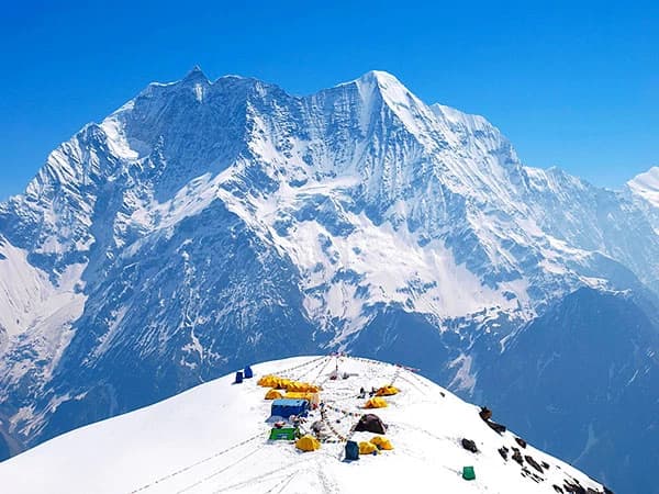
Upper part: Narrow trails, rocky moraines, and increasingly exposed terrain. Upon reaching base camp, one can see the immense walls of Manaslu, ice formations, and the camping spot of the expedition during the climbing season.
Reaching Manaslu Base Camp, however, does not mean that there will be expedition tents or climbers present. Outside the climbing season, the place may be rather deserted.
Always carry lunch, enough water, warm clothing, and a headlamp. Start early, set a turnaround time with the guide, and do not attempt the full hike in case you experience symptoms of altitude sickness. Returning safely to Samagaun matters much more than reaching the summit.
How to Be Prepared for Samagaun to Manaslu Base Camp (4,800 m)?
Depart Samagaun between 6.00-7.00 and 7.00 am
Food: You should order a packed meal from your teahouse before departure.
Water: Bring 2 or 1 liter water and energy foods for snacks.
Clothing: A down jacket, waterproof shell, gloves, and a warm hat will be needed on this trip.
Gears and Clothings: Sticks, Sunglasses, Sunscreen Lotion and Head a headlamp to be brought along with you.
Boots: Sturdy Trekking Boots are a must for rocky paths.
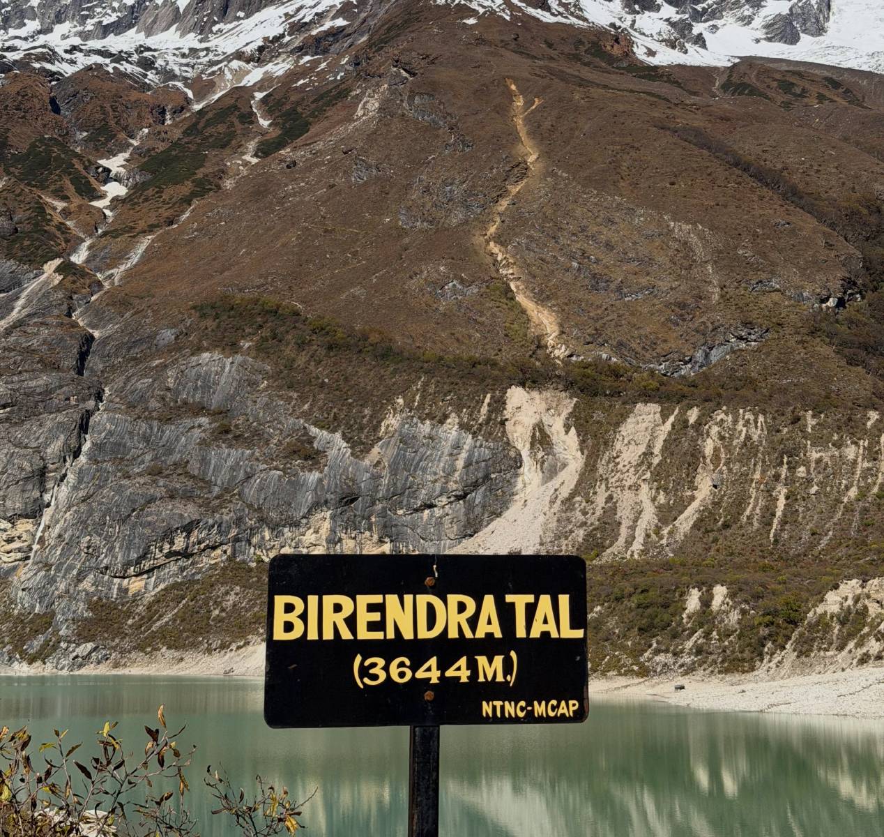
The Birendra Lake, otherwise known as Birendra Tal, is a lake that can be found above Samagaun, located at the terminus of a trail that branches from the Manaslu Glacier trail. The Birendra Lake is a must-see site, located somewhere between 3,600- 3,700 m above sea level. It will take 45-90 minutes to trek up to the Birendra Lake from where you are staying at your guesthouse or teahouse, depending on your location, path to the lake, and walking pace. Allocate 2-3 hours for the entire adventure.
On the trail, you will walk through the upper portion of the Samagaun village before turning onto another trail that leads to the lake. While you won’t have to trek as far as the Manaslu Base Camp, your trail will be rocky, rough, and uneven, and there will be portions of moraine to skirt around. Nonetheless, apart from being rocky at times, it is an easy trek. Hiking boots that can provide a good grip will do well.
While walking out of the village, you will be able to see the massive Manaslu mountain range for the first time. The Birendra Lake is famous for the blue or turquoise water that comes from the melting ice, which makes the water look so attractive. But the color of the water keeps changing depending on the weather and sediment content.
Details to expect during the Birendra Lake hike:
The route itself is short but not always flat.
Facilities become less available as soon as you get out of the village.
Glacier deposits and rocks make walking more difficult.
The color of the lake changes according to weather conditions.
On a sunny day, there are great views of the mountain ranges.
It is usually the same teahouse in Samagaun where trekkers spend the night.
Important preface note: Birendra Lake has been swept away by a flood of water in 2024. Beware of wandering close to the shoreline, moraines or outlets of Birendra Lake, for the simple reason that others may have already tried doing it. Observe the contemporary caution and do stay away from the potentially dangerous shores.
It is also a great choice for those who would prefer to have a leisurely walk up to the lake in lieu of the strenuous one to the base camp.
How to Be Prepared for Samagaun to Birendra Lake (3,600–3,700 m)
Start: Leave around 7:00–9:00 AM.
Water: Bring plenty of water (around 1L) and some light food.
Clothing: Trekking shoes with good soles.
Gears: Trekking poles and sunglasses.
Safety: Check local conditions on the trail. Avoid loose moraine, glacier ice and lake edges.
Return: Around 2-3 hours return.
Samagaun to Pungyen Gompa (Pungyen Monastery) Hike
Side Hike to Gompa
Pungyen Gompa is a Buddhist monastery situated in high pastures below Manaslu and can be found at an elevation of about 4,050 m. The trails are 6-7 km from Samagaun, as far as the published trails are concerned, but it depends on your junction point with the side trail. It usually takes 5-7 hours to walk back from Samagaun, including rest.
The trail that passes to the Manaslu Base Camp trail is a glacial moraine trail, but the trek to the Pungyen Gompa is actually a meadow and mountain pasture trek. Some trekkers choose to go around via Shyala to Samagaun and take the Gompa monastery along the way instead of backtracking to Shyala later.
The route can be taken by hikers from Samagaun to make their way back to the Shyala side and then venture off to the monastery. The trail is one that winds in and out of other existing routes, pasture lands, and uphill climbs. It runs through slopes, rocks, and even seasonal water bodies. Depending on the presence of loose rocks and snow, the trail can at times be treacherous.
What makes the Pungyen Gompa hike different?
What to expect: The main trail of Manaslu Circuit moves further into the pastures.
Scenery: Beautiful views of Manaslu and Himalchuli are available if there are no clouds.
Local life: Yaks can be seen grazing in the high pastures at appropriate times of the year.
About the monastery: The visitors will admire the architecture and religious views situated amidst the mountains.
Getting back: You will use the same trails to return to Samagaun unless you are making part of the Shyala-Samagaun trek.
Please bear in mind that the interior of the monastery may not be open for visitors. The availability of people inside may depend on the religious activities taking place. You should always ask for permission to enter the religious buildings or take pictures of something or someone sacred.
Not considering the fact that the hike is simpler than the hike to Manaslu Base Camp, it still requires considerable effort.
How to Be Prepared for Samagaun to Pungyen Gompa (4,050 m)
Leave at approx. 7 am
Packed lunch
Around 2L of water and an energy snack.
Fleece, waterproof jacket, gloves and sun cream.
Wear suitable walking boots for grassy and rocky inclines.
Ensure you are going down the right trail with your guide.
Dress modestly and request permission to enter the Monastery and take photos.
Approx. 5-7hrs return time, depending on route and pace.
Samagaun to Chöling Monastery Hike
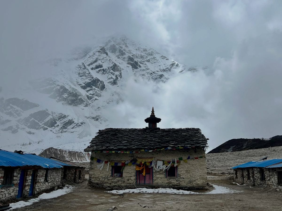
The name of the Chöling Monastery may need some clarification as well. In Samagaun, the historical monastery was known as Pema Chöling (alternatively Pema Choling, or even Pema Chholing). It is a Buddhist temple site situated high up above the village of Samagaun. According to some sources, there is also the name of Kargu Choling associated with the monastery of Samagaun; however, it is not clear whether this name is connected to it in any way at all.
The visit to Pema Chöling is a village activity rather than a trekking event. There is no official walking distance specified from any teahouse, as it differs according to the starting point of the walk; therefore, it is wrong to give an exact number of kilometers. You should allow from 30 to 60 minutes for the visit to the monastery from the area of Samagaun village itself.
The trail will move you out of the concentration of trekking lodges to places featuring stone houses, stone walls, and religious spots. Some trails have stretches of climbs and rugged stone steps.
This will be more of a cultural tour than trekking. Samagaun falls within the Nubri cultural zone where religious traditions of Tibetan Buddhism are still important parts of village life. Pema Chöling has been found to be an important place for the conduct of community religious rituals.
What can visitors observe?
Traditional Buddhist Monastery.
Many religious symbols and prayer flags.
The monastery is set high above the village.
There is a lot of religious activity in this area, with ceremonies and visitors.
You can see the stone houses of Samagaun and also the mountainous backdrop.
The monastery should be regarded as a worship place instead of just an attraction for tourists. It is recommended that one be quite while at the place and get permission from the caretaker of the monastery before stepping inside. One should not disturb people who are in prayer and those involved in any ceremony. The rules regarding taking pictures must also be made clear by the caretaker of the monastery.
Unlike the previous three journeys, this journey can be managed within a few hours of arrival in Samagaun if the health conditions of the trekker allow him/her to do so.
How to Be Prepared for Samagaun to Pema Chöling Monastery
Time: Ask your teahouse or local guide.
Duration: 30 - 60 minutes.
Clothing: Shoulders and knees should be covered.
Footwear: Comfortable footwear.
Photography: Permission should be asked before taking photographs of monks, rituals or inside buildings.
Etiquette: You will be asked to take off your shoes, and you shouldn't touch any sacred items.
Trekking kit/packed lunch: Usually none is needed.
Samagaun to Larkya La Pass Hike/ The Highest Point of the Manaslu Circuit Trek (5,106 m)
Trekking from Samagaun to Larkya La Pass typically lasts three days of trekking to two high mountain villages such as Samdo (3,860 m) and Dharamsala (4,460 m) before arriving at the pass at an elevation of 5,106 meters. So, if you start in Samagaun (3,530 m), you will have climbed 1,576 meters. The journey to the pass will cover around 21-25 km.
On the first day, you will be moving through the higher parts of the Budhi Gandaki Valley, crossing grassland where you can find yaks grazing and stream valleys before you get to Samdo village. Further, there will be no trees, but you will walk up and cross a rocky slope to Dharamsala via the glacial moraine.
On crossing day, you are supposed to leave Dharamsala between 3:00 and 5:00 AM. You walk on rocky, frozen, and snowy ground before getting to Larkya La mountain. After appreciating the view, you will descend on the other side of the mountain to Bimthang at an elevation of 3,720 meters. It will be a long descent walk on a steep slope. The crossing day usually takes between 8 and 12 hours.
How to Prepare for the Larkya La Pass Hike From Samagaun
Acclimatisation: Spend the day acclimatising in Samagaun.
Accommodation: Make sure you have accommodation booked at the teahouses in Samdo and Dharamsala.
Food: Bring along some energy bars, dried fruit, chocolate and a packed lunch.
Drinks: It is best to bring 2 L of water. Some can be heated up in a thermos.
Clothing: Thermal base layer, down jacket, rain gear, insulated gloves and beanie.
Weather: Ask your guide about how much snow is falling, wind and conditions on the pass.
Preparation: Get your gear ready from the evening before.
Don’t go across the pass if the weather looks dangerous or if you are feeling any symptoms of altitude sickness.
How Can You Reach Mount Manaslu, The World's Eighth-Highest Mountain From Samagaun?
Mount Manaslu (8,163 m) is located above the village of Samagaun. From Samagaun (3,530 m), it is possible to take a strenuous day hike of 5-7 km each way up to Manaslu Base Camp (4,800 m) with views of the snow-covered summit. The trail climbs up above the yak pastures along narrow gorges towards Birendra Lake, and the scree-covered moraines of the Manaslu Glacier.
This is tough walking, with the need to scramble over difficult ground, scree slopes, and patches of snow. The journey will take 7-9 hours return, but does not take into account the time spent exploring the abandoned Buddhist temples on the shore of the lake. In climbing season, one is likely to come across expeditions pitching their tents and giving the mountain a good workout.
However, trekking to Manaslu Base Camp and climbing Manaslu are very different experiences. The ascent of the mountain is another mountaineering expedition requiring a permit, equipment, and guides. Several weeks of acclimatization are also needed. Meanwhile, the typical Manaslu Circuit trekker heads back to Samagaun.
What Meals Should You Try During Your Two-Day Stay in Samagaun?
The eateries in Samagaun offer local cuisine influenced by Nepali and Tibetan cultures. The food includes dishes like dal bhat, thukpa, Tibetan bread, potatoes, and tsampa. If you’re engaged in the Manaslu Circuit Trek for two nights, the menu depends on whether you’re relaxing in the town or busy completing an adventurous acclimatization hike.
Day 1: Meals After Arriving in Samagaun
Lunch: Order dal bhat with lentil soup, rice, boiled seasonal vegetables, potato curry, and pickle. This is a heavy meal after the long trek from Shyala.
Snacks: Eat some Tibetan bread, honey and ginger tea.
Dinner: Either try vegetable thukpa or boiled potatoes and vegetable curry.
Special: They may have tsampa (roasted barley flour) to eat as porridge or mixed with tea.
Day 2: Meals During Your Acclimatization Hike
Breakfast (6- 7 am): Porridge with eggs, Tibetan bread, chapati and pancakes.
Lunch (packed): Take some boiled eggs, chapati, boiled potatoes, cheese and snacks for your lunch. This can be made the night before.
Lunch after a short hike: On your return from Birendra Lake, you can have some fried rice, momos or noodle soup.
Halfway stop: Treat yourself to some butter tea, or hot lemon tea with biscuits. The butter tea will be salty, but very flavourful. It is a new experience for first-time visitors.
Dinner: Enjoy some of the delights, including dal bhat, potato curry or vegetable noodles.
Typical Food Prices in Samagaun
Meal
Approximate cost
Breakfast
NPR 300–500
Lunch
NPR 400–700
Dinner
NPR 400–700
Three main meals daily
NPR 1,100–1,900
Order your breakfast and pack lunch the night before an early hike. Internationally renowned vegetarian meals are easily accessible, but the quality of fresh ingredients, dairy products, or anything special depends on the supplies in the teahouses. Drink boiled water at all times and don’t expect to find restaurants on the lesser trails.
Accommodation Facilities in Samagaun
Hotel Norling (Norling Guest House)
Location: Central village thoroughfare, Samagaon, Gandaki Province, Nepal.
Target Guest: Large commercial trekking groups, expedition support teams, and independent hikers.
Norling Hotel is one of the biggest, most active, and well-structured mountain hotels in Samagaon. This hotel is situated on the main trekking route of the circuit, and it acts as the main base camp for the trekking companies that bring in groups of Manaslu Circuit trekkers and mountaineers to reach Manaslu Base Camp. This hotel is built in such a way that there is a large dining hall built out of wooden planks that the tourists use as a common place. This room is heated by the help of a firewood and yak dung stove inside the room, which the tourists use during the chilly night in the mountains.
Rooms & Beds
There are facilities for twin sharing and triples in the rooms provided by the lodge without heating, which feature wooden flooring. The rooms are furnished with twin beddings, high density foam mattress, bed sheets, and heavy wool blankets. It is recommended that the clients provide their own sleeping bags because the temperature in the rooms drops below freezing point at night especially during the peak seasons (spring and autumn).
Facilities & Extra Charges
Hot Shower: Gas-heated or solar bucket showers (NPR 300 – 400 per use).
Device Charging: Multi-plug extensions at the reception/dining counter (NPR 200 – 300 per full phone or power bank charge).
Wi-Fi / Internet: Local satellite Wi-Fi card/code system (NPR 300 – 400 per device/day).
Safe Drinking Water: Boiled, filtered drinking water served in thermos flasks (NPR 150 – 250 per liter).
Toilets: Clean communal squat toilets and shared Western-style flush facilities located in the hallways.
2. Mount Manaslu Guest House & Hotel
Location: Main trail loop, Samagaon village, Nepal.
Target Guest: Acclimatizing trekkers, high-altitude mountaineers, and expedition crews.
Mount Manaslu Guest House is a mountain hostel used by the hikers required to take an acclimatization break in Samagaon. This is an improved building that ensures better protection from the wind draft for its guests. The common area is spacious and warm; it has a big heavy stove. The cooks are professionals; they cook healthy mountain meals rich in calories.
Rooms & Beds
The twin beds are arranged in wooden panel rooms that feature a robust frame, foam mattress, and soft pillows. The quilts are also provided in the rooms. In some rooms, there is provision of a bathroom, something very rare at such an altitude. The other rooms share bathrooms located in the corridor.
Facilities & Extra Charges
Hot water showers: Use of a solar or gas geyser bucket, with prices varying from NPR 300-500 for standard rooms, while included in some premium rooms for free.
Device Charging: There is a dedicated solar/generator panel in the main dining hall, with a fee of NPR 200-400 charged for each device.
Wi-Fi/Internet: Internet service is provided via satellite from high-altitude places, with cost of NPR 300-500 depending on the climate conditions.
Safe drinking water: Hot water is boiled for drinking, with cost of NPR 150-250 for 1 liter.
Toilets: Basis of use is communal.
3. Norbu Guest House
Location: Central village area, Samagaon, Gorkha, Nepal.
Operating Hours: 6:00 AM – 9:00 PM.
Property Size: Family-run lodge (~12 to 15 bedrooms).
Target Guest: Independent trekkers, small groups, and budget-conscious travelers.
Norbu Guest House is a lovely locally owned hotel that is known throughout the Manaslu Circuit area for its excellent host atmosphere. The reason behind the exceptional atmosphere in this hotel is that it is operated by local village people, who make sure that visitors can enjoy the best hospitality and culture. The restaurant is much more personal than the restaurants in mega-hotel complexes and you can interact with the locals directly while having the food prepared by them.
Rooms & Beds
The hotel has basic twin-bedded rooms with bare wooden walls and wooden floors. The appearance of the rooms is very clean and tidy. There are soft foam beds with woolen blankets in the rooms. The foam bed is reasonably firm; however, the local villagers appear to like these beds. The rooms remain warm in the winter season.
Facilities & Extra Charges
Hot shower: The bucket shower system used is heated with gas (extra cost: NPR 300 – 400).
Charging of the devices: The solar panels supply the charge to the centralized charging point (cost: NPR 200 – 300 per cell phone or camcorder battery).
Wi-Fi/Internet: The use of local wireless satellite cards (cost = NPR 300 – 400).
Size: Traditional Teahouse (Approx. 15 Twin Rooms)
Target Guests: Ideal for culture enthusiasts, solo trekkers and guided groups
Tashi Guest House, alternatively referred to as Tashi Delek Hotel, is a traditional teahouse situated in the cultural village of Samagaon. It provides guests with a true mountain village experience with plenty of Tibetan flags, wooden beams and cozy eating space. We suggest that you stay at Tashi Guest House to enjoy your acclimatization day around Birendra Lake and Sama Gompa before having a nice meal at the restaurant.
Rooms and Beds
The rooms are furnished with twin beds and wooden walls, without any source of heat, single beds, pillows, and thick blankets.
Facilities & Extra Charges
Hot Shower: Solar- or gas-heated water buckets available (NPR 300 - 400 for a shower).
Device Charging: Device charging at solar power station in dining hall (NPR 200 - 300 per device).
Wi-Fi/Internet: Satellite internet connection available (NPR 300 - 500 for access).
Boiled Water: Drinkable water charged per flask (NPR 150 - 250 per liter).
Toilets: Shared squatting toilets with cold water available.
5. Peace Haven Guest House (Peace Heaven)
Location: Eastern residential edge, Samagaon village, Nepal.
Target Guest: Trekkers seeking peace, quiet, rest-day relaxation, and sunlight.
Peace Haven Guest House is an excellent option because it deserves its name. This guesthouse is situated slightly off the main trail, where most tourists gather. You have a chance to relax by stretching out in the bright sun in the courtyard in front of the building. Peace Haven is suitable both for reading books and for watching the magnificent view of the Manaslu mountain. The guesthouse is rather small, so you have fewer tourists around and more privacy. The owners of the guesthouse are very friendly and hospitable. It is also pleasant that there is no noise at night, when everyone goes to bed.
Rooms & Beds
There are 8 simple rooms with wooden single beds, comfortable foam pads, fresh pillowcases, and quilted warm blankets. All of the rooms are bright and spacious because they are built on the sunny side of the courtyard. When the weather is cloudy in the morning, the rooms become very warm because of the light that enters the room.
Facilities & Extra Charges
Hot Shower: Gas-powered bucket shower (costing NPR 300 – 400 each time it is used).
Device Charging: Solar-powered charging board in the common lounge (costing NPR 200 – 300 for each device).
Wi-Fi / Internet: Satellite Internet vouchers (costing NPR 300 – 400 for each device).
Dining: Simple and clean family meals prepared upon order (priced per menu item).
Toilets: Common shared toilets and flush toilets.
6. Nubri Valley Guest House
Location: village edge overlooking open mountains of Samagaon, Nepal.
Contact: Accessible via local Samagaon teahouse network.
Property Size: ~10 to 12 twin rooms.
Best for: Trekkers wanting an authentic taste of local culture.
The valley offers a unique place for trekkers and explorers, thanks to its location and rugged terrain. We are a family-run business and encourage you to stay in the village to experience a real mountain lifestyle.
A traditionally built, comfortable lodge with Tibetan-style architecture. The local stone and timber have all been sourced locally. The lodge is run by a family who take pride in serving healthy traditional dishes made with local ingredients, including buckwheat, potatoes and mountain herbs. Typical continental trekking food is also served at the guest house.
Rooms and Beds
The rooms are small and cozy, each with wooden panels along the walls, keeping the cold out. The wooden beds provide a decent sleeping surface, with a foam pad, clean linens, and thick woolen blankets. Guests are advised to bring their sleeping bags for additional warmth.
Facilities & Extra Charges
Hot Shower: Bucket showers heated by gas are available for an additional charge of NPR 300–400.
Charging Device: The guest will be using a solar power charging facility in the dining hall, which will charge about NPR 200–300 per charge.
Wi-Fi / Internet: The guest will be getting internet access through a local wireless satellite facility, which will charge around NPR 300–500 per day.
Boiled Water: Safe hot water is available for sale on a per-liter basis.
Toilets: Shared outdoor and indoor toilets for squatting.
7. Rojen Guest House
Location: Central trail corridor, Samagaon, Nepal.
Operating Hours: 6:00 AM – 9:00 PM.
Contact: Local walk-in and guide network booking.
Property Size: ~12 standard twin rooms.
Target Guest: Budget hikers, backpackers and local mountaineering guides.
Rojen Guest House is an affordable place for accommodation near the trekking path in Samagaon. It is famous for being a very good value for money due to the generous meal portions and the hospitable atmosphere. It is often used by many local guides and individual trekkers as an affordable place to have a meal and rest. There is a dining hall where people sit at the low wooden tables near the burning wood stove.
Rooms and Beds
Unheated twin-bedded rooms with exposed wooden walls, wooden beds, foam mattresses, and heavy blankets.
Facilities and Extra Charges
Hot shower: Gas or solar bucket hot water (NPR 300 – 400 extra).
Charging mobile devices: Multi-plug charging board in common area (NPR 200 – 300 each).
Internet Access or wifi: Basic satellite internet connection (NPR 300 – 400 extra).
Drinking water: Hot boiled water refills (NPR 150 – 250 per liter).
Toilets: Common hallway toilets used by all users.
8. Gyalzen Guest House
Location: Near Sama Gompa monastery path, Samagaon, Nepal.
Operating Hours: 6:00 AM – 8:30 PM.
Size of Property: Family Lodge (about 10 rooms)
Type of Guest: Quiet people, budget trekkers, and cultural tourists.
The Gyalzen Guest House is a humble, tranquil family guest house situated on the way to the old Samagaon Gompa (monastery). Not in proximity to the bustling commercial area, it offers a basic accommodation experience which attempts to provide guests with friendly hospitality, peace, and comfort. The family provides efficient service and takes care to ensure that the guests are served hot tea, warm fires at night, and fresh food ordered by them.
Rooms and Beds
It has simple and clean twin rooms with wooden beds, foam mattresses, clean linens, and heavy blankets. The rooms are not fancy but well taken care of, providing peaceful rest for acclimatizing trekkers.
Facilities and Additional Charges
Hot Shower: Solar or gas bucket water (costs .300 – 400 NRS per use).
Charging Station: A common device charging station in the hall (costs 200 – 300 NRS).
Wi-Fi/ Internet: Satellite internet (costs 300 – 400 NRS extra).
Food and Drinks Provided: Dal Bhat, noodle soup, Tibetan bread, and all types of drinks (Charged based on the menu).
Restrooms: Shared squat toilet in the common washroom
9. Boddhisattva Hotel and Cafe
Location: Central Samagaon (near Karma Cafe), Gandaki Province, Nepal.
Operating Hours: 6:00 AM – 9:30 PM daily.
Property Size: 21 guest bedrooms and 12 bathrooms (one of the largest/newest properties).
Target Guest: Trekkers seeking modern comforts, specialty coffee, and premium lodge facilities.
Bodhisattva Hotel and Cafe is a newly refurbished luxury high mountain lodge located in the Manaslu region. This type of lodge has a combination of a tea house concept along with a café where one can enjoy barista made espresso, snacks and much more food items from the menu. This type of lodge is perfect for resting during acclimatization days in a highly decorated wooden paneled lodge with thick walls and a big dining hall.
Rooms and Beds
This place features 21 highly insulated wooden floor rooms that are either twins or triplets. These rooms contain highly padded mattresses which are unlike the mattresses found in teahouses; they feature bed sheets made from white cotton, pillows and heavy winter wool blankets for warmth against the biting cold.
Facilities and Extra Charges
Hot Shower: Modern geysers using either gas and solar heating technology (NPR 300 – 500 extra).
Charging Devices: Charging stations for your devices (NPR 200 – 400 each device/per day).
Wi-Fi/Internet: Satellite-based internet service (NPR 300 – 500 per device per day).
Cafe with Specialty Drinks: Machines for espresso coffee, cappuccino, and herbal tea; also pastries (at the price of a cafe menu).
Toilets: 12 hygienic toilets including western and squat toilets.
How to Reach Samagaun Village From Kathmandu?
Samagaun village (3530m) can be visited using the Manaslu Circuit Trek route. You will need to drive from Kathmandu to Machhakhola and then trek for 5 days. In the View Nepal Trek, you will arrive at Samagaun village on Day 7 and pass through Jagat, Deng, Namrung and Lho Gaun.
View Nepal Treks: Kathmandu to Samagaun Itinerary
Day
Route
Elevation
Transport
Approx. time
01
Arrival in Kathmandu, hotel transfer
1,400 m
Drive
According to arrival
02
Kathmandu to Machhakhola
900 m
Drive
7–10 hours
03
Machhakhola to Jagat
1,340 m
Trek
6–8 hours
04
Jagat to Deng
1,860 m
Trek
6–8 hours
05
Deng to Namrung
2,630 m
Trek
5–7 hours
06
Namrung to Lho Gaun
3,180 m
Trek
3–5 hours
07
Lho Gaun to Samagaun
3,530 m
Trek
4–5 hours
Samagaun village (3,530 m) can be accessed by reaching Machhakhola by road from Kathmandu and trekking for 5 days on Manaslu Circuit Trek. View Nepal Treks’ trekkers arrive in Samagaun village on Day 7 after visiting Jagat, Deng, Namrung, and Lho Gaun.
The road trip takes you to pass through Dhading, Arughat, and Soti Khola to reach Machhakhola. The road trip includes several bridges, crossing through riverside villages and trekking from lower valleys up to Nubri region. Your trekking on day seven of the circuit starts from Lho Gaun, where you trek through the forest to reach Shyala and further proceed to Samagaun village. It is expected that you trek for around 4-5 hours in the open valley on the last stretch of your trekking route.
Travel Information: This information is general in nature and applicable for most of the itineraries and may not represent current status on the ground. Please confirm road and trekking routes, as they may have been impacted by floods due to monsoon rains in October 2026.
Reaching Samagaun by Jeep
No road links Samagaun directly. Tourists who come by road normally travel 160 km via Arughat, Machhakhola, and Soti Khola from Kathmandu to Machhakhola. It takes 7-10 hours of driving. The cost of riding a jeep with others is approximately NPR 2,600-3,900, while that of traveling in a private jeep is USD 150-200 per jeep.
Reaching Samagaun by Helicopter
A privately chartered air flight between Kathmandu and Samagaun is roughly 45-60 minutes long, depending on the routes used. Helicopter charters cost USD 3,500-5,000 per helicopter for a round-trip journey with a maximum occupancy of 5 people due to the weight limit at high altitudes. Landings and takeoffs will require the proper permits and clearances prior to them. There are no regular flights available; pricing should be verified independently.
Reaching Samagaun by Foot
The most frequent path to Samagaun is the one that begins from Machhakhola (900m), goes through Jagat, Deng, Namrung, and Lho, and finishes in Samagaun (3,530m). The trek is 73 km long and takes place over 5 days. The trek can take between 3 and 8 hours per day, depending on the route. This can vary in price depending on the guide, permits, food and accommodation.
Samagaun Weather and Temperature: Monthly Conditions and Best Time to Visit
Samagaun Weather and Temperature by Month
The temperatures listed below are representative of the average precipitation and temperatures at various times of the year, based on the most reliable published climate-model estimates for Samagaun. They are planning references only.
Month
Daytime temperature
Nighttime temperature
Typical weather
Trekking suitability
January
-3°C
-15°C
Freezing, snow possible
Very difficult
February
-2°C
-13°C
Cold, occasional snow
Very difficult
March
1°C
-10°C
Cold, gradually clearing
Variable
April
4°C
-6°C
Cool, mixed sun and cloud
Good
May
7°C
-2°C
Warmer, more afternoon cloud
Good
June
11°C
4°C
Monsoon developing
Poor
July
13°C
7°C
Cloudy, wet monsoon
Poor
August
13°C
7°C
Continued monsoon
Poor
September
12°C
4°C
Wet early, improving later
Variable
October
7°C
-4°C
Generally clearer and drier
Excellent
November
3°C
-9°C
Clear but increasingly cold
Good
December
0°C
-12°C
Freezing, snow risk increases
Difficult
Spring Weather in Samagaun (March, April, and May)
Samagaun is among the most recommended seasons for travel to Samagaun. Temperatures begin to warm, though it is still cold at night.
March: The temperatures vary between 1°C in daytime and -10°C at night. Snowing and icy conditions on the shaded tracks are common.
April: Conditions improve for trekking activities as temperatures are between 4°C in the daytime and freezing at night. The forests of Lower Manaslu show signs of spring vegetation, while it is cold at night in Samagaun.
May: Temperatures are about 7°C in the daytime. Trekking is more favorable, though there will be cloud formation in the afternoon and pre-monsoon rainfall.
The best season for Spring is April until early May.
Summer and Monsoon Weather in Samagaun (June, July, and August)
While it gets somewhat warmer during the summer season in Samagaun, there is much greater uncertainty due to monsoon conditions along the approach from the lower valley of the Budhi Gandaki.
June: Average day temperatures of 11°C. Cloudiness and rain may impair visibility and impact trekking routes.
July: Day temperatures of up to 13°C, but one of the wettest months with high flows and slippery sections along the approach route.
August: Warm yet unpredictable weather prevails. Heavy cloudiness, rain, and poor condition of the trails will make trekking even harder.
Main danger: While weather conditions in Samagaun proper are good, the poor condition of roads and bridges along the valley might prevent trekkers from reaching this place at all.
3. Autumn Weather in Samagaun (September, October, and November)
Autumn is usually considered the most suitable season for a combination of clear views and trekking conditions.
September: The first two weeks are usually wet, and the weather gets better with the monsoon retreating. The average daytime temperature is about 12 degrees C.
October: Average temperature during the day is 7 degrees C; nights get freezing. These are the most common months to travel on the Manaslu circuit, when the skies clear up.
November: Daytime temperature is 3 degrees C; nights are about -9 degrees C or even less. The weather in the morning might be clear, but the temperature will be a problem.
The Best autumn season: October and early November, when the path is available and weather conditions permit.
4. Winter Weather in Samagaun (December, January, and February)
Winter is the most extreme season in Samagaun, where snow may fall even on the trails above the village, and there is very little daylight for walking.
December: The daytime temperature might reach freezing point, and night temperatures are around -12 C.
January: The daytime temperatures might be below freezing point (around -3 C) while night temperatures are around -15 C.
February: Temperatures may experience slight rise, while snow, ice, and very cold nights are predominant.
The major challenge during the winter season is passing Larkya La Pass because of heavy snowfall. Few teahouses at high altitudes may not be operating or may provide limited facilities.
What Medical Facilities, Health Posts, Doctors, and Emergency Treatments Are Available in Samagaun?
Samagaun is a small village with a government-operated health post, where some medicine is available for the villagers and trekkers on Manaslu Circuit Trek. There is no proper hospital available here, and there is only limited medicine and staff available here. There might be a need to evacuate the patient to Kathmandu.
What Medical Services Are Available in Samagaun?
Medical facility or service
Availability
Government health post
Available
Doctors
Permanent availability unverified
Nurses and health assistants
Reported; staffing varies
Basic first aid
Generally available
Wound cleaning and dressing
Basic treatment
Medicines
Limited supplies
Altitude sickness assessment
Basic assessment, depending on staff
Oxygen cylinders
Availability not confirmed
X-ray, surgery, and ICU
Not available locally
Emergency hospital treatment
Requires transfer
Are Doctors and Nurses Available in Samagaun?
Samagaun Health Post relies completely on the local workforce. According to the medical outreach report of May 2025, Kamana Koirala is a health assistant conducting medical operations in the village. She still needs to be confirmed in her current position and role.
Do not expect any specialist doctor or emergency medical unit.
What Happens During a Medical Emergency?
In the case of minor injuries, visit the health post for medical check and treatment.
If you experience a headache or feel unwell because of high altitude, then you have to go down.
In case of severe altitude sickness, organize urgent descent and its management.
In case of injury, contact your trekking agency and ask for help with medical assistance and evacuation.
In case of an emergency, make sure you reach a place where the emergency can be managed properly.
Symptoms of emergency include confusion, wobbling, and shortness of breath.
Is Helicopter Evacuation Available in Samagaun, and How Do Emergency Rescues Work?
Yes. Samagaun has a helicopter landing ground, and emergency helicopter rescue can be arranged if the weather and other factors are favorable. Helicopter rescue is not guaranteed and depends on weather conditions, permissions, availability of flight, and suitable landing zone.
How Does Helicopter Rescue From Samagaun Work?
A brief medical assessment of the patient by the guide or other medical professional on site.
The guide contacts the Kathmandu trekking agency with an emergency evacuation request.
The Kathmandu trekking agency contacts the travel insurance and helicopter operator with emergency patient evacuation request.
The helicopter operator will advise on permission, weather conditions, availability of the helicopter, and pickup location.
Patients will be evacuated to the nearest appropriate hospital via helicopter.
Patients will receive emergency care and treatment at a nearby medical facility.
In case of emergency, do not wait for insurance approval before providing essential care and evacuating the patient to the nearest medical facility in Kathmandu.
How Much Does Helicopter Evacuation Cost From Samagaun?
Rescue details
Approximate information
Pickup location
Samagaun, 3,530 m
Flight to Kathmandu
45–60 minutes
Published private charter prices
USD 3,500–6,500
Emergency rescue charges
Individually quoted
Hospital treatment
Usually charged separately
Insurance coverage
Depends on policy conditions
Weather delays
Possible
These are commercial charter estimates, not fixed emergency evacuation rates.
What Happens if Helicopters Cannot Fly?
Evacuation may be hindered due to lack of visibility, snow, wind, or landing constraints.
The guide coordinates first aid and medical assessment.
The trekking company helps coordinate with the rescue service.
Sick people suffering from altitude sickness are lowered down where possible.
The rescue team revisits evacuation plans when conditions permit.
What Insurance Should Trekkers Carry?
What should be covered by your insurance?
Trekking above 5,100 meters.
Evacuation via helicopter in case of an emergency.
Altitude illness treatment.
Medical bills and transport.
Search and rescue, if possible.
Emergency and assistance service, and repatriation.
Before leaving Kathmandu, make sure that you inform your guide about your insurance number and emergency assistance number.
FAQS About Samagaun Nepal Village
1. How old is Samagaun Village?
The village of Samagaun is an old Himalayan village which has some Tibetan influence. It is hard to find out how old the village is, as there is no information. The village was set up due to having lots of years of agriculture, animal husbandry, religious practices and connections with other villages in the Nubri Valley.
2. What does Samagaun mean?
Samagaun can also be known as Sama Gaun or Samagaon. The name Samagaun has been made from ‘sama’ and ‘gaun’. ‘Gaun’ means village in the Nepali language. ‘Sama’ is the name of the village. We do not know the full history of the village.
3. Is Samagaun the same as Sama Gaon?
Samagaun is also known as Samagaon. There are different versions of the name of the village. This can be found on maps, itineraries and accomodation. So it is good to know all of these names.
4. How has tourism developed in Samagaun?
Tourism has boomed since 1991 when foreigners were allowed to trek to the Manaslu region of Nepal. The families in the area quickly adapted to what the tourists needed. They gained additional income from this on top of their usual income from agriculture, animal husbandry and other tasks.
5. Is Samagaun more developed than Samdo?
Yes, in a way. Samagaun is a bigger village and offers more choices for accomodation. Samagaun also gives you the bonus of having assistance and facilities to prepare for the next couple of days. Samdo is a smaller village and further up the trail, so it is best to stay here for the first night(s) to restock.
6. Can you trek around Samagaun without your main rucksack?
Yes. If you are staying for 2 days or longer in Samagaun, it is very likely your host will allow you to leave your big rucksack with them. They will then give it back when you leave to go to your next destination. However, you must take your passport, money, gadgets and anything else of value with you.
7. Are trekking poles necessary for walking around Samagaun?
No, but some people may need them in order to walk in the hills around Samagaun. Since Samagaun is a high-elevation area with many slippery areas, it would be safer for you to use trekking poles in case you are wearing ankle boots. If you have a daypack, then trekking poles are also required.
8. Can trekkers meet local artisans in Samagaun?
Domestic skills are a part of the village culture; however, there is no certainty as to whether a certain demonstration will take place or not. It is worth asking about the possibility of a family from the village demonstrating their skills and history.
9. Are there public rest areas around Samagaun?
Although trekking paths might have specific spots for pauses and rest, it is better not to assume that there will be developed public resting places or seats. Do not sit on family lands or block the entrance to a local family's house.
10. Are there any local shops where we can buy souvenirs?
There may be local shops offering locally made products or crafts created by local people. However, since Samagaun isn’t really a tourist destination, there will only be a couple of options. You won’t be able to get any particular crafts.
11. Is there a set check-in time for the tea houses?
Most tea houses have a relaxed approach and don’t offer a set check-in time. Usually you won’t be able to get a room until you arrive. If you want to arrive early or late, speak to your guide in advance.
12. Do Samagaun teahouses provide towels and toiletries?
Not really. It is unlikely that towels, shampoo, soap, or other toiletries will be provided at the basic teahouses. Some better teahouses may provide additional services. You should think of carrying your own towel and toiletries instead of those that would be available in teahouse.
13. Are there restrictions on using firewood in Samagaun?
Firewood is a major concern for the mountain communities inside the Manaslu Conservation Area. Please respect their culture and surroundings by not using firewood yourself or from teahouses.
14. Can trekkers send postcards or parcels from Samagaun?
Do not use Samagaun for your routine mail service or couriers. It does not have reliable facilities for sending things in comparison to Kathmandu. You could send your cards, letters, or other important things before or after your journey.
15. What should travelers do if they lose something in Samagaun?
You should let your guide know, and also the teahouse owner. Try to remember where you left your things, and check with shops nearby if you have lost valuables and important documents; then your guide will tell you who to contact.
Manaslu Circuit Larkey pass Trek start from Barpak (Epicenter of Earthquake 2015), samagaun, monasteries , Tibet boarder and Larkey Pass